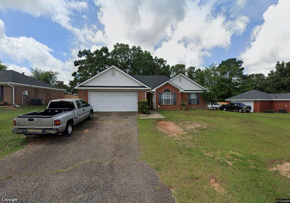
9531 Oak Forrest Dr Mobile, AL 36695
Baker NeighborhoodEstimated Value: $216,321 - $245,000
3
Beds
2
Baths
1,589
Sq Ft
$149/Sq Ft
Est. Value
About This Home
This home is located at 9531 Oak Forrest Dr, Mobile, AL 36695 and is currently estimated at $236,080, approximately $148 per square foot. 9531 Oak Forrest Dr is a home located in Mobile County with nearby schools including Elsie Collier Elementary School, Bernice J Causey Middle School, and Baker High School.
Ownership History
Date
Name
Owned For
Owner Type
Purchase Details
Closed on
May 20, 2005
Sold by
Fannie Mae
Bought by
Lewis Bruce Allen and Lewis Tomasine R
Current Estimated Value
Home Financials for this Owner
Home Financials are based on the most recent Mortgage that was taken out on this home.
Original Mortgage
$100,800
Outstanding Balance
$51,404
Interest Rate
5.8%
Mortgage Type
Fannie Mae Freddie Mac
Estimated Equity
$184,677
Purchase Details
Closed on
Jun 30, 1998
Sold by
John Howard Homes Ltd
Bought by
Kelley James R and Kelley Melissa Y
Home Financials for this Owner
Home Financials are based on the most recent Mortgage that was taken out on this home.
Original Mortgage
$106,400
Interest Rate
7.1%
Create a Home Valuation Report for This Property
The Home Valuation Report is an in-depth analysis detailing your home's value as well as a comparison with similar homes in the area
Home Values in the Area
Average Home Value in this Area
Purchase History
| Date | Buyer | Sale Price | Title Company |
|---|---|---|---|
| Lewis Bruce Allen | $126,000 | -- | |
| Kelley James R | -- | -- |
Source: Public Records
Mortgage History
| Date | Status | Borrower | Loan Amount |
|---|---|---|---|
| Open | Lewis Bruce Allen | $100,800 | |
| Previous Owner | Kelley James R | $106,400 | |
| Closed | Lewis Bruce Allen | $25,200 |
Source: Public Records
Tax History
| Year | Tax Paid | Tax Assessment Tax Assessment Total Assessment is a certain percentage of the fair market value that is determined by local assessors to be the total taxable value of land and additions on the property. | Land | Improvement |
|---|---|---|---|---|
| 2025 | $868 | $17,930 | $4,000 | $13,930 |
| 2024 | $868 | $16,670 | $4,000 | $12,670 |
| 2023 | $785 | $16,100 | $4,000 | $12,100 |
| 2022 | $632 | $14,400 | $4,000 | $10,400 |
| 2021 | $621 | $14,170 | $4,000 | $10,170 |
| 2020 | $644 | $14,650 | $3,200 | $11,450 |
| 2019 | $645 | $14,680 | $0 | $0 |
| 2018 | $659 | $14,960 | $0 | $0 |
| 2017 | $668 | $13,720 | $0 | $0 |
| 2016 | $604 | $13,840 | $0 | $0 |
| 2013 | $687 | $14,680 | $0 | $0 |
Source: Public Records
Map
Nearby Homes
- 9613 Oak Forrest Place
- 9630 Oak Forrest Dr Unit 2
- 9410 Ashwood Ct
- 9650 Oak Forrest Dr
- 9375 Ashwood Ct
- 0 New Neck Rd Unit 387066
- 860 Trailwood Dr E
- 835 Royal Woods Dr E
- 9633 Royal Woods Dr S
- 1170 Wellington Ct S
- 9751 Pine Knoll Rd
- 801 Copperfield Dr E
- 750 Hale Rd
- 10635 Burlington Estates Dr
- 1145 Dominion Dr E
- 11905 Airport Blvd
- 11905 Airport Blvd Unit 3
- 9841 Shadow Wood Dr
- 653 Begeman Rd
- 1235 Wakefield Dr E
- 9521 Oak Forrest Dr
- 9541 Oak Forrest Dr
- 9530 Signal Ct
- 9551 Oak Forrest Dr
- 9511 Oak Forrest Dr
- 9520 Oak Forest Dr
- 9520 Oak Forrest Dr
- 9530 Oak Forrest Dr
- 9520 Signal Ct
- 9510 Oak Forrest Dr
- 1185 Colonial Hills Dr
- 9501 Oak Forrest Dr
- 1165 Colonial Hills Dr
- 9540 Signal Ct
- 1175 Colonial Hills Dr
- 9550 Oak Forrest Dr
- 9510 Signal Ct
- 9511 Ashwood Dr
- 1195 Colonial Hills Dr
- 9491 Oak Forrest Dr
Your Personal Tour Guide
Ask me questions while you tour the home.