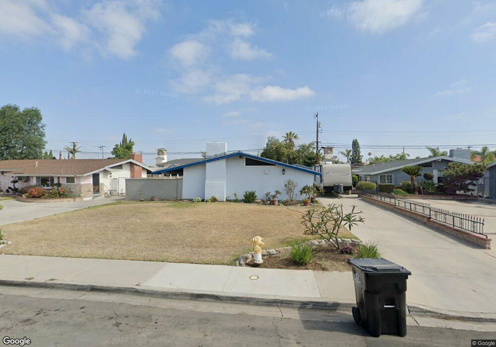
9541 Harle Ave Anaheim, CA 92804
West Anaheim NeighborhoodEstimated Value: $464,000 - $953,000
3
Beds
2
Baths
1,214
Sq Ft
$671/Sq Ft
Est. Value
About This Home
This home is located at 9541 Harle Ave, Anaheim, CA 92804 and is currently estimated at $814,638, approximately $671 per square foot. 9541 Harle Ave is a home located in Orange County with nearby schools including Jonas E. Salk Elementary School, Dale Jr High School, and Magnolia High.
Ownership History
Date
Name
Owned For
Owner Type
Purchase Details
Closed on
Jun 14, 2019
Sold by
Ruhland Teresita
Bought by
Ruhland Teresita and Soriano Laura
Current Estimated Value
Home Financials for this Owner
Home Financials are based on the most recent Mortgage that was taken out on this home.
Original Mortgage
$279,812
Outstanding Balance
$245,524
Interest Rate
4%
Mortgage Type
FHA
Estimated Equity
$569,114
Create a Home Valuation Report for This Property
The Home Valuation Report is an in-depth analysis detailing your home's value as well as a comparison with similar homes in the area
Home Values in the Area
Average Home Value in this Area
Purchase History
| Date | Buyer | Sale Price | Title Company |
|---|---|---|---|
| Ruhland Teresita | $170,000 | Ticor Ttl Orange Cnty Branch |
Source: Public Records
Mortgage History
| Date | Status | Borrower | Loan Amount |
|---|---|---|---|
| Open | Ruhland Teresita | $279,812 |
Source: Public Records
Tax History Compared to Growth
Tax History
| Year | Tax Paid | Tax Assessment Tax Assessment Total Assessment is a certain percentage of the fair market value that is determined by local assessors to be the total taxable value of land and additions on the property. | Land | Improvement |
|---|---|---|---|---|
| 2025 | $4,972 | $429,399 | $360,376 | $69,023 |
| 2024 | $4,972 | $420,980 | $353,310 | $67,670 |
| 2023 | $4,886 | $412,726 | $346,382 | $66,344 |
| 2022 | $4,805 | $404,634 | $339,590 | $65,044 |
| 2021 | $4,742 | $396,700 | $332,931 | $63,769 |
| 2020 | $4,701 | $392,633 | $329,517 | $63,116 |
| 2019 | $3,713 | $294,903 | $228,661 | $66,242 |
| 2018 | $3,664 | $289,121 | $224,177 | $64,944 |
| 2017 | $3,538 | $283,452 | $219,781 | $63,671 |
| 2016 | $3,530 | $277,895 | $215,472 | $62,423 |
| 2015 | $3,488 | $273,721 | $212,235 | $61,486 |
| 2014 | $3,322 | $268,360 | $208,078 | $60,282 |
Source: Public Records
Map
Nearby Homes
- 9272 Cerritos Ave
- 10301 Rhiems Rd
- 9155 Pacific Ave Unit 265
- 10301 Antigua St
- 90093 Stacie Ln
- 2533 W Chanticleer Rd
- 9592 Katella Ave
- 9041 Stacie Ln Unit 12
- 1765 S Biscayne Ct
- 2631 W Cerritos Ave
- 927 S Webster Ave
- 8921 Kennelly Ln
- 998 S Crossbow Ln Unit 12D
- 1737 S Garden Dr
- 958 S Crossbow Ln Unit 8
- 9762 Gamble Ave
- 1250 S Brookhurst St Unit 1059
- 1250 S Brookhurst St Unit 2028
- 1250 S Brookhurst St
- 1250 S Brookhurst St Unit 2033
- 9551 Harle Ave
- 9521 Harle Ave
- 9561 Harle Ave
- 9542 Cerritos Ave
- 9511 Harle Ave
- 9552 Cerritos Ave
- 9562 Cerritos Ave
- 9512 Cerritos Ave
- 9571 Harle Ave
- 9542 Harle Ave
- 9552 Harle Ave
- 10542 Gilbert St
- 9522 Harle Ave
- 9562 Harle Ave
- 9572 Cerritos Ave
- 9512 Harle Ave
- 9502 Cerritos Ave
- 9581 Harle Ave
- 9572 Harle Ave
- 10562 Gilbert St