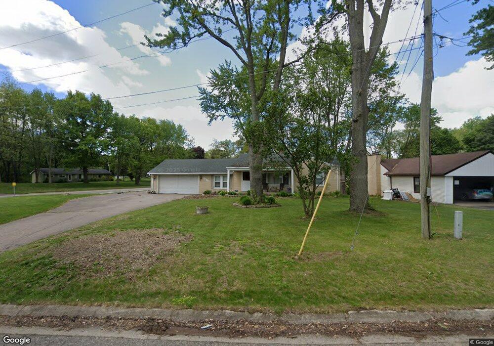
9543 Susin Ln Clarkston, MI 48348
Estimated Value: $196,000 - $338,000
2
Beds
1
Bath
1,185
Sq Ft
$227/Sq Ft
Est. Value
About This Home
This home is located at 9543 Susin Ln, Clarkston, MI 48348 and is currently estimated at $268,625, approximately $226 per square foot. 9543 Susin Ln is a home located in Oakland County with nearby schools including Springfield Christian Academy.
Ownership History
Date
Name
Owned For
Owner Type
Purchase Details
Closed on
Jan 7, 2011
Sold by
Dishon Madeline J
Bought by
Locke John M and Philpott Wendy S
Current Estimated Value
Home Financials for this Owner
Home Financials are based on the most recent Mortgage that was taken out on this home.
Original Mortgage
$50,000
Interest Rate
6.88%
Mortgage Type
New Conventional
Purchase Details
Closed on
Sep 7, 2010
Sold by
Steward Jerome F and Steward Carol A
Bought by
Citizens Bank
Purchase Details
Closed on
Apr 2, 2008
Sold by
Furman Carol A and Steward Carol A
Bought by
Steward Carol A
Create a Home Valuation Report for This Property
The Home Valuation Report is an in-depth analysis detailing your home's value as well as a comparison with similar homes in the area
Home Values in the Area
Average Home Value in this Area
Purchase History
| Date | Buyer | Sale Price | Title Company |
|---|---|---|---|
| Locke John M | $78,000 | Title Partners | |
| Locke John M | $78,000 | Title Partners | |
| Citizens Bank | $60,977 | None Available | |
| Steward Carol A | -- | None Available |
Source: Public Records
Mortgage History
| Date | Status | Borrower | Loan Amount |
|---|---|---|---|
| Previous Owner | Locke John M | $50,000 |
Source: Public Records
Tax History Compared to Growth
Tax History
| Year | Tax Paid | Tax Assessment Tax Assessment Total Assessment is a certain percentage of the fair market value that is determined by local assessors to be the total taxable value of land and additions on the property. | Land | Improvement |
|---|---|---|---|---|
| 2024 | $1,959 | $129,360 | $0 | $0 |
| 2023 | $1,868 | $117,750 | $0 | $0 |
| 2022 | $2,884 | $111,260 | $0 | $0 |
| 2021 | $2,676 | $120,240 | $0 | $0 |
| 2020 | $1,710 | $115,500 | $0 | $0 |
| 2018 | $2,598 | $111,700 | $31,200 | $80,500 |
| 2015 | -- | $90,100 | $0 | $0 |
| 2014 | -- | $73,900 | $0 | $0 |
| 2011 | -- | $69,700 | $0 | $0 |
Source: Public Records
Map
Nearby Homes
- 8453 Harbortowne Dr
- 0 Dixie Hwy Unit 20251027429
- 9765 Dixie Hwy
- 9866 Dixie Hwy
- 9635 Norman Rd
- 9876 Dixie Hwy
- 9580 Dixie Hwy
- 8911 Tartan Dr
- 9877 Dixie Hwy
- 8700 Clarridge Rd
- 10086 King Rd
- 10145 Creekwood Trail
- 9266 Hillcrest
- 9909 Kingston Ridge Unit 44
- 9933 Kingston Ridge Unit 43
- 7565 Old Pond Dr
- 8410 S Shore Dr Unit 29
- 10418 King Rd
- 9755 Forest Ridge Dr Unit 29
- 10438 King Rd
- 9553 Susin Ln Unit Bldg-Unit
- 9553 Susin Ln
- 9567 Susin Ln
- 9546 Susin Ln
- 9554 Susin Ln
- 9591 Susin Ln
- 9530 Susin Ln
- 9570 Susin Ln
- 9641 Davisburg Rd
- 9635 Davisburg Rd
- 9627 Susin Ln
- 9548 Dolores
- 9564 Dolores
- 9632 Susin Ln
- 00 Davisburg Rd
- 9633 Susin Ln
- 9596 Dolores
- 9524 Dolores
- 9635 Susin Ln
- 9599 Davisburg Rd