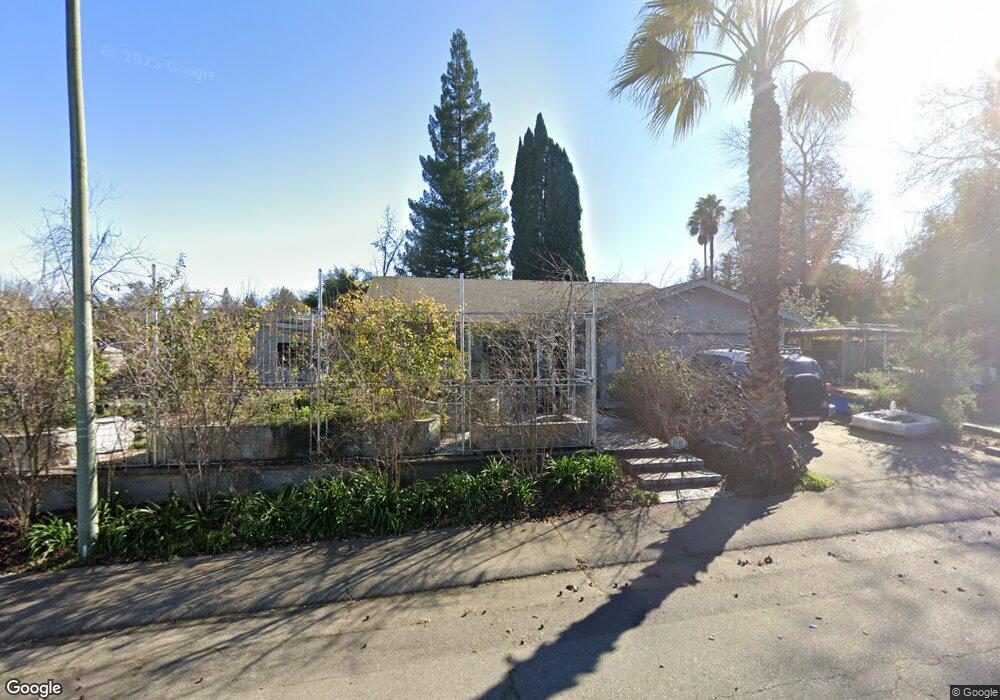
9548 Central Ave Folsom, CA 95630
Estimated Value: $613,000 - $709,000
3
Beds
2
Baths
1,615
Sq Ft
$403/Sq Ft
Est. Value
About This Home
This home is located at 9548 Central Ave, Folsom, CA 95630 and is currently estimated at $651,048, approximately $403 per square foot. 9548 Central Ave is a home located in Sacramento County with nearby schools including Ottomon Way Elementary School, Louis Pasteur Fundamental Middle School, and Casa Roble Fundamental High School.
Ownership History
Date
Name
Owned For
Owner Type
Purchase Details
Closed on
Sep 14, 2023
Sold by
Christopher Family Trust
Bought by
Christopher Melissa Ann
Current Estimated Value
Purchase Details
Closed on
Apr 25, 2013
Sold by
Christopher Socrates and Christopher Barbara
Bought by
Christopher Socrates S and Christopher Barbara J
Purchase Details
Closed on
Oct 23, 2002
Sold by
Benbow Jerry L
Bought by
Christopher Socrates and Christopher Barbara
Create a Home Valuation Report for This Property
The Home Valuation Report is an in-depth analysis detailing your home's value as well as a comparison with similar homes in the area
Purchase History
| Date | Buyer | Sale Price | Title Company |
|---|---|---|---|
| Christopher Melissa Ann | -- | None Listed On Document | |
| Christopher Socrates S | -- | None Available | |
| Christopher Socrates | $275,000 | Stewart Title Of Sacramento |
Source: Public Records
Tax History
| Year | Tax Paid | Tax Assessment Tax Assessment Total Assessment is a certain percentage of the fair market value that is determined by local assessors to be the total taxable value of land and additions on the property. | Land | Improvement |
|---|---|---|---|---|
| 2025 | $6,994 | $601,800 | $204,000 | $397,800 |
| 2024 | $6,994 | $590,000 | $200,000 | $390,000 |
| 2023 | $4,565 | $382,806 | $104,397 | $278,409 |
| 2022 | $4,541 | $375,300 | $102,350 | $272,950 |
| 2021 | $4,465 | $367,943 | $100,344 | $267,599 |
| 2020 | $4,382 | $364,172 | $99,316 | $264,856 |
| 2019 | $4,293 | $357,032 | $97,369 | $259,663 |
| 2018 | $4,244 | $350,032 | $95,460 | $254,572 |
| 2017 | $4,202 | $343,170 | $93,589 | $249,581 |
| 2016 | $3,948 | $336,442 | $91,754 | $244,688 |
| 2015 | $3,897 | $331,389 | $90,376 | $241,013 |
| 2014 | $3,819 | $324,898 | $88,606 | $236,292 |
Source: Public Records
Map
Nearby Homes
- 116 Pheasant Ln
- 118 S Fork Way
- 104 Winding Canyon Ln
- 102 Spring Water Way
- 116 Raeanne Ln
- 300 Water View Way
- 115 Canyon Rim Dr
- 224 Oak Canyon Way
- 9666 Lake Natoma Dr
- 9340 Orangevale Ave Unit 26
- 9340 Orangevale Ave Unit 38
- 9340 Orangevale Ave Unit 27
- 6132 Main Ave Unit 43
- 20 American River Canyon Dr
- 7314 Santa Juanita Ave
- 9505 Tonkin Dr
- 9350 River Oaks Ln
- 621 Landrise Ct
- 9184 Central Ave
- 5943 Main Ave Unit A
- 172 Placer Mine Rd
- 9544 Central Ave
- 6628 Santa Juanita Ave
- 9540 Central Ave
- 9552 Central Ave
- 168 Placer Mine Rd
- 6636 Santa Juanita Ave
- 105 Sourdough Ct
- 9559 Central Ave
- 9536 Central Ave
- 105 Jacobs Ct
- 6640 Santa Juanita Ave
- 164 Placer Mine Rd
- 100 Jacobs Ct
- 103 Sourdough Ct
- 109 Sourdough Ct
- 9532 Central Ave
- 9556 Central Ave
- 109 Jacobs Ct
- 9537 Central Ave
Your Personal Tour Guide
Ask me questions while you tour the home.