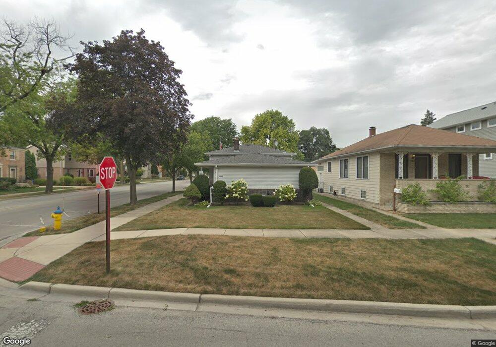
9548 Jackson Ave Brookfield, IL 60513
Estimated Value: $334,000 - $374,000
3
Beds
1
Bath
1,236
Sq Ft
$286/Sq Ft
Est. Value
About This Home
This home is located at 9548 Jackson Ave, Brookfield, IL 60513 and is currently estimated at $353,085, approximately $285 per square foot. 9548 Jackson Ave is a home located in Cook County with nearby schools including S. E. Gross Middle School, Brook Park Elementary School, and Riverside Brookfield High School.
Ownership History
Date
Name
Owned For
Owner Type
Purchase Details
Closed on
Feb 6, 2003
Sold by
Krolicki John F and Krolicki Linda M
Bought by
Western Springs National Bank & Trust and Trust #3991
Current Estimated Value
Purchase Details
Closed on
Jun 29, 1998
Sold by
Wainer James G and Wainer Mary L
Bought by
Krolicki John F and Krolicki Linda M
Home Financials for this Owner
Home Financials are based on the most recent Mortgage that was taken out on this home.
Original Mortgage
$25,000
Interest Rate
7.17%
Create a Home Valuation Report for This Property
The Home Valuation Report is an in-depth analysis detailing your home's value as well as a comparison with similar homes in the area
Home Values in the Area
Average Home Value in this Area
Purchase History
| Date | Buyer | Sale Price | Title Company |
|---|---|---|---|
| Western Springs National Bank & Trust | -- | -- | |
| Krolicki John F | $159,000 | -- |
Source: Public Records
Mortgage History
| Date | Status | Borrower | Loan Amount |
|---|---|---|---|
| Previous Owner | Krolicki John F | $25,000 |
Source: Public Records
Tax History
| Year | Tax Paid | Tax Assessment Tax Assessment Total Assessment is a certain percentage of the fair market value that is determined by local assessors to be the total taxable value of land and additions on the property. | Land | Improvement |
|---|---|---|---|---|
| 2025 | $7,867 | $28,001 | $3,563 | $24,438 |
| 2024 | $7,867 | $28,001 | $3,563 | $24,438 |
| 2023 | -- | $28,001 | $3,563 | $24,438 |
| 2022 | $0 | $19,707 | $3,088 | $16,619 |
| 2021 | $2,287 | $19,705 | $3,087 | $16,618 |
| 2020 | $2,287 | $19,705 | $3,087 | $16,618 |
| 2019 | $0 | $22,852 | $2,731 | $20,121 |
| 2018 | $0 | $22,852 | $2,731 | $20,121 |
| 2017 | $0 | $22,852 | $2,731 | $20,121 |
| 2016 | $0 | $19,867 | $2,493 | $17,374 |
| 2015 | $0 | $19,867 | $2,493 | $17,374 |
| 2014 | $4,159 | $19,867 | $2,493 | $17,374 |
| 2013 | $5,982 | $22,670 | $2,493 | $20,177 |
Source: Public Records
Map
Nearby Homes
- 3227 Harrison Ave
- 3321 Harrison Ave
- 1127 Morgan Ave
- 3128 Arthur Ave
- 1211 Homestead Rd
- 3229 Maple Ave
- 3108 Oak Ave
- 3730 Madison Ave
- 3417 Oak Ave
- 1424 N Maple Ave
- 3518 Oak Ave
- 1534 Harrison Ave
- 712 N Catherine Ave
- 3545 Oak Ave
- 1425 Stonegate Rd
- 8900 31st St Unit 9
- 425 N Catherine Ave
- 9120 26th Place
- 217 Finsbury Ln
- 141 N La Grange Rd Unit 1006
- 9544 Jackson Ave
- 9540 Jackson Ave
- 9536 Jackson Ave
- 9547 Lexington Ave
- 904 Kemman Ave
- 900 Kemman Ave
- 9543 Lexington Ave
- 908 Kemman Ave
- 9541 Jackson Ave
- 9535 Lexington Ave
- 9530 Jackson Ave
- 912 Kemman Ave
- 836 Kemman Ave
- 9537 Jackson Ave
- 9537 Jackson Ave
- 9524 Jackson Ave
- 9529 Lexington Ave
- 916 Kemman Ave
- 9535 Jackson Ave
Your Personal Tour Guide
Ask me questions while you tour the home.