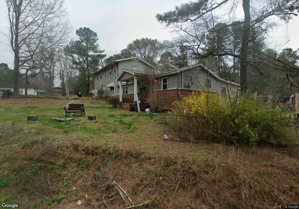
955 E Point Rd Cedartown, GA 30125
Estimated Value: $247,000 - $286,009
3
Beds
2
Baths
2,604
Sq Ft
$106/Sq Ft
Est. Value
About This Home
This home is located at 955 E Point Rd, Cedartown, GA 30125 and is currently estimated at $275,752, approximately $105 per square foot. 955 E Point Rd is a home located in Polk County with nearby schools including Cedar Christian School.
Ownership History
Date
Name
Owned For
Owner Type
Purchase Details
Closed on
Aug 21, 2024
Sold by
Knight Norval
Bought by
Knight Norval
Current Estimated Value
Purchase Details
Closed on
May 19, 1978
Sold by
Bridges Frances I
Bought by
Knight Norvell
Purchase Details
Closed on
Aug 22, 1969
Sold by
Bridges Frances I
Bought by
Bridges Frances I
Purchase Details
Closed on
Jul 15, 1969
Bought by
Bridges Frances I
Create a Home Valuation Report for This Property
The Home Valuation Report is an in-depth analysis detailing your home's value as well as a comparison with similar homes in the area
Purchase History
| Date | Buyer | Sale Price | Title Company |
|---|---|---|---|
| Knight Norval | -- | -- | |
| Knight Norvell | -- | -- | |
| Bridges Frances I | -- | -- | |
| Bridges Frances I | -- | -- |
Source: Public Records
Tax History
| Year | Tax Paid | Tax Assessment Tax Assessment Total Assessment is a certain percentage of the fair market value that is determined by local assessors to be the total taxable value of land and additions on the property. | Land | Improvement |
|---|---|---|---|---|
| 2025 | $1,955 | $86,871 | $4,753 | $82,118 |
| 2024 | $1,138 | $86,439 | $4,321 | $82,118 |
| 2023 | $842 | $67,495 | $4,321 | $63,174 |
| 2022 | $633 | $58,682 | $2,880 | $55,802 |
| 2021 | $641 | $58,682 | $2,880 | $55,802 |
| 2020 | $1,111 | $56,977 | $2,880 | $54,097 |
| 2019 | $197 | $20,654 | $2,880 | $17,774 |
| 2018 | $181 | $19,758 | $2,880 | $16,878 |
| 2017 | $174 | $19,758 | $2,880 | $16,878 |
| 2016 | $237 | $22,191 | $5,313 | $16,878 |
| 2015 | $238 | $22,255 | $5,313 | $16,942 |
| 2014 | $240 | $22,255 | $5,313 | $16,942 |
Source: Public Records
Map
Nearby Homes
- 873 E Point Rd
- 0 Coaling Rd Unit 9221-D 10352096
- 0 Coaling Rd Unit 9221-C 10352086
- 0 Coaling Rd Unit 9221 10352063
- 0 Coaling Rd Unit 9221-B 10352079
- 55 Lovvorn Rd
- 232 Tuck St
- 117 Hicklen Dr
- 202 Ridgewood Rd
- 00 Juliette St
- 10 Woodglen Dr
- 305 Greenview Ct
- 117 Cason Rd
- 160 Tate Rd
- 567 Morton Springs Rd
- 0 Woodall Rd Unit 7730884
- 0 Woodall Rd Unit 10705831
- 1101 East Ave
- 1706 Antioch Rd
- 427 Park St
- 996 E Point Rd
- 999 E Point Rd
- 925 E Point Rd
- 1025 E Point Rd
- 907 E Point Rd
- 1050 E Point Rd
- 1050 E Point Rd
- 872 E Point Rd
- 1909 Lees Chapel Rd
- 1733 Lees Chapel Rd
- 0 Road Unit 7694031
- 0 Road Unit 7672255
- 0 Road Unit 7703662
- 1835 Lees Chapel Rd
- 1100 E Point Rd
- 841 E Point Rd
- 1858 Lees Chapel Rd
- 1836 Lees Chapel Rd
- 670 Lovvorn Rd
- 1900 Lees Chapel Rd
Your Personal Tour Guide
Ask me questions while you tour the home.