Estimated Value: $206,000 - $433,311
3
Beds
1
Bath
1,096
Sq Ft
$275/Sq Ft
Est. Value
About This Home
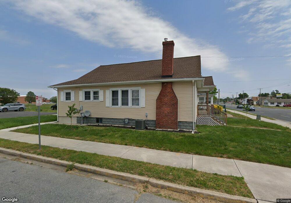
This home is located at 955 Forest St, Dover, DE 19904 and is currently estimated at $301,437, approximately $275 per square foot. 955 Forest St is a home located in Kent County with nearby schools including Booker T. Washington Elementary School, William Henry Middle School, and Central Middle School.
Ownership History
Date
Name
Owned For
Owner Type
Purchase Details
Closed on
Mar 2, 2023
Sold by
Futrell Mamie
Bought by
Fcc Rentals Llc
Current Estimated Value
Purchase Details
Closed on
Apr 27, 2022
Sold by
Greenfield Norman H
Bought by
Futrell Mamie
Home Financials for this Owner
Home Financials are based on the most recent Mortgage that was taken out on this home.
Original Mortgage
$151,065
Interest Rate
4.42%
Mortgage Type
New Conventional
Purchase Details
Closed on
Jun 1, 1998
Bought by
Greenfield Norman H and Dungan Sandy Jo
Create a Home Valuation Report for This Property
The Home Valuation Report is an in-depth analysis detailing your home's value as well as a comparison with similar homes in the area
Home Values in the Area
Average Home Value in this Area
Purchase History
| Date | Buyer | Sale Price | Title Company |
|---|---|---|---|
| Fcc Rentals Llc | -- | -- | |
| Futrell Mamie | $160,000 | -- | |
| Futrell Mamie | $160,000 | None Listed On Document | |
| Greenfield Norman H | $18,800 | -- |
Source: Public Records
Mortgage History
| Date | Status | Borrower | Loan Amount |
|---|---|---|---|
| Previous Owner | Futrell Mamie | $151,065 |
Source: Public Records
Tax History
| Year | Tax Paid | Tax Assessment Tax Assessment Total Assessment is a certain percentage of the fair market value that is determined by local assessors to be the total taxable value of land and additions on the property. | Land | Improvement |
|---|---|---|---|---|
| 2025 | $2,863 | $487,200 | $378,700 | $108,500 |
| 2024 | $2,765 | $487,200 | $378,700 | $108,500 |
| 2023 | $890 | $26,500 | $3,500 | $23,000 |
| 2022 | $535 | $18,800 | $3,500 | $15,300 |
| 2021 | $418 | $18,800 | $3,500 | $15,300 |
| 2020 | $498 | $18,800 | $3,500 | $15,300 |
| 2019 | $471 | $18,800 | $3,500 | $15,300 |
| 2018 | $430 | $18,800 | $3,500 | $15,300 |
| 2017 | $418 | $18,800 | $0 | $0 |
| 2016 | $847 | $18,800 | $0 | $0 |
| 2015 | $424 | $18,800 | $0 | $0 |
| 2014 | $425 | $18,800 | $0 | $0 |
Source: Public Records
Map
Nearby Homes
- 1172 Jefferson Ct
- 52 Eiger Ct
- 118 N Queen St
- 28 S Queen St
- 130 N Queen St
- 24 S Queen St
- 133 Meetinghouse Ln
- 109 S Queen St
- 527 William St
- 305 W Reed St
- 209 N New St
- 30 N Governors Ave
- 605 Columbia Ave
- 28 S Governors Ave
- 8 S Governors Ave
- 40 S Governors Ave
- 102 S Governors Ave
- 118 W Division St
- 706 Ruth Way
- 40 S Bradford St
Your Personal Tour Guide
Ask me questions while you tour the home.