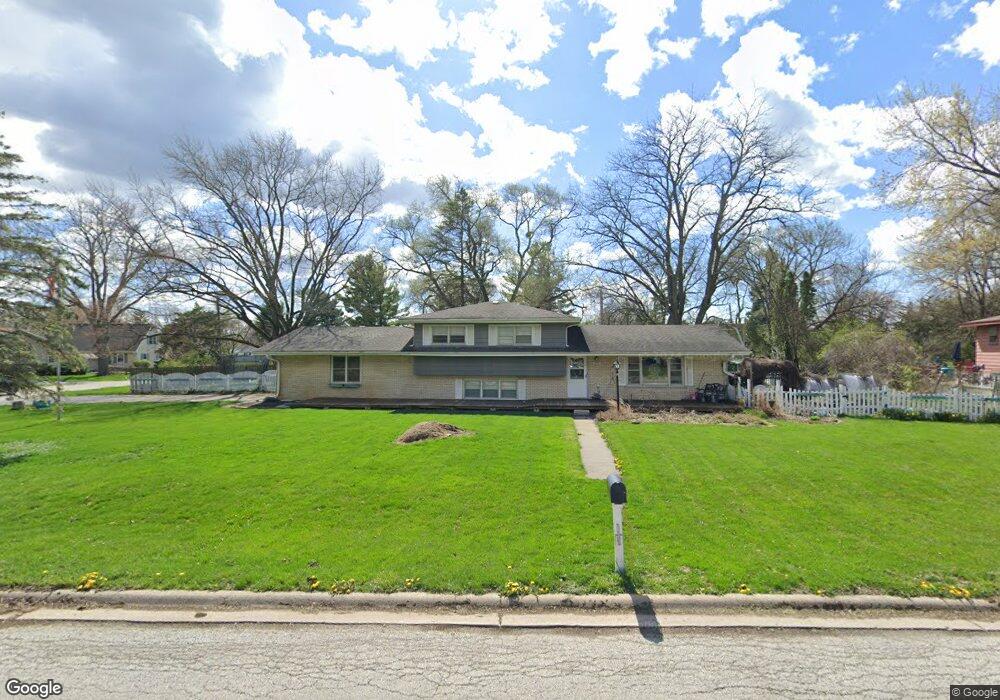
955 Lindenwood Dr Unit 3 Aurora, IL 60506
Pine Knoll NeighborhoodEstimated Value: $279,979 - $377,000
--
Bed
--
Bath
1,824
Sq Ft
$180/Sq Ft
Est. Value
About This Home
This home is located at 955 Lindenwood Dr Unit 3, Aurora, IL 60506 and is currently estimated at $327,495, approximately $179 per square foot. 955 Lindenwood Dr Unit 3 is a home located in Kane County with nearby schools including Freeman Elementary School, Washington Middle School, and West Aurora High School.
Ownership History
Date
Name
Owned For
Owner Type
Purchase Details
Closed on
Nov 24, 1999
Sold by
Adams John D and Adams Cynthia A
Bought by
Jeske Michael S and Jeske Erika L
Current Estimated Value
Home Financials for this Owner
Home Financials are based on the most recent Mortgage that was taken out on this home.
Original Mortgage
$129,900
Outstanding Balance
$40,476
Interest Rate
8.02%
Estimated Equity
$287,019
Create a Home Valuation Report for This Property
The Home Valuation Report is an in-depth analysis detailing your home's value as well as a comparison with similar homes in the area
Home Values in the Area
Average Home Value in this Area
Purchase History
| Date | Buyer | Sale Price | Title Company |
|---|---|---|---|
| Jeske Michael S | $145,000 | First American Title |
Source: Public Records
Mortgage History
| Date | Status | Borrower | Loan Amount |
|---|---|---|---|
| Open | Jeske Michael S | $129,900 |
Source: Public Records
Tax History Compared to Growth
Tax History
| Year | Tax Paid | Tax Assessment Tax Assessment Total Assessment is a certain percentage of the fair market value that is determined by local assessors to be the total taxable value of land and additions on the property. | Land | Improvement |
|---|---|---|---|---|
| 2024 | $4,478 | $75,771 | $13,260 | $62,511 |
| 2023 | $4,267 | $67,701 | $11,848 | $55,853 |
| 2022 | $4,115 | $61,771 | $10,810 | $50,961 |
| 2021 | $4,575 | $66,189 | $10,064 | $56,125 |
| 2020 | $4,326 | $61,480 | $9,348 | $52,132 |
| 2019 | $4,174 | $56,963 | $8,661 | $48,302 |
| 2018 | $4,259 | $56,501 | $8,011 | $48,490 |
| 2017 | $4,088 | $52,988 | $7,381 | $45,607 |
| 2016 | $4,013 | $50,490 | $6,327 | $44,163 |
| 2015 | -- | $47,979 | $5,441 | $42,538 |
| 2014 | -- | $44,976 | $5,233 | $39,743 |
| 2013 | -- | $44,335 | $5,158 | $39,177 |
Source: Public Records
Map
Nearby Homes
- 977 Lindenwood Dr
- 2021 Radcliffe Dr
- 430 Cottrell Ln
- 422 Cottrell Ln
- 408 Cottrell Ln
- 399 S Constitution Dr
- 892 Audubon Ln Unit 1
- Rutherford Plan at Prairie Meadows
- Napa Plan at Prairie Meadows
- Sonoma Plan at Prairie Meadows
- Siena Plan at Prairie Meadows
- 888 Summerhill Dr Unit 2
- 2451 Roseglen Way
- 1243 Jericho Rd
- 381 S Constitution Dr
- 369 S Constitution Dr
- 381 Constitution Dr
- 375 Constitution Dr
- 369 Constitution Dr
- 336 S Constitution Dr
- 1951 Rosemont Ave
- 947 Lindenwood Dr
- 2009 Rosemont Ave
- 954 Lindenwood Dr Unit 2
- 967 Lindenwood Dr
- 941 Lindenwood Dr
- 1942 Lindenwood Ct
- 962 Lindenwood Dr
- 1940 Rosemont Ave
- 1002 Monticello Dr
- 933 Lindenwood Dr
- 970 Lindenwood Dr
- 950 Johnston Dr Unit 2
- 954 Johnston Dr
- 2025 Rosemont Ave
- 1938 Lindenwood Ct
- 1010 Monticello Dr
- 1003 Monticello Dr
- 925 Lindenwood Dr Unit 1
- 1941 Lindenwood Ct