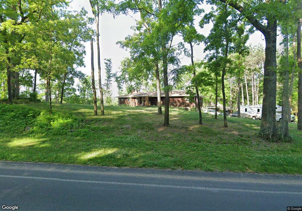
9551 Ravine Rd Kalamazoo, MI 49009
Estimated Value: $274,000
5
Beds
3
Baths
2,304
Sq Ft
$119/Sq Ft
Est. Value
About This Home
This home is located at 9551 Ravine Rd, Kalamazoo, MI 49009 and is currently priced at $274,000, approximately $118 per square foot. 9551 Ravine Rd is a home located in Kalamazoo County with nearby schools including Otsego High School.
Ownership History
Date
Name
Owned For
Owner Type
Purchase Details
Closed on
Oct 20, 2021
Sold by
Richard D And Marilyn J Majeswila Trust
Bought by
Majewski Mathew
Current Estimated Value
Purchase Details
Closed on
Jul 23, 2021
Sold by
Majeswski Marilyn and Majeswski John
Bought by
Ogle Jason and Ogle Cresta
Home Financials for this Owner
Home Financials are based on the most recent Mortgage that was taken out on this home.
Original Mortgage
$392,000
Interest Rate
3%
Mortgage Type
New Conventional
Purchase Details
Closed on
Mar 26, 2008
Sold by
Majewski Richard and Majewski Marilyn
Bought by
Richard D & Marilyn Majewski Joint Trust
Home Financials for this Owner
Home Financials are based on the most recent Mortgage that was taken out on this home.
Original Mortgage
$145,600
Interest Rate
6.1%
Mortgage Type
Stand Alone Refi Refinance Of Original Loan
Create a Home Valuation Report for This Property
The Home Valuation Report is an in-depth analysis detailing your home's value as well as a comparison with similar homes in the area
Home Values in the Area
Average Home Value in this Area
Purchase History
| Date | Buyer | Sale Price | Title Company |
|---|---|---|---|
| Majewski Mathew | -- | None Available | |
| Ogle Jason | $392,000 | Chicago Title Of Mi Inc | |
| Richard D & Marilyn Majewski Joint Trust | -- | Lighthouse Group | |
| Majewski Richard | -- | Lighthouse Title |
Source: Public Records
Mortgage History
| Date | Status | Borrower | Loan Amount |
|---|---|---|---|
| Previous Owner | Ogle Jason | $392,000 | |
| Previous Owner | Majewski Richard | $145,600 |
Source: Public Records
Tax History Compared to Growth
Tax History
| Year | Tax Paid | Tax Assessment Tax Assessment Total Assessment is a certain percentage of the fair market value that is determined by local assessors to be the total taxable value of land and additions on the property. | Land | Improvement |
|---|---|---|---|---|
| 2022 | $987 | $0 | $0 | $0 |
| 2021 | $987 | $152,500 | $0 | $0 |
| 2020 | $4,247 | $139,300 | $0 | $0 |
| 2019 | $4,247 | $122,500 | $0 | $0 |
| 2018 | $0 | $121,600 | $0 | $0 |
| 2017 | $0 | $121,600 | $0 | $0 |
| 2016 | -- | $116,400 | $0 | $0 |
| 2015 | -- | $115,100 | $0 | $0 |
| 2014 | -- | $111,100 | $0 | $0 |
Source: Public Records
Map
Nearby Homes
- 7131 W B Ave
- 1 Millberg Ridge
- Parcel A D Ave W
- 7841 W D Ave
- 5205 Kitz Way
- VL W Ab Ave
- 0 W D Ave W Unit VL 24060554
- 8060 Hunters Crossing
- 3455 W B Ave
- Elements 1870 Plan at Southpointe Trails
- Integrity 1605 Plan at Southpointe Trails
- Elements 2070 Plan at Southpointe Trails
- Integrity 2000 Plan at Southpointe Trails
- Elements 1680 Plan at Southpointe Trails
- integrity 2280 Plan at Southpointe Trails
- Integrity 1910 Plan at Southpointe Trails
- integrity 1800 Plan at Southpointe Trails
- Integrity 2061 V8.1a Plan at Southpointe Trails
- Elements 2390 Plan at Southpointe Trails
- Integrity 2190 Plan at Southpointe Trails