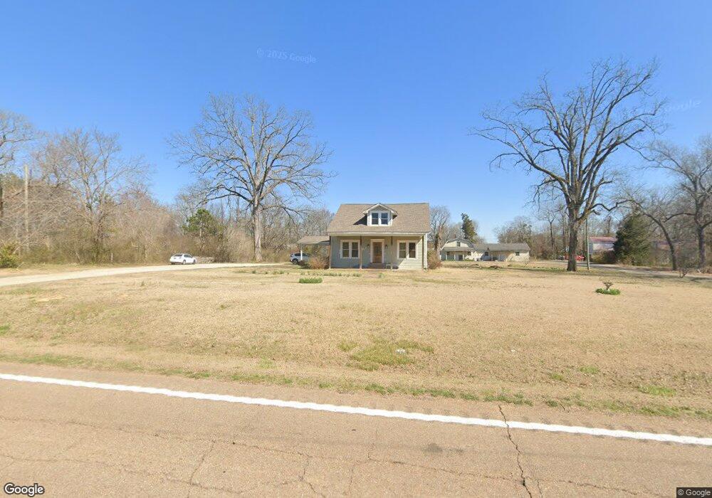
9552 Highway 22 S Unit 1 Michie, TN 38357
Estimated Value: $151,000 - $192,740
4
Beds
2
Baths
1,740
Sq Ft
$100/Sq Ft
Est. Value
About This Home
This home is located at 9552 Highway 22 S Unit 1, Michie, TN 38357 and is currently estimated at $174,435, approximately $100 per square foot. 9552 Highway 22 S Unit 1 is a home located in McNairy County with nearby schools including Michie Elementary School, Ramer Elementary School, and Selmer Elementary School.
Ownership History
Date
Name
Owned For
Owner Type
Purchase Details
Closed on
Sep 14, 2016
Sold by
Smith Penny
Bought by
Smith Penny
Current Estimated Value
Purchase Details
Closed on
Aug 8, 2008
Sold by
Federal National Mortgage Association
Bought by
Smith Penny
Purchase Details
Closed on
Mar 24, 2008
Sold by
Cox Larry W
Bought by
Federal National Mortgage
Purchase Details
Closed on
Nov 16, 2005
Sold by
Dickerson James D
Bought by
Cox Larry W
Purchase Details
Closed on
Jul 11, 1996
Sold by
Milton Dickerson
Bought by
Dickerson James D
Create a Home Valuation Report for This Property
The Home Valuation Report is an in-depth analysis detailing your home's value as well as a comparison with similar homes in the area
Home Values in the Area
Average Home Value in this Area
Purchase History
| Date | Buyer | Sale Price | Title Company |
|---|---|---|---|
| Smith Penny | -- | -- | |
| Smith Penny | $47,000 | -- | |
| Federal National Mortgage | -- | -- | |
| Cox Larry W | $120,000 | -- | |
| Dickerson James D | $50,625 | -- |
Source: Public Records
Tax History Compared to Growth
Tax History
| Year | Tax Paid | Tax Assessment Tax Assessment Total Assessment is a certain percentage of the fair market value that is determined by local assessors to be the total taxable value of land and additions on the property. | Land | Improvement |
|---|---|---|---|---|
| 2024 | $546 | $34,625 | $2,775 | $31,850 |
| 2023 | $546 | $34,625 | $2,775 | $31,850 |
| 2022 | $546 | $34,625 | $2,775 | $31,850 |
| 2021 | $454 | $22,200 | $2,200 | $20,000 |
| 2020 | $454 | $22,200 | $2,200 | $20,000 |
| 2019 | $454 | $22,200 | $2,200 | $20,000 |
| 2018 | $454 | $22,200 | $2,200 | $20,000 |
| 2017 | $454 | $22,200 | $2,200 | $20,000 |
| 2016 | $445 | $22,200 | $2,200 | $20,000 |
| 2015 | $464 | $22,200 | $2,200 | $20,000 |
| 2014 | $397 | $18,975 | $2,450 | $16,525 |
Source: Public Records
Map
Nearby Homes
- 9516 Tennessee 22
- 10057 Tennessee 22
- 8809 Highway 22 S
- 0 John George Loop Unit 10202475
- 0 John George Loop Unit 25-2649
- 10434 Tennessee 22
- 820 John George Loop
- 0 Will Coln Rd Unit 24-1734
- 7837 Highway 22 S
- 47 Mississippi 350
- 1 Northtowne Dr
- 3 Northtowne Dr
- 106 Afton Dr
- Lot 15 Northtown Dr
- Lot 12 Northtown Dr
- Lot 14 Northtown Dr
- Lot 16 Northtown Dr
- Lot 8 Northtown Dr
- Lot 9 Northtown Dr
- Lot 5 Northtown Dr
- 9552 Highway 22 S
- 1 Hamburg Rd
- 9516 Highway 22 S
- 9586 Highway 22 S
- 9602 Highway 22 S
- 9490 Highway 22 S
- 9577 Highway 22 S
- 9577 Highway 22 S
- 9577 Tennessee 22
- 9466 Highway 22 S
- 9480 Highway 22 S
- 9607 Highway 22 S
- 9607 Highway 22 S
- 9495 Highway 22 S
- 67 Berry Bottom Rd
- 9642 Highway 22 S
- 0 Davis Yancey Rd
- 9459 Highway 22 S
- 70 Davis Yancey Rd
- 9678 Highway 22 S