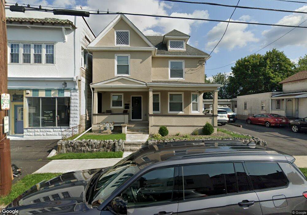
956 Prescott Ave Scranton, PA 18510
Hill Section NeighborhoodEstimated Value: $104,789 - $246,000
3
Beds
--
Bath
2,400
Sq Ft
$82/Sq Ft
Est. Value
About This Home
This home is located at 956 Prescott Ave, Scranton, PA 18510 and is currently estimated at $197,447, approximately $82 per square foot. 956 Prescott Ave is a home located in Lackawanna County with nearby schools including Lakeside Elementary School, Pinchbeck Elementary School, and Columbia Heights Elementary School.
Ownership History
Date
Name
Owned For
Owner Type
Purchase Details
Closed on
Oct 10, 2012
Sold by
Us Reo Fund V Llc
Bought by
Fisch Robert P and Fisch Robert J
Current Estimated Value
Purchase Details
Closed on
Sep 24, 2012
Sold by
U S Bank Na
Bought by
Us Reo Fund V Llc
Purchase Details
Closed on
Nov 7, 2011
Sold by
Lutz Emily L and Rogers Emily L
Bought by
U S Bank Na
Create a Home Valuation Report for This Property
The Home Valuation Report is an in-depth analysis detailing your home's value as well as a comparison with similar homes in the area
Home Values in the Area
Average Home Value in this Area
Purchase History
| Date | Buyer | Sale Price | Title Company |
|---|---|---|---|
| Fisch Robert P | $18,500 | None Available | |
| Us Reo Fund V Llc | $5,110 | None Available | |
| U S Bank Na | -- | None Available | |
| U S Bank Na | $2,647 | None Available |
Source: Public Records
Tax History Compared to Growth
Tax History
| Year | Tax Paid | Tax Assessment Tax Assessment Total Assessment is a certain percentage of the fair market value that is determined by local assessors to be the total taxable value of land and additions on the property. | Land | Improvement |
|---|---|---|---|---|
| 2025 | $3,903 | $11,000 | $3,600 | $7,400 |
| 2024 | $3,591 | $11,000 | $3,600 | $7,400 |
| 2023 | $3,591 | $11,000 | $3,600 | $7,400 |
| 2022 | $3,512 | $11,000 | $3,600 | $7,400 |
| 2021 | $3,512 | $11,000 | $3,600 | $7,400 |
| 2020 | $3,453 | $11,000 | $3,600 | $7,400 |
| 2019 | $3,256 | $11,000 | $3,600 | $7,400 |
| 2018 | $3,256 | $11,000 | $3,600 | $7,400 |
| 2017 | $3,204 | $11,000 | $3,600 | $7,400 |
| 2016 | $1,211 | $11,000 | $3,600 | $7,400 |
| 2015 | $2,470 | $11,000 | $3,600 | $7,400 |
| 2014 | -- | $11,000 | $3,600 | $7,400 |
Source: Public Records
Map
Nearby Homes
- 1406 Ash St
- 1017 Prescott Ave
- 917 Taylor Ave
- 949 Taylor Ave
- 805-807 N Irving Ave
- 1112 Ridge Ave
- 715 Prescott Ave Unit L17
- 0 Colfax and Gibson Ave Unit GSBSC255175
- 139 William St
- 7 Oakwood Place
- 616-618 Harrison Ave
- 825 827 Quincy Ave Unit 825-827
- 1325 Olive St
- 615-617 Quincy Ave
- 545 Prescott Ave
- 2122 Ash St
- 1105 Quincy Ave
- 832 Monroe Ave
- 516 Harrison Ave
- 560 N Webster Ave
- 958 Prescott Ave Unit 2
- 958 Prescott Ave
- 950 Prescott Ave
- 960 Prescott Ave
- 958-960 Prescott Ave
- 947 Ridge Ave
- 944 Prescott Ave
- 937 Ridge Ave
- 942 Prescott Ave
- 933 Ridge Ave
- 961 Prescott Ave
- 945 Prescott Ave
- 1514 Ash St
- 953 Prescott L 14 Ave
- 953 Prescott Ave
- 936 Prescott Ave
- 949 Prescott Ave
- 929 Ridge Ave
- 941 Prescott Ave Unit 43
- 927 Ridge Ave