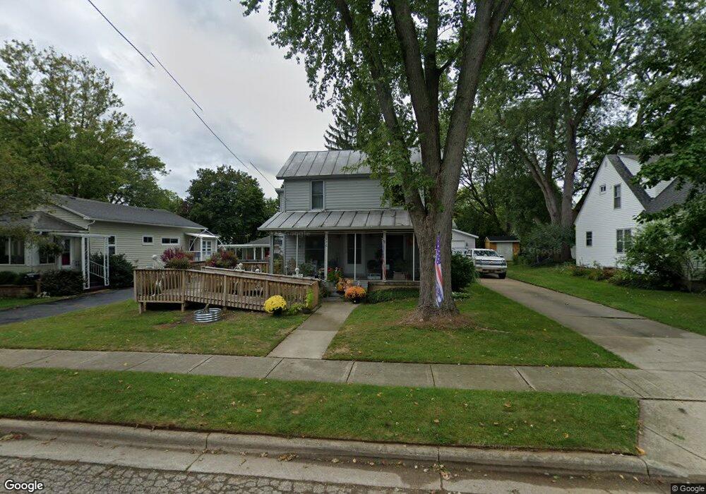
956 Riverside Dr Lowell, MI 49331
Estimated Value: $238,000 - $269,845
2
Beds
2
Baths
1,408
Sq Ft
$181/Sq Ft
Est. Value
About This Home
This home is located at 956 Riverside Dr, Lowell, MI 49331 and is currently estimated at $255,211, approximately $181 per square foot. 956 Riverside Dr is a home located in Kent County with nearby schools including Bushnell Elementary School, Cherry Creek Elementary School, and Lowell Middle School.
Ownership History
Date
Name
Owned For
Owner Type
Purchase Details
Closed on
Oct 27, 2016
Sold by
Catlin Rrichard D and Catlin Shelley M
Bought by
Catlin Richard D and Catlin Family Trust
Current Estimated Value
Purchase Details
Closed on
Dec 11, 2003
Sold by
Catlin Shelley M and Merigan Shelley
Bought by
Catlin Richard D and Catlin Shelley M
Home Financials for this Owner
Home Financials are based on the most recent Mortgage that was taken out on this home.
Original Mortgage
$80,000
Interest Rate
6.04%
Mortgage Type
Stand Alone Refi Refinance Of Original Loan
Purchase Details
Closed on
Sep 1, 1992
Bought by
Catlin Staskus>Merigian and Catlin Richard D
Purchase Details
Closed on
Mar 28, 1983
Bought by
Empire Natl Bank>Stasku and Catlin Richard D
Create a Home Valuation Report for This Property
The Home Valuation Report is an in-depth analysis detailing your home's value as well as a comparison with similar homes in the area
Home Values in the Area
Average Home Value in this Area
Purchase History
| Date | Buyer | Sale Price | Title Company |
|---|---|---|---|
| Catlin Richard D | -- | None Available | |
| Catlin Richard D | -- | Chicago Title | |
| Catlin Staskus>Merigian | $41,500 | -- | |
| Empire Natl Bank>Stasku | $32,000 | -- |
Source: Public Records
Mortgage History
| Date | Status | Borrower | Loan Amount |
|---|---|---|---|
| Closed | Catlin Richard D | $80,000 |
Source: Public Records
Tax History Compared to Growth
Tax History
| Year | Tax Paid | Tax Assessment Tax Assessment Total Assessment is a certain percentage of the fair market value that is determined by local assessors to be the total taxable value of land and additions on the property. | Land | Improvement |
|---|---|---|---|---|
| 2025 | $1,954 | $118,500 | $0 | $0 |
| 2024 | $1,954 | $97,700 | $0 | $0 |
| 2023 | $2,208 | $89,100 | $0 | $0 |
| 2022 | $2,119 | $80,800 | $0 | $0 |
| 2021 | $2,059 | $73,200 | $0 | $0 |
| 2020 | $1,707 | $65,500 | $0 | $0 |
| 2019 | $2,004 | $63,000 | $0 | $0 |
| 2018 | $1,961 | $59,900 | $0 | $0 |
| 2017 | $1,912 | $52,500 | $0 | $0 |
| 2016 | $1,859 | $47,000 | $0 | $0 |
| 2015 | -- | $47,000 | $0 | $0 |
| 2013 | -- | $45,900 | $0 | $0 |
Source: Public Records
Map
Nearby Homes
- 725 N Lafayette St SE
- 610 Birchwood Ct SE
- 913 N Monroe St
- 510 N Hudson St SE
- 926 N Washington St
- 521 Spring St
- 220 King St Unit 10
- 220 King St Unit 6
- 1060 N Washington St
- 414 N Jefferson St
- 1080 N Washington St SE
- Cedarwood Plan at Flat River Estates
- Sycamore Plan at Flat River Estates
- Elmwood Plan at Flat River Estates
- Chestnut Plan at Flat River Estates
- Redwood Plan at Flat River Estates
- Whitby Plan at Flat River Estates
- Bay Harbor Plan at Flat River Estates
- Pentwater Plan at Flat River Estates
- Maplewood Plan at Flat River Estates
- 964 Riverside Dr
- 950 Riverside Dr
- 961 N Hudson St
- 948 Riverside Dr
- 937 N Hudson St
- 937 N Hudson St SE
- 1004 Riverside Dr
- 928 Riverside Dr
- 325 Hunt St
- 923 N Hudson St
- 923 N Hudson St SE
- 950 N Hudson St
- 990 N Hudson St
- 990 N Hudson St SE
- 403 Hunt St
- 924 Riverside Dr
- 934 N Hudson St
- 1012 Riverside Dr
- 403 Hunt St SE
- 928 N Hudson St