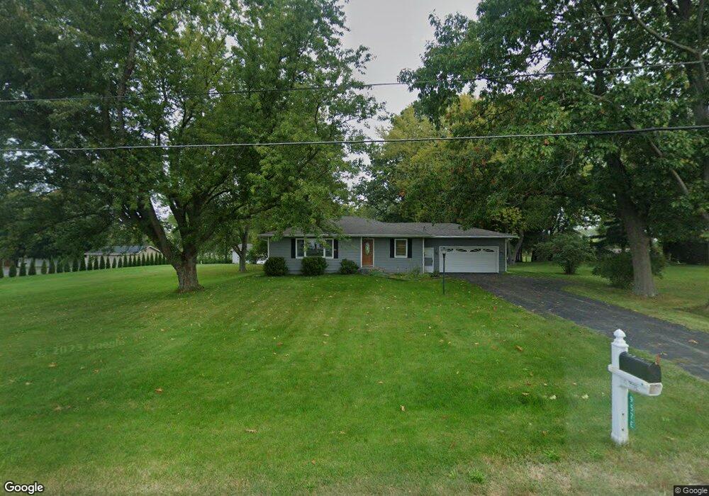
957 E John Beers Rd Saint Joseph, MI 49085
Estimated Value: $275,000 - $294,263
4
Beds
2
Baths
1,328
Sq Ft
$212/Sq Ft
Est. Value
About This Home
This home is located at 957 E John Beers Rd, Saint Joseph, MI 49085 and is currently estimated at $282,066, approximately $212 per square foot. 957 E John Beers Rd is a home located in Berrien County with nearby schools including Lakeshore High School and Michigan Lutheran High School.
Ownership History
Date
Name
Owned For
Owner Type
Purchase Details
Closed on
Nov 9, 2022
Sold by
Muday Thomas P and Muday Janice
Bought by
Thomas And Janice Muday Family Legacy Trust
Current Estimated Value
Purchase Details
Closed on
Aug 20, 2020
Sold by
Muday Thomas P
Bought by
Muday Thomas P and Muday Janice
Purchase Details
Closed on
Aug 18, 2020
Sold by
Muday Thomas P
Bought by
Muday Thomas P and Muday Janice
Purchase Details
Closed on
Aug 25, 1988
Purchase Details
Closed on
Jul 22, 1988
Create a Home Valuation Report for This Property
The Home Valuation Report is an in-depth analysis detailing your home's value as well as a comparison with similar homes in the area
Home Values in the Area
Average Home Value in this Area
Purchase History
| Date | Buyer | Sale Price | Title Company |
|---|---|---|---|
| Thomas And Janice Muday Family Legacy Trust | -- | -- | |
| Muday Thomas P | -- | None Listed On Document | |
| Muday Thomas P | -- | None Available | |
| -- | $63,000 | -- | |
| -- | -- | -- |
Source: Public Records
Tax History
| Year | Tax Paid | Tax Assessment Tax Assessment Total Assessment is a certain percentage of the fair market value that is determined by local assessors to be the total taxable value of land and additions on the property. | Land | Improvement |
|---|---|---|---|---|
| 2025 | $2,096 | $111,200 | $0 | $0 |
| 2024 | $1,674 | $102,000 | $0 | $0 |
| 2023 | $1,594 | $92,100 | $0 | $0 |
| 2022 | $1,510 | $82,200 | $0 | $0 |
| 2021 | $1,789 | $76,300 | $23,200 | $53,100 |
| 2020 | $1,743 | $77,700 | $0 | $0 |
| 2019 | $1,778 | $69,900 | $21,400 | $48,500 |
| 2018 | $1,719 | $69,900 | $0 | $0 |
| 2017 | $1,783 | $71,600 | $0 | $0 |
| 2016 | $1,732 | $71,300 | $0 | $0 |
| 2015 | $1,724 | $75,000 | $0 | $0 |
| 2014 | $1,424 | $68,100 | $0 | $0 |
Source: Public Records
Map
Nearby Homes
- 333 Rainbow Dr
- 1229 E Marquette Woods Rd
- 1243 E Marquette Woods Rd
- 4711 Scottdale Rd
- 4923 Knollwood Dr
- 4779 Pleasant Meadow
- V/L Scottdale Rd
- 4883 Knollwood Dr
- 573 Wittenberg Path
- 561 Wittenberg Path
- 545 Wittenberg Path
- 418 & 420 Wittenberg Path
- V/L Lauren Ln
- 4687 &4689 Luther Path
- 2035 Jasper Dairy Rd
- 471 Wittenberg Path
- 1173 Anna Ln
- 4674 &4676 Luther Path
- 527 & 529 Augsburg Pth
- 2348 Spring Arbor
- 969 E John Beers Rd
- 999 E John Beers Rd
- 895 E John Beers Rd
- 898 E John Beers Rd
- 5718 Scottdale Rd
- 1040 E John Beers Rd
- V/L Parcel 1 Scottdale Rd
- 5790 Scottdale Rd
- 5772 Scottdale Rd
- 1043 E John Beers Rd
- 890 E John Beers Rd
- 5795 Scottdale Rd
- 1097 E John Beers Rd
- 0 E John Beers Rd
- 846 E John Beers Rd
- 5540 Scottdale Rd
- 5504 Scottdale Rd
- 5885 Scottdale Rd
- 850 E John Beers Rd
- 800 E John Beers Rd
Your Personal Tour Guide
Ask me questions while you tour the home.