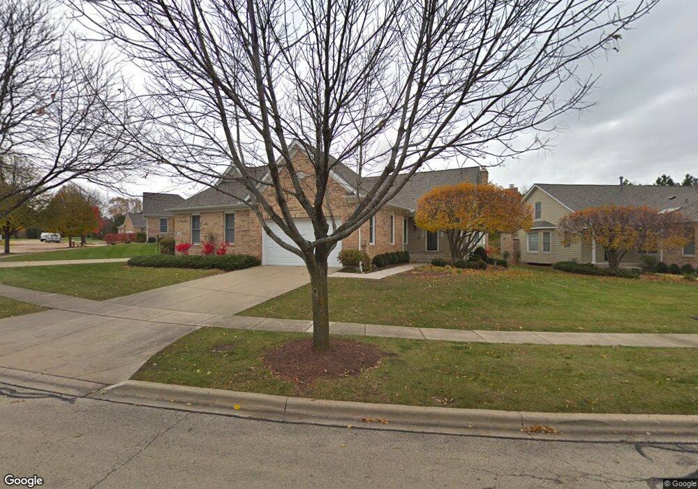
957 Ginger Ln Unit B Geneva, IL 60134
Southwest Geneva NeighborhoodEstimated Value: $455,236 - $502,000
2
Beds
3
Baths
1,891
Sq Ft
$249/Sq Ft
Est. Value
About This Home
This home is located at 957 Ginger Ln Unit B, Geneva, IL 60134 and is currently estimated at $470,309, approximately $248 per square foot. 957 Ginger Ln Unit B is a home located in Kane County with nearby schools including Williamsburg Elementary School, Geneva Community High School, and St. Peter School.
Ownership History
Date
Name
Owned For
Owner Type
Purchase Details
Closed on
Mar 25, 2024
Sold by
Thomas B Garlando Trust and Kathy M Garlando Trust
Bought by
James E Mcdonough And Nancy A Mcdonough Livin and Mcdonough
Current Estimated Value
Purchase Details
Closed on
Nov 15, 2005
Sold by
Dori Dennis and Dori Lynne
Bought by
Johnson Margaret A
Home Financials for this Owner
Home Financials are based on the most recent Mortgage that was taken out on this home.
Original Mortgage
$288,000
Interest Rate
6.04%
Mortgage Type
Fannie Mae Freddie Mac
Purchase Details
Closed on
Apr 6, 2001
Sold by
Lautz Builders Inc
Bought by
Lynn Dori Dennis and Lynn Dori
Home Financials for this Owner
Home Financials are based on the most recent Mortgage that was taken out on this home.
Original Mortgage
$277,900
Interest Rate
6%
Create a Home Valuation Report for This Property
The Home Valuation Report is an in-depth analysis detailing your home's value as well as a comparison with similar homes in the area
Home Values in the Area
Average Home Value in this Area
Purchase History
| Date | Buyer | Sale Price | Title Company |
|---|---|---|---|
| James E Mcdonough And Nancy A Mcdonough Livin | $419,000 | Chicago Title | |
| Johnson Margaret A | $360,500 | -- | |
| Lynn Dori Dennis | $293,500 | Ticor Title Insurance |
Source: Public Records
Mortgage History
| Date | Status | Borrower | Loan Amount |
|---|---|---|---|
| Previous Owner | Johnson Margaret A | $288,000 | |
| Previous Owner | Lynn Dori Dennis | $277,900 |
Source: Public Records
Tax History
| Year | Tax Paid | Tax Assessment Tax Assessment Total Assessment is a certain percentage of the fair market value that is determined by local assessors to be the total taxable value of land and additions on the property. | Land | Improvement |
|---|---|---|---|---|
| 2024 | $10,084 | $138,402 | $39,949 | $98,453 |
| 2023 | $10,322 | $125,820 | $36,317 | $89,503 |
| 2022 | $9,762 | $116,912 | $33,746 | $83,166 |
| 2021 | $9,494 | $112,567 | $32,492 | $80,075 |
| 2020 | $9,393 | $110,849 | $31,996 | $78,853 |
| 2019 | $9,377 | $108,750 | $31,390 | $77,360 |
| 2018 | $8,935 | $103,769 | $31,390 | $72,379 |
| 2017 | $8,240 | $94,072 | $30,553 | $63,519 |
| 2016 | $7,752 | $92,801 | $30,140 | $62,661 |
| 2015 | -- | $88,231 | $28,656 | $59,575 |
| 2014 | -- | $91,459 | $28,656 | $62,803 |
| 2013 | -- | $105,283 | $28,656 | $76,627 |
Source: Public Records
Map
Nearby Homes
- 2528 Heritage Ct Unit 1
- Unit 6A Prairie Grove Dr
- Unit 5B Prairie Grove Dr
- Unit 4A Prairie Grove Dr
- Unit 5A Prairie Grove Dr
- Unit 4B Prairie Grove Dr
- Unit 7A Prairie Grove Dr
- Unit 6C Prairie Grove Dr
- Unit 5C Prairie Grove Dr
- Unit 6B Prairie Grove Dr
- Unit 4C Prairie Grove Dr
- Unit 7C Prairie Grove Dr
- 839 S Randall Rd
- 1271 Herrington Rd
- 2309 Sudbury Ln
- 1823 Fargo Blvd
- 2731 Stone Cir
- 2767 Stone Cir
- 2769 Stone Cir
- 2719 Stone Cir
- 977 Ginger Ln Unit A
- 949 Ginger Ln Unit A
- 981 Ginger Ln Unit B
- 935 Ginger Ln Unit B
- 929 Ginger Ln
- 923 Ginger Ln Unit B
- 984 Ginger Ln Unit B
- 964 Ginger Ln
- 968 Ginger Ln Unit B
- 960 Ginger Ln Unit B
- 988 Ginger Ln Unit A
- 952 Ginger Ln Unit A
- 946 Ginger Ln Unit B
- 938 Ginger Ln Unit B
- 942 Ginger Ln Unit A
- 932 Ginger Ln Unit A
- 926 Ginger Ln Unit B
- 905 Ginger Ln Unit A
- 919 Lewis Rd
- 925 Lewis Rd
Your Personal Tour Guide
Ask me questions while you tour the home.