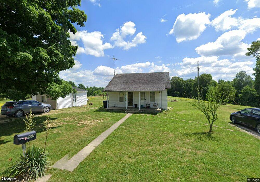
957 Rock Branch Rd Westmoreland, TN 37186
Estimated Value: $119,500 - $216,000
--
Bed
1
Bath
1,752
Sq Ft
$88/Sq Ft
Est. Value
About This Home
This home is located at 957 Rock Branch Rd, Westmoreland, TN 37186 and is currently estimated at $153,875, approximately $87 per square foot. 957 Rock Branch Rd is a home located in Macon County.
Ownership History
Date
Name
Owned For
Owner Type
Purchase Details
Closed on
May 9, 2011
Sold by
Johnson Travis
Bought by
Johnson Kevin and C/O Travis Johnson Etal
Current Estimated Value
Purchase Details
Closed on
Jun 25, 2009
Sold by
North Donna Jean
Bought by
Johnson Travis
Purchase Details
Closed on
Apr 19, 2008
Sold by
North Albert D
Bought by
North Donna Jean
Purchase Details
Closed on
Mar 27, 1996
Sold by
North Frank L
Bought by
North Frank L
Purchase Details
Closed on
Jul 9, 1991
Bought by
North Frank L and Kay Thelma R
Create a Home Valuation Report for This Property
The Home Valuation Report is an in-depth analysis detailing your home's value as well as a comparison with similar homes in the area
Home Values in the Area
Average Home Value in this Area
Purchase History
| Date | Buyer | Sale Price | Title Company |
|---|---|---|---|
| Johnson Kevin | $35,000 | -- | |
| Johnson Travis | $40,000 | -- | |
| North Donna Jean | -- | -- | |
| North Frank L | $8,500 | -- | |
| North Frank L | $18,000 | -- |
Source: Public Records
Tax History Compared to Growth
Tax History
| Year | Tax Paid | Tax Assessment Tax Assessment Total Assessment is a certain percentage of the fair market value that is determined by local assessors to be the total taxable value of land and additions on the property. | Land | Improvement |
|---|---|---|---|---|
| 2024 | $413 | $29,225 | $2,725 | $26,500 |
| 2023 | $413 | $29,225 | $0 | $0 |
| 2022 | $264 | $11,000 | $875 | $10,125 |
| 2021 | $264 | $11,000 | $875 | $10,125 |
| 2020 | $264 | $11,000 | $875 | $10,125 |
| 2019 | $264 | $11,000 | $875 | $10,125 |
| 2018 | $243 | $11,000 | $875 | $10,125 |
| 2017 | $222 | $8,825 | $975 | $7,850 |
| 2016 | $212 | $8,825 | $975 | $7,850 |
| 2015 | $212 | $8,825 | $975 | $7,850 |
| 2014 | $212 | $8,814 | $0 | $0 |
Source: Public Records
Map
Nearby Homes
- 0 Hanestown Rd
- 10 Hanestown Rd
- 2533 Hanestown Rd
- 1030 Hanestown Rd
- 6358 Rocky Mound Rd
- 760 Hanestown Rd
- 6184 Rocky Mound Rd
- 6170 Rocky Mound Rd
- 5879 Mount Union Rd
- 5837 Rocky Mound Rd
- 0 Pryor Ln Unit RTC2943657
- 100 Poplar Grove Rd
- 0 Hawkins Rd
- 137 Hawkins Rd
- 151 Hawkins Rd
- 8205 Hoskins Hollow Rd
- 429 Marlin Ln
- 3910 Union Chapel Rd
- 1137 Poplar Grove Rd
- 3902 Union Chapel Rd
- 0 Rock Branch Rd
- 855 Rock Branch Rd
- 1235 Rock Branch Rd
- 585 Rock Branch Rd
- 1418 Rock Branch Rd
- 380 Vanderboss Ln
- 660 Rock Ln
- 1373 Rock Branch Rd
- 438 Rock Ln Unit 438D
- 9173 Hanes Rd
- 755 Hanes Rd
- 1280 Hanes Rd
- 9075 Hanes Rd
- 1587 Rock Branch Rd
- 693 Hanes Rd
- 8959 Hanes Rd
- 2649 Hanestown Rd
- 1986 Rock Branch Rd
- 2914 Hanestown Rd
- 2950 Hanestown Rd