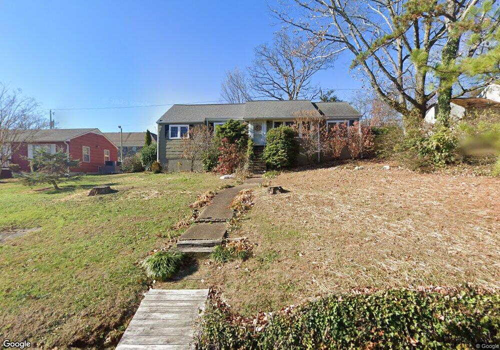
957 Signal Rd Signal Mountain, TN 37377
Estimated Value: $302,555 - $371,000
--
Bed
--
Bath
1,444
Sq Ft
$245/Sq Ft
Est. Value
About This Home
This home is located at 957 Signal Rd, Signal Mountain, TN 37377 and is currently estimated at $353,139, approximately $244 per square foot. 957 Signal Rd is a home located in Hamilton County with nearby schools including Thrasher Elementary School, Signal Mountain Middle/High School, and Signal Mountain Christian School.
Ownership History
Date
Name
Owned For
Owner Type
Purchase Details
Closed on
Jul 27, 2001
Sold by
Brock David M and Brock Jamie D
Bought by
Sutton Craig D and Sutton Karen S
Current Estimated Value
Home Financials for this Owner
Home Financials are based on the most recent Mortgage that was taken out on this home.
Original Mortgage
$108,300
Outstanding Balance
$42,032
Interest Rate
7.08%
Estimated Equity
$311,107
Purchase Details
Closed on
Mar 10, 1995
Sold by
Foky David L and Foky Anne L
Bought by
Brock David M and Brock Jamie D
Create a Home Valuation Report for This Property
The Home Valuation Report is an in-depth analysis detailing your home's value as well as a comparison with similar homes in the area
Home Values in the Area
Average Home Value in this Area
Purchase History
| Date | Buyer | Sale Price | Title Company |
|---|---|---|---|
| Sutton Craig D | $114,000 | First Title | |
| Brock David M | $79,500 | -- |
Source: Public Records
Mortgage History
| Date | Status | Borrower | Loan Amount |
|---|---|---|---|
| Open | Sutton Craig D | $108,300 |
Source: Public Records
Tax History Compared to Growth
Tax History
| Year | Tax Paid | Tax Assessment Tax Assessment Total Assessment is a certain percentage of the fair market value that is determined by local assessors to be the total taxable value of land and additions on the property. | Land | Improvement |
|---|---|---|---|---|
| 2024 | $1,080 | $48,250 | $0 | $0 |
| 2023 | $1,080 | $48,250 | $0 | $0 |
| 2022 | $1,080 | $48,250 | $0 | $0 |
| 2021 | $1,080 | $48,250 | $0 | $0 |
| 2020 | $1,030 | $37,250 | $0 | $0 |
| 2019 | $1,030 | $37,250 | $0 | $0 |
| 2018 | $1,030 | $37,250 | $0 | $0 |
| 2017 | $1,030 | $37,250 | $0 | $0 |
| 2016 | $1,004 | $0 | $0 | $0 |
| 2015 | $1,004 | $36,325 | $0 | $0 |
| 2014 | $1,004 | $0 | $0 | $0 |
Source: Public Records
Map
Nearby Homes
- 958 Signal Rd
- 1018 Ridgeway Ave
- 928 Ridgeway Ave
- 907 Kentucky Ave
- 905 Ridgeway Ave
- 533 Fern Trail
- 853 Kentucky Ave
- 122 Green Gorge Rd
- 779 James Blvd
- 102 Sunnybrook Trail
- 185 Woodcliff Cir
- 1425 Sunset Dr
- 1419 Sunset Dr
- 1521 Sunset Dr
- 15 Grayswood Hill Rd
- 5734 U S 127
- 14 Carriage Hill
- 422 Timberlinks Dr
- 421 Timberlinks Dr
- 1301 E Brow Rd