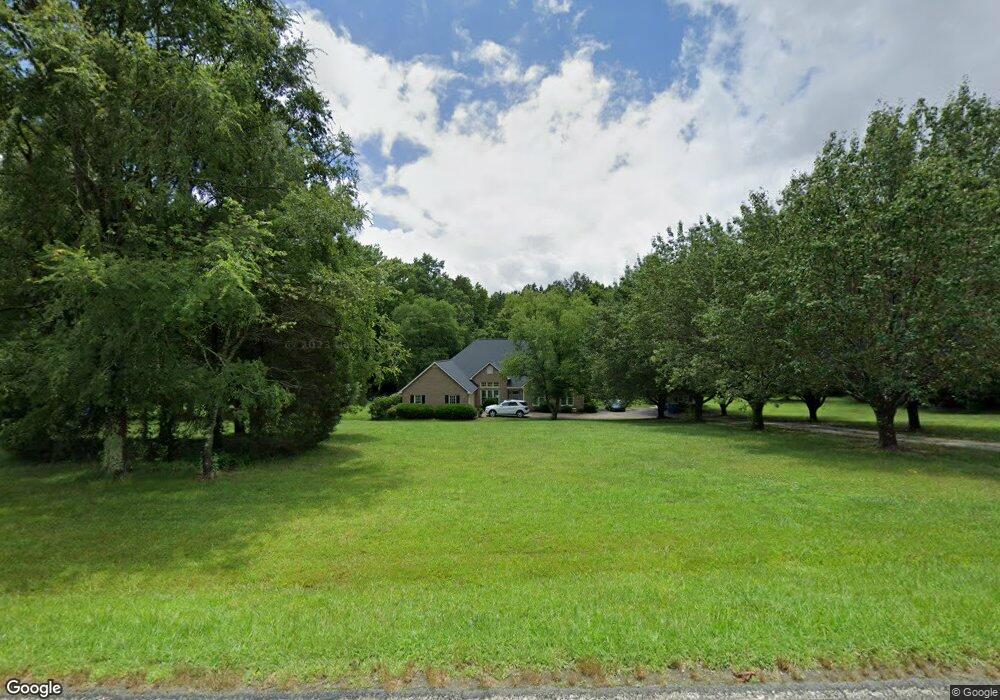
9571 Barnett Rd Concord, NC 28027
Estimated Value: $700,000 - $928,000
3
Beds
3
Baths
2,566
Sq Ft
$317/Sq Ft
Est. Value
About This Home
This home is located at 9571 Barnett Rd, Concord, NC 28027 and is currently estimated at $813,230, approximately $316 per square foot. 9571 Barnett Rd is a home located in Cabarrus County with nearby schools including Charles E. Boger Elementary School, Northwest Cabarrus Middle School, and Northwest Cabarrus High.
Ownership History
Date
Name
Owned For
Owner Type
Purchase Details
Closed on
Aug 19, 2016
Sold by
Bluto Nick W and Bluto Pamela C
Bought by
Gizzi Sandra Maria
Current Estimated Value
Purchase Details
Closed on
Jul 1, 1995
Bought by
Bluto Nicholas W and Bluto Wife
Purchase Details
Closed on
Jul 1, 1993
Create a Home Valuation Report for This Property
The Home Valuation Report is an in-depth analysis detailing your home's value as well as a comparison with similar homes in the area
Home Values in the Area
Average Home Value in this Area
Purchase History
| Date | Buyer | Sale Price | Title Company |
|---|---|---|---|
| Gizzi Sandra Maria | $420,000 | None Available | |
| Gizzi Sandra Maria | $420,000 | None Available | |
| Bluto Nicholas W | $27,500 | -- | |
| -- | $28,000 | -- |
Source: Public Records
Tax History Compared to Growth
Tax History
| Year | Tax Paid | Tax Assessment Tax Assessment Total Assessment is a certain percentage of the fair market value that is determined by local assessors to be the total taxable value of land and additions on the property. | Land | Improvement |
|---|---|---|---|---|
| 2025 | $4,018 | $632,810 | $242,480 | $390,330 |
| 2024 | $4,018 | $632,810 | $242,480 | $390,330 |
| 2023 | $3,529 | $427,780 | $149,770 | $278,010 |
| 2022 | $3,456 | $427,780 | $149,770 | $278,010 |
| 2021 | $3,456 | $427,780 | $149,770 | $278,010 |
| 2020 | $3,456 | $427,780 | $149,770 | $278,010 |
| 2019 | $2,836 | $350,990 | $121,240 | $229,750 |
| 2018 | $2,766 | $350,990 | $121,240 | $229,750 |
| 2017 | $2,696 | $350,990 | $121,240 | $229,750 |
| 2016 | $2,696 | $349,540 | $135,510 | $214,030 |
| 2015 | $2,650 | $349,540 | $135,510 | $214,030 |
| 2014 | $2,650 | $349,540 | $135,510 | $214,030 |
Source: Public Records
Map
Nearby Homes
- 9651 Barnett Rd
- 9650 Barnett Rd
- 9951 Barnett Rd
- 10150 Enclave Cir
- 10083 Castlebrooke Dr
- 10118 Castlebrooke Dr
- 3720 Shiloh Church Rd
- 2606 Cheverny Place
- 2657 Cheverny Place
- 5000 NW 141st St
- 4900 NW 141st St
- 4904 NW 141st St
- 4980 NW 141st St
- 5004 NW 141st St
- 3455 Shiloh Church Rd
- 11325 Sudbury Rd Unit 8
- 11325 Sudbury Rd Unit 6
- 11325 Sudbury Rd Unit 7
- Elliott Plan at Cannon Manor
- Maple Plan at Cannon Manor
- 9450 Barnett Rd
- 9600 Barnett Rd
- 9500 Barnett Rd
- 9520 Barnett Rd
- 9478 Barnett Rd
- 4312 Gail Ln
- 9350 Barnett Rd
- 9600 Sunshine Ln
- 0 Sunshine Ln Unit 2107357
- 9650 Sunshine Ln
- 9521 Barnett Rd
- 000 Barnett Rd
- 4306 Gail Ln
- 9251 Barnett Rd
- 9251 Barnett Rd
- 9700 Sunshine Ln
- 9651 Sunshine Ln
- 9655 Sunshine Ln
- 4318 Gail Ln
- 9720 Barnett Rd