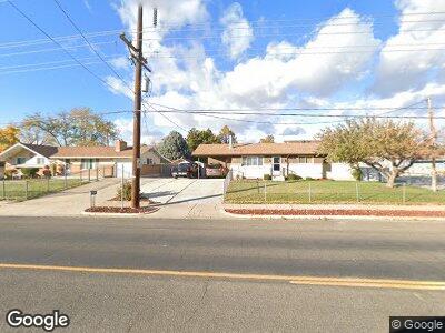
958 W Gordon Ave Layton, UT 84041
Estimated Value: $432,000 - $462,387
4
Beds
2
Baths
2,464
Sq Ft
$180/Sq Ft
Est. Value
About This Home
This home is located at 958 W Gordon Ave, Layton, UT 84041 and is currently estimated at $444,097, approximately $180 per square foot. 958 W Gordon Ave is a home located in Davis County with nearby schools including Central Davis Junior High School, Layton High School, and North Davis Preparatory Academy.
Ownership History
Date
Name
Owned For
Owner Type
Purchase Details
Closed on
Oct 4, 2016
Sold by
Woodall Louis D and Woodall Linda S
Bought by
Woodall Louis D and Woodall Family Trust
Current Estimated Value
Purchase Details
Closed on
Jul 15, 2016
Sold by
Bubak Shirley C
Bought by
Bubak Shirley C
Create a Home Valuation Report for This Property
The Home Valuation Report is an in-depth analysis detailing your home's value as well as a comparison with similar homes in the area
Home Values in the Area
Average Home Value in this Area
Purchase History
| Date | Buyer | Sale Price | Title Company |
|---|---|---|---|
| Woodall Louis D | -- | First American Title | |
| Bubak Shirley C | -- | Founders Title |
Source: Public Records
Mortgage History
| Date | Status | Borrower | Loan Amount |
|---|---|---|---|
| Open | Valdez Maria E Pena | $419,098 | |
| Closed | Woodall Louis D | $58,000 | |
| Closed | Linda S Woodall Trustee | $50,000 | |
| Previous Owner | Woodall Louis D | $78,553 | |
| Previous Owner | Woodall Louis D | $100,000 | |
| Previous Owner | Woodall Louis D | $105,600 |
Source: Public Records
Tax History Compared to Growth
Tax History
| Year | Tax Paid | Tax Assessment Tax Assessment Total Assessment is a certain percentage of the fair market value that is determined by local assessors to be the total taxable value of land and additions on the property. | Land | Improvement |
|---|---|---|---|---|
| 2024 | $2,013 | $212,850 | $92,657 | $120,193 |
| 2023 | -- | $345,000 | $144,824 | $200,176 |
| 2022 | $1,254 | $205,150 | $69,354 | $135,796 |
| 2021 | $1,254 | $284,000 | $100,762 | $183,238 |
| 2020 | $1,254 | $231,000 | $75,352 | $155,648 |
| 2019 | $1,254 | $225,000 | $72,456 | $152,544 |
| 2018 | $0 | $196,000 | $67,089 | $128,911 |
| 2016 | $1,273 | $93,500 | $22,041 | $71,459 |
| 2015 | $1,197 | $83,490 | $22,041 | $61,449 |
| 2014 | $1,262 | $89,991 | $22,041 | $67,950 |
| 2013 | $1,225 | $82,709 | $20,856 | $61,853 |
Source: Public Records
Map
Nearby Homes
- 1069 W 950 N
- 910 N 1125 W
- 1218 W 1050 N
- 1083 N 1250 W
- 1677 N 1600 W Unit 134
- 1842 W 1500 N Unit 171
- 1439 W 1200 N
- 1500 N Angel St Unit 31
- 1500 N Angel St Unit 22
- 1615 N Angel St Unit D
- 1615 N Angel St Unit C
- 1615 N Angel St Unit B
- 1615 N Angel St Unit A
- 1591 N Marilyn Dr
- 1637 Avalon Dr
- 1598 N Main St
- 1721 N 1500 W
- 1664 N 1600 W Unit 129
- 1678 N 1600 W Unit 123
- 1682 N 1600 W Unit 126
- 958 W Gordon Ave
- 980 W Gordon Ave
- 956 W 1000 N
- 956 W Gordon Ave
- 1053 W 1060 N
- 1000 W Gordon Ave
- 1054 W 1060 N
- 1054 W 1060 N
- 1020 W Gordon Ave
- 959 W 1000 N
- 1065 W 1060 N
- 1054 W 975 N
- 1058 W 975 N
- 1056 W 1060 N
- 1062 W 975 N
- 1040 W Gordon Ave
- 955 W Gordon Ave
- 1022 W 950 N
- 1022 W 950 N Unit 26
- 1066 W 975 N