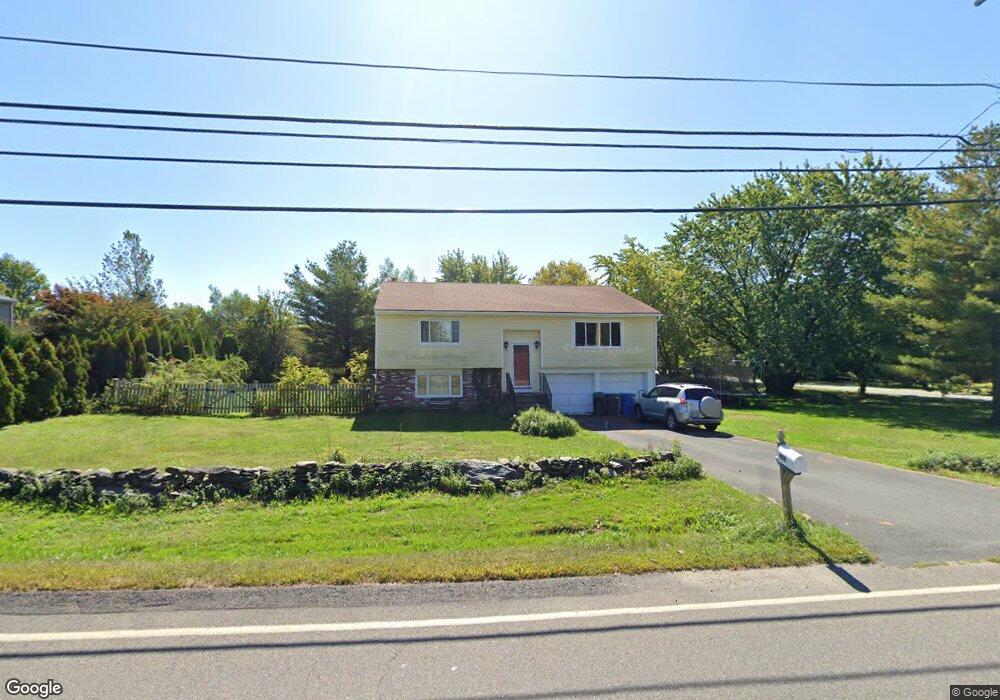
959 Green End Ave Middletown, RI 02842
Estimated Value: $737,319 - $1,386,000
3
Beds
3
Baths
2,300
Sq Ft
$425/Sq Ft
Est. Value
About This Home
This home is located at 959 Green End Ave, Middletown, RI 02842 and is currently estimated at $978,580, approximately $425 per square foot. 959 Green End Ave is a home located in Newport County with nearby schools including Middletown High School, All Saints STEAM Academy, and St George's School.
Ownership History
Date
Name
Owned For
Owner Type
Purchase Details
Closed on
Jun 17, 1997
Sold by
Harris Richard E and Harris Susan
Bought by
Mott Russell M and Mott Patricia
Current Estimated Value
Home Financials for this Owner
Home Financials are based on the most recent Mortgage that was taken out on this home.
Original Mortgage
$110,000
Interest Rate
7.97%
Mortgage Type
Purchase Money Mortgage
Create a Home Valuation Report for This Property
The Home Valuation Report is an in-depth analysis detailing your home's value as well as a comparison with similar homes in the area
Home Values in the Area
Average Home Value in this Area
Purchase History
| Date | Buyer | Sale Price | Title Company |
|---|---|---|---|
| Mott Russell M | $140,000 | -- |
Source: Public Records
Mortgage History
| Date | Status | Borrower | Loan Amount |
|---|---|---|---|
| Open | Mott Russell M | $50,000 | |
| Open | Mott Russell M | $113,000 | |
| Closed | Mott Russell M | $20,000 | |
| Closed | Mott Russell M | $110,000 |
Source: Public Records
Tax History Compared to Growth
Tax History
| Year | Tax Paid | Tax Assessment Tax Assessment Total Assessment is a certain percentage of the fair market value that is determined by local assessors to be the total taxable value of land and additions on the property. | Land | Improvement |
|---|---|---|---|---|
| 2025 | $6,826 | $579,000 | $347,200 | $231,800 |
| 2024 | $6,520 | $579,000 | $347,200 | $231,800 |
| 2023 | $4,491 | $356,700 | $179,600 | $177,100 |
| 2022 | $4,288 | $356,700 | $179,600 | $177,100 |
| 2021 | $4,288 | $356,700 | $179,600 | $177,100 |
| 2020 | $4,925 | $357,900 | $156,200 | $201,700 |
| 2018 | $4,921 | $357,900 | $156,200 | $201,700 |
| 2016 | $4,106 | $266,300 | $111,300 | $155,000 |
| 2015 | $4,005 | $266,300 | $111,300 | $155,000 |
| 2014 | $4,353 | $270,900 | $118,100 | $152,800 |
| 2013 | $4,256 | $270,900 | $118,100 | $152,800 |
Source: Public Records
Map
Nearby Homes
- 980 Green End Ave
- 119 Corey Ln
- 310 Corey Ln
- 318 Corey Ln
- 0 Saltwood Dr
- 16 Sachuest Dr
- 223 Corey Ln
- 0 Honeyman Ave
- 141 Gray Craig Rd
- 476 Green End Ave
- 62 Howland Ave
- 0 Wolcott Ave
- 10 Bartlett Rd
- 118 Wolcott Ave
- 55 John Clarke Rd Unit 8
- 55 John Clarke Rd Unit 3
- 162 Center Ave
- 65 Seascape Ave
- 84 Allston Ave
- 6 Wabasso Terrace
- 973 Green End Ave
- 912 Trout Run
- 207 Trout Dr
- 941 Green End Ave
- 985 Green End Ave
- 942 Green End Ave
- 230 Trout Dr
- 970 Green End Ave
- 927 Green End Ave
- 183 Trout Dr
- 214 Trout Dr
- 930 Green End Ave
- 990 Green End Ave
- 999 Green End Ave
- 204 Trout Dr
- 180 Trout Dr
- 1002 Green End Ave
- 38 Paradise Ave
- 1011 Green End Ave
- 12 Paradise Ave