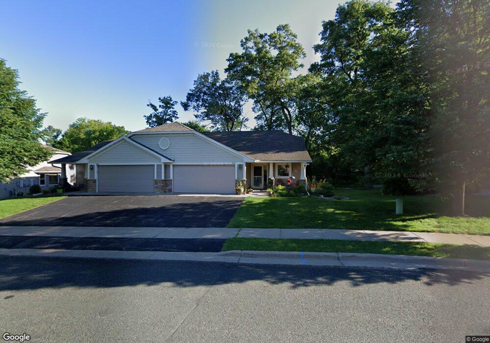
959 Keystone Ct N Unit 14 Hudson, WI 54016
Estimated Value: $419,000 - $449,000
3
Beds
3
Baths
--
Sq Ft
1.54
Acres
About This Home
This home is located at 959 Keystone Ct N Unit 14, Hudson, WI 54016 and is currently estimated at $438,072. 959 Keystone Ct N Unit 14 is a home located in St. Croix County with nearby schools including North Hudson Elementary School, Hudson Middle School, and Hudson High School.
Ownership History
Date
Name
Owned For
Owner Type
Purchase Details
Closed on
Mar 31, 2020
Sold by
Derrick Michael T and Derrick Jennipher
Bought by
Darnold Jeanne M
Current Estimated Value
Home Financials for this Owner
Home Financials are based on the most recent Mortgage that was taken out on this home.
Original Mortgage
$100,000
Outstanding Balance
$88,588
Interest Rate
3.4%
Mortgage Type
New Conventional
Estimated Equity
$349,484
Create a Home Valuation Report for This Property
The Home Valuation Report is an in-depth analysis detailing your home's value as well as a comparison with similar homes in the area
Home Values in the Area
Average Home Value in this Area
Purchase History
| Date | Buyer | Sale Price | Title Company |
|---|---|---|---|
| Darnold Jeanne M | $287,000 | None Available |
Source: Public Records
Mortgage History
| Date | Status | Borrower | Loan Amount |
|---|---|---|---|
| Open | Darnold Jeanne M | $100,000 |
Source: Public Records
Tax History Compared to Growth
Tax History
| Year | Tax Paid | Tax Assessment Tax Assessment Total Assessment is a certain percentage of the fair market value that is determined by local assessors to be the total taxable value of land and additions on the property. | Land | Improvement |
|---|---|---|---|---|
| 2024 | $47 | $364,100 | $32,000 | $332,100 |
| 2023 | $4,678 | $364,100 | $32,000 | $332,100 |
| 2022 | $3,712 | $364,100 | $32,000 | $332,100 |
| 2021 | $3,849 | $189,300 | $20,000 | $169,300 |
| 2020 | $3,735 | $189,300 | $20,000 | $169,300 |
| 2019 | $4,151 | $189,300 | $20,000 | $169,300 |
| 2018 | $3,897 | $189,300 | $20,000 | $169,300 |
| 2017 | $3,434 | $189,300 | $20,000 | $169,300 |
| 2016 | $3,434 | $189,300 | $20,000 | $169,300 |
| 2015 | $3,168 | $189,300 | $20,000 | $169,300 |
| 2014 | $3,274 | $189,300 | $20,000 | $169,300 |
| 2013 | $3,428 | $217,700 | $24,000 | $193,700 |
Source: Public Records
Map
Nearby Homes
- 241 Starrwood
- 1029 Sommers St N
- 1031 Sommers St N
- 611 Lemon St N
- 603 10th St N
- 617 6th St
- 1143 Sommers St N
- 233 River Heights Trail
- 888 Bluebird Ct N
- 312 Meadow Dr N
- 1205 Riverside Dr N
- 1205 Riverside Drive N
- 530 Lakeside Bay Dr S
- 422 2nd St S
- 1094 Golden Oaks Ln
- 296 Valley Estates Ct
- 632 Oakwood St S
- 636 Oakwood St S
- 621 Mallalieu Dr
- 16 Point Rd
- 979 Keystone Ct N Unit 16
- 949 Keystone Ct N Unit 13
- 939 Keystone Ct N Unit 12
- 969 Keystone Ct N Unit 15
- 929 Keystone Ct N Unit 11
- 970 Keystone Ct N Unit 2
- 989 Keystone Ct N Unit 17
- 919 Keystone Ct N Unit 10
- 1000 10th St N Unit 22
- 1004 10th St N Unit 21
- 930 Keystone Ct N Unit 6
- 940 Keystone Ct N Unit 5
- 950 Keystone Ct N Unit 4
- 960 Keystone Ct N Unit 3
- 980 Keystone Ct N Unit 1
- 909 Keystone Ct N Unit 9
- 920 Keystone Ct N Unit 7
- 1015 10th St N
- 910 Keystone Ct N Unit 8
- 1010 10th St N Unit 20