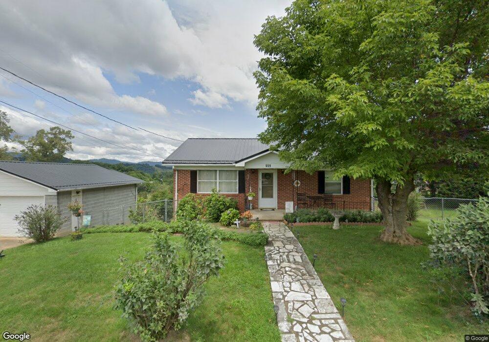
959 Queentown Rd Canton, NC 28716
Estimated Value: $278,298 - $341,000
3
Beds
1
Bath
1,020
Sq Ft
$303/Sq Ft
Est. Value
About This Home
This home is located at 959 Queentown Rd, Canton, NC 28716 and is currently estimated at $309,325, approximately $303 per square foot. 959 Queentown Rd is a home located in Haywood County with nearby schools including Meadowbrook Elementary School, Canton Middle, and Pisgah High School.
Ownership History
Date
Name
Owned For
Owner Type
Purchase Details
Closed on
Jan 17, 2025
Sold by
Duckett Sharon E and Duckett Darrell W
Bought by
Fisher Janice H
Current Estimated Value
Home Financials for this Owner
Home Financials are based on the most recent Mortgage that was taken out on this home.
Original Mortgage
$120,000
Outstanding Balance
$119,132
Interest Rate
6.6%
Mortgage Type
New Conventional
Estimated Equity
$190,193
Purchase Details
Closed on
Aug 5, 1976
Bought by
Hill Carolyn L
Create a Home Valuation Report for This Property
The Home Valuation Report is an in-depth analysis detailing your home's value as well as a comparison with similar homes in the area
Home Values in the Area
Average Home Value in this Area
Purchase History
| Date | Buyer | Sale Price | Title Company |
|---|---|---|---|
| Fisher Janice H | -- | None Listed On Document | |
| Hill Carolyn L | $32,000 | -- |
Source: Public Records
Mortgage History
| Date | Status | Borrower | Loan Amount |
|---|---|---|---|
| Open | Fisher Janice H | $120,000 |
Source: Public Records
Tax History Compared to Growth
Tax History
| Year | Tax Paid | Tax Assessment Tax Assessment Total Assessment is a certain percentage of the fair market value that is determined by local assessors to be the total taxable value of land and additions on the property. | Land | Improvement |
|---|---|---|---|---|
| 2025 | -- | $157,400 | $20,800 | $136,600 |
| 2024 | $1,174 | $157,400 | $20,800 | $136,600 |
| 2023 | $1,158 | $157,400 | $20,800 | $136,600 |
| 2022 | $1,135 | $157,400 | $20,800 | $136,600 |
| 2021 | $1,135 | $157,400 | $20,800 | $136,600 |
| 2020 | $863 | $105,100 | $13,800 | $91,300 |
| 2019 | $868 | $105,100 | $13,800 | $91,300 |
| 2018 | $868 | $105,100 | $13,800 | $91,300 |
| 2017 | $858 | $105,100 | $0 | $0 |
| 2016 | $882 | $112,000 | $0 | $0 |
| 2015 | $882 | $112,000 | $0 | $0 |
| 2014 | $782 | $112,000 | $0 | $0 |
Source: Public Records
Map
Nearby Homes
- 286 Keith Dr
- 178 Keith Dr
- 57 Eden Brook Dr
- 32 Perseverance Dr
- 54 Bittersweet Trail
- 1685 Queentown Rd
- 4 Mayapple Ln
- 189 Brookside Dr
- 21 Crooked Trail
- 50 Morning Star Rd
- 28 Back Stage Pass
- 292 Skyline Dr
- 27 Barkn Cove
- 18 Skyline Dr
- 236 Haywood Dr
- 142 Substation Rd
- 177 Rhoda St
- 8 W Haywood Dr
- 109 Rhoda St
- 317 Poplar St
- 31 Howell Rd
- 907 Queentown Rd
- 41 Howell Rd
- 65 Howell Rd
- 50 Howell Rd
- 1050 Queentown Rd
- 880 Queentown Rd
- 103 Howell Rd
- 58 Abel Rd
- 125 Nells Hollow Rd
- 11 Hemlock Hill
- 123 Howell Rd
- 200 Abel Rd
- 805 Queentown Rd
- 1107 Queentown Rd
- 1088 Queentown Rd
- 840 Queentown Rd
- 191 Abel Rd
- 161 Howell Rd
- 600 Scottdale Rd