Estimated Value: $339,314 - $389,000
3
Beds
2
Baths
1,482
Sq Ft
$244/Sq Ft
Est. Value
About This Home
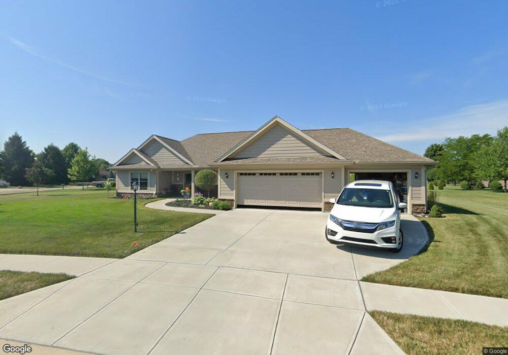
This home is located at 959 Wright Ave, Xenia, OH 45385 and is currently estimated at $361,079, approximately $243 per square foot. 959 Wright Ave is a home located in Greene County with nearby schools including Xenia High School, Summit Academy Community School for Alternative Learners - Xenia, and Legacy Christian Academy.
Ownership History
Date
Name
Owned For
Owner Type
Purchase Details
Closed on
Sep 28, 2018
Sold by
Sibco Ltd
Bought by
Knisley David M and Knisley Marilyn M
Current Estimated Value
Home Financials for this Owner
Home Financials are based on the most recent Mortgage that was taken out on this home.
Original Mortgage
$227,000
Interest Rate
4.5%
Mortgage Type
Future Advance Clause Open End Mortgage
Purchase Details
Closed on
Jul 9, 2008
Sold by
P F D Development P L L
Bought by
Sibco Ltd
Create a Home Valuation Report for This Property
The Home Valuation Report is an in-depth analysis detailing your home's value as well as a comparison with similar homes in the area
Home Values in the Area
Average Home Value in this Area
Purchase History
| Date | Buyer | Sale Price | Title Company |
|---|---|---|---|
| Knisley David M | $39,500 | None Available | |
| Sibco Ltd | -- | None Available |
Source: Public Records
Mortgage History
| Date | Status | Borrower | Loan Amount |
|---|---|---|---|
| Previous Owner | Knisley David M | $227,000 |
Source: Public Records
Tax History
| Year | Tax Paid | Tax Assessment Tax Assessment Total Assessment is a certain percentage of the fair market value that is determined by local assessors to be the total taxable value of land and additions on the property. | Land | Improvement |
|---|---|---|---|---|
| 2025 | $3,849 | $100,700 | $22,270 | $78,430 |
| 2024 | $3,849 | $100,700 | $22,270 | $78,430 |
| 2023 | $3,790 | $100,700 | $22,270 | $78,430 |
| 2022 | $3,274 | $75,690 | $14,850 | $60,840 |
| 2021 | $3,318 | $75,690 | $14,850 | $60,840 |
| 2020 | $3,175 | $75,690 | $14,850 | $60,840 |
| 2019 | $676 | $13,060 | $13,060 | $0 |
| 2018 | $678 | $13,060 | $13,060 | $0 |
| 2017 | $691 | $13,060 | $13,060 | $0 |
| 2016 | $691 | $13,060 | $13,060 | $0 |
| 2015 | $693 | $13,060 | $13,060 | $0 |
| 2014 | $664 | $13,060 | $13,060 | $0 |
Source: Public Records
Map
Nearby Homes
- 938 Wright Ave
- 1978 Lakeview Dr
- 2102 High Wheel Dr
- 920 Wright Cycle Blvd
- 926 Wright Cycle Blvd
- 2276 Tandem Dr
- 2352 Pembury Dr
- 1955 Roxbury Dr
- 2516 Jenny Marie Dr
- 0 Berkshire Dr Unit 949217
- 1321 Massachusetts Dr
- 2813 Raxit Ct
- 2936 W Barnhill Place
- 2096 Alabama Dr
- 1001 Glen Kegley Dr
- 1772 Pueblo Dr
- 1715 Sioux Dr
- 1861 Nebraska Dr
- 1068 Hedges Rd
- 1317 Baybury Ave
- 2118 Tandem Dr
- 969 Wright Ave
- lot #173 Tandem Dr
- lot #172 Wright Ave
- lot #170 Wright Ave
- 2124 Tandem Dr
- 2010 Tandem Dr
- 949 Wright Ave
- 2134 Tandem Dr
- 1911 Lakeview Dr
- 2147 Schwinn Ave
- 943 Wright Ave
- 1927 Lakeview Dr
- 948 Wright Ave
- 2140 Schwinn Ave
- 948 Cannondale Ave
- 2153 Schwinn Ave
- 970 Wright Ave
- 939 Wright Ave
- 980 Wright Ave
Your Personal Tour Guide
Ask me questions while you tour the home.