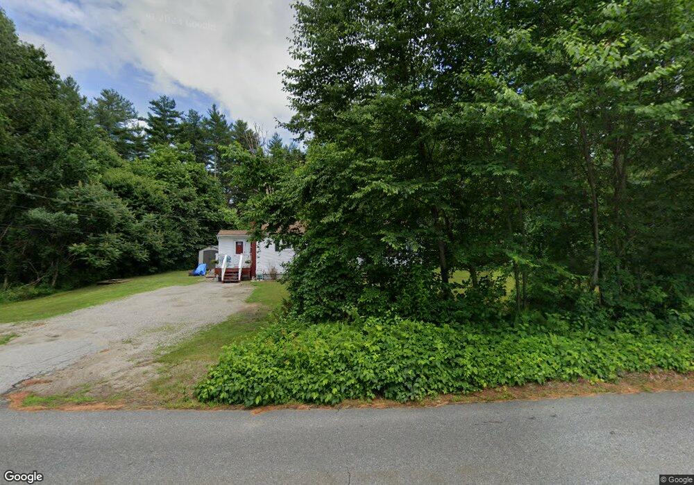
96 A f Putnam Rd Charlton, MA 01507
Estimated Value: $231,000 - $382,000
1
Bed
1
Bath
861
Sq Ft
$370/Sq Ft
Est. Value
About This Home
This home is located at 96 A f Putnam Rd, Charlton, MA 01507 and is currently estimated at $318,153, approximately $369 per square foot. 96 A f Putnam Rd is a home located in Worcester County with nearby schools including Shepherd Hill Regional High School.
Ownership History
Date
Name
Owned For
Owner Type
Purchase Details
Closed on
Apr 13, 2007
Sold by
Bennett Linda R
Bought by
Saulnier-Wright Monica
Current Estimated Value
Home Financials for this Owner
Home Financials are based on the most recent Mortgage that was taken out on this home.
Original Mortgage
$170,000
Outstanding Balance
$102,275
Interest Rate
6.24%
Mortgage Type
Purchase Money Mortgage
Estimated Equity
$215,878
Purchase Details
Closed on
Feb 3, 1999
Sold by
Freeman Carole J
Bought by
Bennett Linda R
Home Financials for this Owner
Home Financials are based on the most recent Mortgage that was taken out on this home.
Original Mortgage
$59,575
Interest Rate
6.74%
Mortgage Type
Purchase Money Mortgage
Create a Home Valuation Report for This Property
The Home Valuation Report is an in-depth analysis detailing your home's value as well as a comparison with similar homes in the area
Home Values in the Area
Average Home Value in this Area
Purchase History
| Date | Buyer | Sale Price | Title Company |
|---|---|---|---|
| Saulnier-Wright Monica | $190,000 | -- | |
| Saulnier-Wright Monica | $190,000 | -- | |
| Bennett Linda R | $59,575 | -- | |
| Bennett Linda R | $59,575 | -- |
Source: Public Records
Mortgage History
| Date | Status | Borrower | Loan Amount |
|---|---|---|---|
| Open | Saulnier-Wright Monica | $170,000 | |
| Closed | Bennett Linda R | $170,000 | |
| Previous Owner | Bennett Linda R | $76,000 | |
| Previous Owner | Bennett Linda R | $65,000 | |
| Previous Owner | Bennett Linda R | $59,575 |
Source: Public Records
Tax History Compared to Growth
Tax History
| Year | Tax Paid | Tax Assessment Tax Assessment Total Assessment is a certain percentage of the fair market value that is determined by local assessors to be the total taxable value of land and additions on the property. | Land | Improvement |
|---|---|---|---|---|
| 2025 | $2,833 | $254,500 | $82,400 | $172,100 |
| 2024 | $2,756 | $243,000 | $82,400 | $160,600 |
| 2023 | $2,721 | $223,600 | $79,700 | $143,900 |
| 2022 | $2,549 | $191,800 | $72,500 | $119,300 |
| 2021 | $2,408 | $160,400 | $68,700 | $91,700 |
| 2020 | $2,355 | $157,600 | $65,900 | $91,700 |
| 2019 | $2,328 | $157,600 | $65,900 | $91,700 |
| 2018 | $2,128 | $157,600 | $65,900 | $91,700 |
| 2017 | $1,956 | $138,700 | $60,400 | $78,300 |
| 2016 | $1,911 | $138,700 | $60,400 | $78,300 |
| 2015 | $1,861 | $138,700 | $60,400 | $78,300 |
| 2014 | $1,818 | $143,600 | $66,100 | $77,500 |
Source: Public Records
Map
Nearby Homes
- 20 Drury Ln
- 18 Mckinstry Dr
- 0 Partridge Hill Rd
- 3 Lelandville Rd
- 2 Lelandville Rd
- 124 Charlton St Unit F
- 4 Toria Heights Rd
- 44 Buffum Rd
- 2 Potter Village Rd
- 58 Colburn Rd
- 3 Willow St
- 7 Dudley Rd
- 62 Larned Rd
- 9 Howarth Rd
- 72 Charlton St
- 4 Corey Dr
- 28 Holly St
- L0T 3 History Dr
- 10 Friar Tuck Ln
- 4 History Dr
- 100 A f Putnam Rd
- 92 A f Putnam Rd
- 91 A f Putnam Rd
- 101 A f Putnam Rd
- 87 A f Putnam Rd
- 84 A f Putnam Rd
- 99 A f Putnam Rd
- 107 A f Putnam Rd
- 108 A f Putnam Rd
- 109 A f Putnam Rd
- 79 A f Putnam Rd
- 7 Dennis Wilbur Dr
- 5 Dennis Wilbur Dr
- 113 A f Putnam Rd
- 75 A f Putnam Rd
- 3 Dennis Wilbur Dr
- 117 A f Putnam Rd
- 4 Dennis Wilbur Dr
- 73 A f Putnam Rd
- 2 Dennis Wilbur Dr