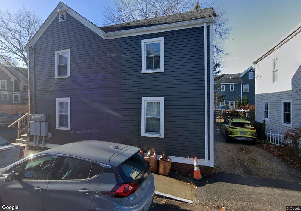
96 Brewster St Portsmouth, NH 03801
West End NeighborhoodEstimated Value: $733,195 - $1,670,000
4
Beds
2
Baths
1,678
Sq Ft
$627/Sq Ft
Est. Value
About This Home
This home is located at 96 Brewster St, Portsmouth, NH 03801 and is currently estimated at $1,051,799, approximately $626 per square foot. 96 Brewster St is a home located in Rockingham County with nearby schools including Little Harbour School, Portsmouth Middle School, and Portsmouth High School.
Ownership History
Date
Name
Owned For
Owner Type
Purchase Details
Closed on
Sep 24, 2013
Sold by
Shone Brinton W
Bought by
Shone Brinton W and Shore Tatjiana R
Current Estimated Value
Purchase Details
Closed on
May 8, 2003
Sold by
Newbury North Dev Corp
Bought by
Reddy Homes Brentwood
Purchase Details
Closed on
Aug 20, 1997
Sold by
Fleming Peyton C and Fleming Samuel W
Bought by
Shone Brinton W
Home Financials for this Owner
Home Financials are based on the most recent Mortgage that was taken out on this home.
Original Mortgage
$104,959
Interest Rate
7.42%
Mortgage Type
Purchase Money Mortgage
Create a Home Valuation Report for This Property
The Home Valuation Report is an in-depth analysis detailing your home's value as well as a comparison with similar homes in the area
Home Values in the Area
Average Home Value in this Area
Purchase History
| Date | Buyer | Sale Price | Title Company |
|---|---|---|---|
| Shone Brinton W | -- | -- | |
| Reddy Homes Brentwood | $181,800 | -- | |
| Shone Brinton W | $118,000 | -- |
Source: Public Records
Mortgage History
| Date | Status | Borrower | Loan Amount |
|---|---|---|---|
| Previous Owner | Shone Brinton W | $147,000 | |
| Previous Owner | Shone Brinton W | $104,959 |
Source: Public Records
Tax History Compared to Growth
Tax History
| Year | Tax Paid | Tax Assessment Tax Assessment Total Assessment is a certain percentage of the fair market value that is determined by local assessors to be the total taxable value of land and additions on the property. | Land | Improvement |
|---|---|---|---|---|
| 2024 | $7,591 | $679,000 | $440,800 | $238,200 |
| 2023 | $6,838 | $423,900 | $255,500 | $168,400 |
| 2022 | $6,443 | $423,900 | $255,500 | $168,400 |
| 2021 | $6,371 | $423,900 | $255,500 | $168,400 |
| 2020 | $6,231 | $423,900 | $255,500 | $168,400 |
| 2019 | $6,299 | $423,900 | $255,500 | $168,400 |
| 2018 | $6,467 | $408,300 | $249,700 | $158,600 |
| 2017 | $5,655 | $367,700 | $209,100 | $158,600 |
| 2016 | $5,117 | $300,300 | $159,800 | $140,500 |
| 2015 | $5,042 | $300,300 | $159,800 | $140,500 |
| 2014 | $4,402 | $243,200 | $140,900 | $102,300 |
| 2013 | $4,358 | $243,300 | $140,900 | $102,400 |
| 2012 | $4,270 | $243,300 | $140,900 | $102,400 |
Source: Public Records
Map
Nearby Homes
- 92 Brewster St
- 99 Foundry Place Unit 106
- 99 Foundry Place Unit 408
- 99 Foundry Place Unit 102
- 99 Foundry Place Unit 310
- 99 Foundry Place Unit 109
- 99 Foundry Place Unit 308
- 99 Foundry Place Unit 208
- 99 Foundry Place Unit 101
- 99 Foundry Place Unit 207
- 99 Foundry Place Unit 301
- 99 Foundry Place Unit 206
- 99 Foundry Place Unit 103
- 198 Islington St Unit 6
- 4 Rock St Unit B
- 332 Hanover St
- 51 Islington St Unit 406
- 199 Mcdonough St
- 238 Deer St Unit 305
- 238 Deer St Unit 206
- 82 Brewster St
- 98 Brewster St
- 95 Brewster St
- 85 Brewster St Unit 2
- 101 Langdon St Unit 3
- 3 Mcdonough St
- 7 Mcdonough St
- 13 Mcdonough St
- 91 Langdon St Unit 2
- 81 Langdon St Unit 1
- 49 Sudbury St
- 4 Mcdonough St
- 16 Mcdonough St
- 82 Langdon St
- 18 Mcdonough St
- 31 Sudbury St
- 72 Langdon St
- 439 Hanover St
- 6 Mcdonough St
- 6 Mcdonough St Unit 2