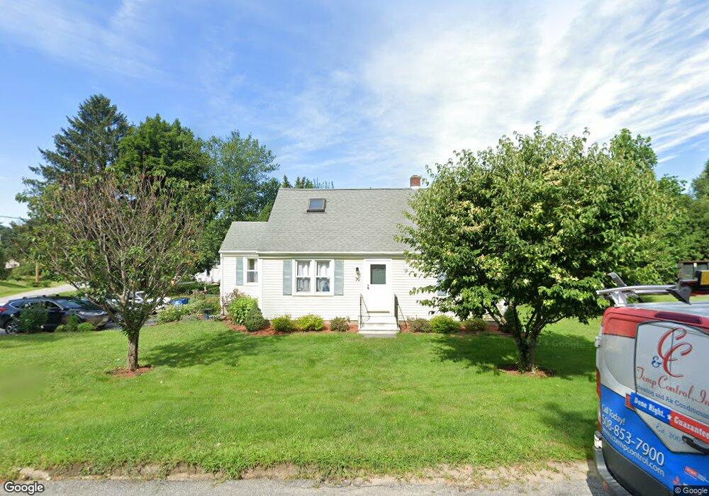
96 Bunkerhill Pkwy West Boylston, MA 01583
Estimated Value: $478,000 - $512,000
4
Beds
2
Baths
1,452
Sq Ft
$338/Sq Ft
Est. Value
About This Home
This home is located at 96 Bunkerhill Pkwy, West Boylston, MA 01583 and is currently estimated at $490,591, approximately $337 per square foot. 96 Bunkerhill Pkwy is a home located in Worcester County with nearby schools including Major Edwards Elementary School, West Boylston Junior/Senior High School, and Abby Kelley Foster Charter Public School.
Ownership History
Date
Name
Owned For
Owner Type
Purchase Details
Closed on
Jul 31, 2021
Sold by
Marsh Robert A and Marsh Mary E
Bought by
Marsh Ft
Current Estimated Value
Purchase Details
Closed on
Apr 25, 1991
Sold by
Fnma
Bought by
Marsh Robert A and Mary E Marsh
Purchase Details
Closed on
Apr 17, 1991
Sold by
Dupont Paul R
Bought by
Federal National Mortgage Association
Create a Home Valuation Report for This Property
The Home Valuation Report is an in-depth analysis detailing your home's value as well as a comparison with similar homes in the area
Home Values in the Area
Average Home Value in this Area
Purchase History
| Date | Buyer | Sale Price | Title Company |
|---|---|---|---|
| Marsh Ft | -- | None Available | |
| Marsh Robert A | $99,800 | -- | |
| Federal National Mortgage Association | $115,000 | -- |
Source: Public Records
Mortgage History
| Date | Status | Borrower | Loan Amount |
|---|---|---|---|
| Previous Owner | Federal National Mortgage Association | $147,000 | |
| Previous Owner | Federal National Mortgage Association | $132,000 |
Source: Public Records
Tax History Compared to Growth
Tax History
| Year | Tax Paid | Tax Assessment Tax Assessment Total Assessment is a certain percentage of the fair market value that is determined by local assessors to be the total taxable value of land and additions on the property. | Land | Improvement |
|---|---|---|---|---|
| 2025 | $54 | $387,500 | $99,900 | $287,600 |
| 2024 | $5,090 | $344,400 | $99,900 | $244,500 |
| 2023 | $5,112 | $328,100 | $99,100 | $229,000 |
| 2022 | $4,643 | $262,600 | $99,100 | $163,500 |
| 2021 | $4,657 | $252,300 | $96,000 | $156,300 |
| 2020 | $4,589 | $247,000 | $96,000 | $151,000 |
| 2019 | $4,420 | $234,500 | $96,000 | $138,500 |
| 2018 | $4,296 | $229,500 | $96,000 | $133,500 |
| 2017 | $4,080 | $217,000 | $96,000 | $121,000 |
| 2016 | $3,867 | $209,600 | $89,400 | $120,200 |
| 2015 | $3,774 | $205,800 | $88,600 | $117,200 |
Source: Public Records
Map
Nearby Homes
- 1 Highland Ave
- 39 Davidson Rd
- 12 Birchbrush Ln
- 740 Burncoat St Unit B
- 33 Meola Ave
- 39 Meola Ave
- 33 Isleboro St
- 29 Isleboro St
- 1110 W Boylston St Unit A
- 1097 W Boylston St
- 156 Hillside Village Dr
- 62 Maple St
- 54 Maple St
- 44 Dixfield St
- 83 Hillside Village Dr
- 59 Santoro Rd
- 97 Hillside Village Dr
- 22 Danielles Way
- 26 Danielles Way
- 31 Danielles Way
- 92 Bunkerhill Pkwy
- 387 Worcester St
- 391 Worcester St
- 12 Yorktown Rd
- 383 Worcester St
- 91 Bunkerhill Pkwy
- 16 Yorktown Rd
- 8 Yorktown Rd
- 88 Bunkerhill Pkwy
- 20 Yorktown Rd
- 379 Worcester St
- 23 Yorktown Rd
- 4 Yorktown Rd
- 21 Edgewood Ave
- 87 Bunkerhill Pkwy
- 17 Edgewood Ave
- 84 Bunkerhill Pkwy
- 24 Yorktown Rd
- 9 Edgewood Ave
- 375 Worcester St