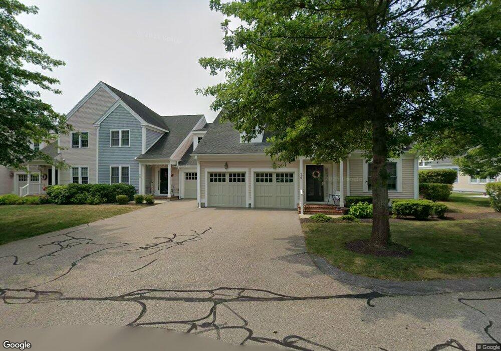
96 Godfrey Dr Norton, MA 02766
Estimated Value: $652,363 - $689,000
2
Beds
3
Baths
2,314
Sq Ft
$290/Sq Ft
Est. Value
About This Home
This home is located at 96 Godfrey Dr, Norton, MA 02766 and is currently estimated at $670,591, approximately $289 per square foot. 96 Godfrey Dr is a home located in Bristol County with nearby schools including J.C. Solmonese Elementary School, Henri A. Yelle Elementary School, and Norton Middle School.
Ownership History
Date
Name
Owned For
Owner Type
Purchase Details
Closed on
Nov 28, 2018
Sold by
Mermelsten Lothar and Mermelstein Terry
Bought by
R Lothar
Current Estimated Value
Purchase Details
Closed on
Feb 2, 2004
Sold by
Thorndike Prop Of Mass
Bought by
Mermelstein Lothar and Mermelstein Terry
Home Financials for this Owner
Home Financials are based on the most recent Mortgage that was taken out on this home.
Original Mortgage
$150,000
Interest Rate
5.82%
Mortgage Type
Purchase Money Mortgage
Create a Home Valuation Report for This Property
The Home Valuation Report is an in-depth analysis detailing your home's value as well as a comparison with similar homes in the area
Home Values in the Area
Average Home Value in this Area
Purchase History
| Date | Buyer | Sale Price | Title Company |
|---|---|---|---|
| R Lothar | -- | -- | |
| Mermelstein Lothar | $398,760 | -- |
Source: Public Records
Mortgage History
| Date | Status | Borrower | Loan Amount |
|---|---|---|---|
| Previous Owner | Mermelstein Lothar | $150,000 |
Source: Public Records
Tax History Compared to Growth
Tax History
| Year | Tax Paid | Tax Assessment Tax Assessment Total Assessment is a certain percentage of the fair market value that is determined by local assessors to be the total taxable value of land and additions on the property. | Land | Improvement |
|---|---|---|---|---|
| 2025 | $72 | $553,300 | $0 | $553,300 |
| 2024 | $6,958 | $537,300 | $0 | $537,300 |
| 2023 | $6,551 | $504,300 | $0 | $504,300 |
| 2022 | $6,748 | $473,200 | $0 | $473,200 |
| 2021 | $6,551 | $438,800 | $0 | $438,800 |
| 2020 | $6,394 | $432,000 | $0 | $432,000 |
| 2019 | $6,228 | $418,000 | $0 | $418,000 |
| 2018 | $6,125 | $404,000 | $0 | $404,000 |
| 2017 | $5,861 | $381,300 | $0 | $381,300 |
| 2016 | $5,901 | $378,000 | $0 | $378,000 |
| 2015 | $5,450 | $354,100 | $0 | $354,100 |
| 2014 | $5,289 | $344,100 | $0 | $344,100 |
Source: Public Records
Map
Nearby Homes
- 157 Mansfield Ave Unit 14
- 250 Mansfield Ave Unit 66
- 93 Mansfield Ave
- 15 Reservoir St Unit 44
- 39 Evergreen Rd
- 21 Juniper Rd
- 15 Patten Rd
- 18 Columbine Rd
- 268 Reservoir St
- 10 Ridge Rd
- 0 Brook Pkwy
- 37 Oakleaf Dr
- 9 Larson Farm Dr
- 23 Indian Rd
- 12 Sylvan Rd
- 14 Country Club Way
- 2 Oak St Unit 2D
- 2 Oak St Unit 2A
- 2 Oak St Unit 2C
- 2 Oak St Unit 2B
- 95 Godfrey Dr
- 94 Godfrey Dr
- 92 Godfrey Dr
- 91 Godfrey Dr
- 152 Godfrey Drive Barker Unit 2,15
- 76 Godfrey Dr
- 75 Godfrey Dr
- 74 Godfrey Dr
- 72 Godfrey Dr
- 71 Godfrey Dr
- 52 Godfrey Dr
- 51 Godfrey Dr
- 116 Godfrey Dr
- 115 Godfrey Dr
- 114 Godfrey Dr
- 113 Godfrey Dr
- 111 Godfrey Dr
- 116 Godfrey Dr Unit 6,11
- 135 Godfrey Dr
- 134 Godfrey Dr