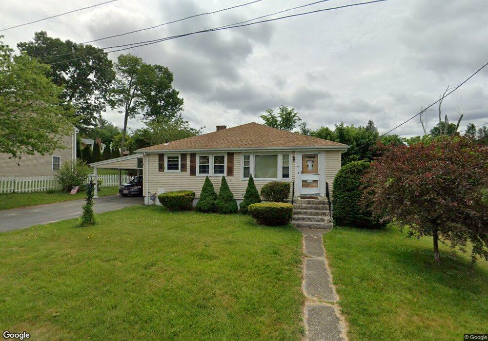
96 Kalmar St Worcester, MA 01606
Greendale NeighborhoodEstimated Value: $403,000 - $446,000
About This Home
This home is located at 96 Kalmar St, Worcester, MA 01606 and is currently estimated at $426,996, approximately $348 per square foot. 96 Kalmar St is a home located in Worcester County with nearby schools including Jacob Hiatt Magnet School, Chandler Magnet, and Thorndyke Road School.
Ownership History
We collect this data history from publicly available records. To have your information removed, we recommend requesting removal directly through your county’s website.
Purchase Details
Home Values in the Area
Average Home Value in this Area
Purchase History
We collect this data history from publicly available records. To have your information removed, we recommend requesting removal directly through your county’s website.
| Date | Buyer | Sale Price | Title Company |
|---|---|---|---|
| $156,000 | -- |
Mortgage History
We collect this data history from publicly available records. To have your information removed, we recommend requesting removal directly through your county’s website.
| Date | Status | Borrower | Loan Amount |
|---|---|---|---|
| Open | $50,000 | ||
| Closed | $41,200 | ||
| Closed | $15,000 |
Tax History
We collect this data history from publicly available records. To have your information removed, we recommend requesting removal directly through your county’s website.
| Year | Tax Paid | Tax Assessment Tax Assessment Total Assessment is a certain percentage of the fair market value that is determined by local assessors to be the total taxable value of land and additions on the property. | Land | Improvement |
|---|---|---|---|---|
| 2025 | $4,986 | $378,000 | $118,000 | $260,000 |
| 2024 | $4,877 | $354,700 | $118,000 | $236,700 |
| 2023 | $4,718 | $329,000 | $102,600 | $226,400 |
| 2022 | $4,259 | $280,000 | $82,100 | $197,900 |
| 2021 | $4,143 | $254,500 | $65,700 | $188,800 |
| 2020 | $3,973 | $233,700 | $65,700 | $168,000 |
| 2019 | $3,731 | $207,300 | $59,100 | $148,200 |
| 2018 | $3,616 | $191,200 | $59,100 | $132,100 |
| 2017 | $3,673 | $191,100 | $59,100 | $132,000 |
| 2016 | $3,590 | $174,200 | $43,100 | $131,100 |
| 2015 | $3,496 | $174,200 | $43,100 | $131,100 |
| 2014 | $3,404 | $174,200 | $43,100 | $131,100 |
Map
- 4 Marmion Ave
- 148 Whitmarsh Ave
- 74 Wilkinson St
- 21 Dorothy Ave
- 2 Jeppson Ave
- 35 Summerhill Ave
- 45 Bay State Rd
- 78 Leeds St
- 101 Bay State Rd
- 28 Greendale Ave
- 336 Burncoat St
- 40 Calumet Ave
- 53 Barber Ave
- 1 Summerhill Ave
- 117 Longmeadow Ave
- 223 Beverly Rd
- 26 Fales St
- 175 W Boylston Dr
- 46 North Pkwy
- 24 Paper Birch Path
- 98 Kalmar St
- 111 Christine St
- 0 Marmion Ave
- 103 Christine St
- 101 Kalmar St
- 90 Kalmar St
- 24 Marmion Ave
- 20 Marmion Ave
- 91 Kalmar St
- 14 Marmion Ave
- 95 Christine St
- 162 King Philip Rd
- 84 Kalmar St
- 158 King Philip Rd
- 10 Marmion Ave
- 110 Christine St
- 104 Christine St
- 11 Hillcroft Ave
- 91 Christine St
- 19 Hillcroft Ave
Ask me questions while you tour the home.