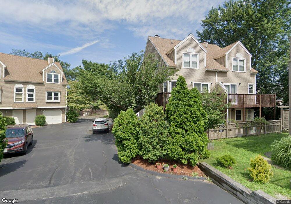
96 North St Unit 3 Somerville, MA 02144
West Somerville NeighborhoodEstimated Value: $998,000 - $1,152,000
3
Beds
3
Baths
1,740
Sq Ft
$625/Sq Ft
Est. Value
About This Home
This home is located at 96 North St Unit 3, Somerville, MA 02144 and is currently estimated at $1,088,333, approximately $625 per square foot. 96 North St Unit 3 is a home located in Middlesex County with nearby schools including Somerville High School, International School of Boston, and Lesley Ellis School.
Ownership History
Date
Name
Owned For
Owner Type
Purchase Details
Closed on
Mar 6, 2012
Sold by
Levin Elizabeth A
Bought by
Elizabeth A Levin 2010 and Levin Elizabeth A
Current Estimated Value
Purchase Details
Closed on
Aug 16, 2010
Sold by
Levin Elizabeth A
Bought by
Est Levin Elizabeth A and Levin Elizabeth A
Purchase Details
Closed on
Aug 28, 2008
Sold by
Talley John J and Talley Patricia E
Bought by
Levin Elizabeth A
Purchase Details
Closed on
Jun 5, 2003
Sold by
Est Spreadby Marian L and Wentworth Maura Putney
Bought by
Talley John J and Talley Patricia E
Home Financials for this Owner
Home Financials are based on the most recent Mortgage that was taken out on this home.
Original Mortgage
$322,700
Interest Rate
5.83%
Mortgage Type
Purchase Money Mortgage
Create a Home Valuation Report for This Property
The Home Valuation Report is an in-depth analysis detailing your home's value as well as a comparison with similar homes in the area
Home Values in the Area
Average Home Value in this Area
Purchase History
| Date | Buyer | Sale Price | Title Company |
|---|---|---|---|
| Elizabeth A Levin 2010 | -- | -- | |
| Est Levin Elizabeth A | -- | -- | |
| Levin Elizabeth A | $500,000 | -- | |
| Talley John J | $426,360 | -- |
Source: Public Records
Mortgage History
| Date | Status | Borrower | Loan Amount |
|---|---|---|---|
| Previous Owner | Talley John J | $322,700 |
Source: Public Records
Tax History Compared to Growth
Tax History
| Year | Tax Paid | Tax Assessment Tax Assessment Total Assessment is a certain percentage of the fair market value that is determined by local assessors to be the total taxable value of land and additions on the property. | Land | Improvement |
|---|---|---|---|---|
| 2025 | $9,917 | $909,000 | $0 | $909,000 |
| 2024 | $9,229 | $877,300 | $0 | $877,300 |
| 2023 | $9,117 | $881,700 | $0 | $881,700 |
| 2022 | $8,574 | $842,200 | $0 | $842,200 |
| 2021 | $8,227 | $807,400 | $0 | $807,400 |
| 2020 | $7,732 | $766,300 | $0 | $766,300 |
| 2019 | $7,752 | $720,400 | $0 | $720,400 |
| 2018 | $7,640 | $675,500 | $0 | $675,500 |
| 2017 | $6,814 | $583,900 | $0 | $583,900 |
| 2016 | $7,445 | $594,200 | $0 | $594,200 |
| 2015 | $6,818 | $540,700 | $0 | $540,700 |
Source: Public Records
Map
Nearby Homes
- 16 High St Unit 2
- 21 High St
- 235 Powder House Blvd
- 6 Hamilton Rd Unit 6
- 327 Alewife Brook Pkwy Unit A
- 34 Belknap St
- 31 Fairfax St
- 69 Sterling St
- 202 Powder House Blvd Unit 2
- 33 Conwell Ave
- 9 Woods Ave
- 44 Woods Ave Unit 44
- 16 Hamilton Rd
- 11 Watson St Unit 1
- 11 Watson St Unit 2
- 12 Arizona Terrace Unit 2
- 57 Garrison Ave
- 395 Alewife Brook Pkwy Unit 2C
- 395 Alewife Brook Pkwy Unit PH E
- 6 Gordon Rd
- 96 North St Unit 9
- 96 North St Unit 8
- 96 North St Unit 7
- 96 North St Unit 6
- 96 North St Unit 5
- 96 North St Unit 4
- 96 North St Unit 2
- 96 North St Unit 1
- 96 North St
- 104 North St
- 94 North St
- 94 North St
- 94 North St Unit 94
- 94 North St Unit 1
- 92 North St Unit 92
- 92 North St Unit 1
- 287 Alewife Brook Pkwy
- 287 Alewife Brook Pkwy
- 287 Alewife Brook Pkwy Unit 2
- 6 High St