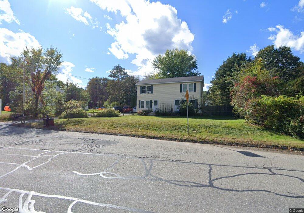
96 Worcester Rd Sterling, MA 01564
Estimated Value: $359,000 - $464,000
4
Beds
2
Baths
1,824
Sq Ft
$229/Sq Ft
Est. Value
About This Home
This home is located at 96 Worcester Rd, Sterling, MA 01564 and is currently estimated at $418,541, approximately $229 per square foot. 96 Worcester Rd is a home located in Worcester County with nearby schools including Wachusett Regional High School.
Ownership History
Date
Name
Owned For
Owner Type
Purchase Details
Closed on
Dec 29, 2011
Sold by
Clancy Thomas R
Bought by
Stc Worcester Rt and Clancy Thomas R
Current Estimated Value
Purchase Details
Closed on
Dec 29, 2005
Sold by
Frechette Michelle K
Bought by
Clancy Thomas R
Home Financials for this Owner
Home Financials are based on the most recent Mortgage that was taken out on this home.
Original Mortgage
$243,700
Interest Rate
6.39%
Mortgage Type
Purchase Money Mortgage
Purchase Details
Closed on
Jun 26, 1998
Sold by
Leger James J and Leger Lisa A
Bought by
Frechette Michelle K
Purchase Details
Closed on
May 14, 1987
Sold by
Mayfair Prop Inc
Bought by
Leger J J
Create a Home Valuation Report for This Property
The Home Valuation Report is an in-depth analysis detailing your home's value as well as a comparison with similar homes in the area
Home Values in the Area
Average Home Value in this Area
Purchase History
| Date | Buyer | Sale Price | Title Company |
|---|---|---|---|
| Stc Worcester Rt | -- | -- | |
| Clancy Thomas R | $325,000 | -- | |
| Frechette Michelle K | $129,900 | -- | |
| Leger J J | $147,500 | -- |
Source: Public Records
Mortgage History
| Date | Status | Borrower | Loan Amount |
|---|---|---|---|
| Previous Owner | Clancy Thomas R | $243,700 | |
| Previous Owner | Leger J J | $185,000 | |
| Previous Owner | Leger J J | $143,500 | |
| Previous Owner | Leger J J | $16,588 |
Source: Public Records
Tax History
| Year | Tax Paid | Tax Assessment Tax Assessment Total Assessment is a certain percentage of the fair market value that is determined by local assessors to be the total taxable value of land and additions on the property. | Land | Improvement |
|---|---|---|---|---|
| 2025 | $4,307 | $334,400 | $107,200 | $227,200 |
| 2024 | $4,300 | $323,100 | $107,200 | $215,900 |
| 2023 | $4,450 | $311,200 | $108,300 | $202,900 |
| 2022 | $4,572 | $299,800 | $98,300 | $201,500 |
| 2021 | $4,621 | $279,700 | $96,300 | $183,400 |
| 2020 | $4,332 | $257,700 | $94,200 | $163,500 |
| 2019 | $4,473 | $259,000 | $94,200 | $164,800 |
| 2018 | $4,055 | $231,200 | $88,500 | $142,700 |
| 2017 | $3,958 | $219,500 | $85,000 | $134,500 |
| 2016 | $3,902 | $212,900 | $85,000 | $127,900 |
| 2015 | $3,678 | $212,700 | $87,600 | $125,100 |
| 2014 | $3,449 | $203,700 | $82,100 | $121,600 |
Source: Public Records
Map
Nearby Homes
- 223 Worcester Rd
- 0 Boutelle Rd
- 61 Boutelle Rd
- 4 Jewett Rd Unit B
- 4 Jewett Rd Unit A
- 2 Lakeview Ave
- 15 Myrtle Ave
- 21 Myrtle Ave
- 15 N Cove Rd
- 5 Pine Woods Ln
- 16 N Main St
- 11 Millie's Way Unit 11
- 64 Rivington Dr
- 90 Sterling St Unit A
- 287 Laurel St
- 90 Tuttle Rd
- 96 Clinton Rd
- 6A Patriots Way Unit 37
- 45 Neylon St
- 134 Leominster Rd
- 96 Worcester Rd Unit B
- 96 Worcester Rd Unit A
- 1 Bean Rd
- 9 Walnut Dr
- 7 Walnut Dr
- 73B Worcester Rd Unit B 1
- 71 Worcester Rd Unit A
- 71 Worcester Rd Unit B
- 69A Worcester Rd Unit 69A
- 71A Worcester Rd Unit A
- 71A Worcester Rd Unit 71 A
- 71B Worcester Rd Unit B-71
- 71B Worcester Rd Unit 71B,2
- 5 Walnut Dr
- 10 Walnut Dr
- 2 Jewett Rd
- 69 Worcester Rd Unit B
- 69 Worcester Rd Unit A
- 1 Oakwood Dr
- 3 Walnut Dr
Your Personal Tour Guide
Ask me questions while you tour the home.