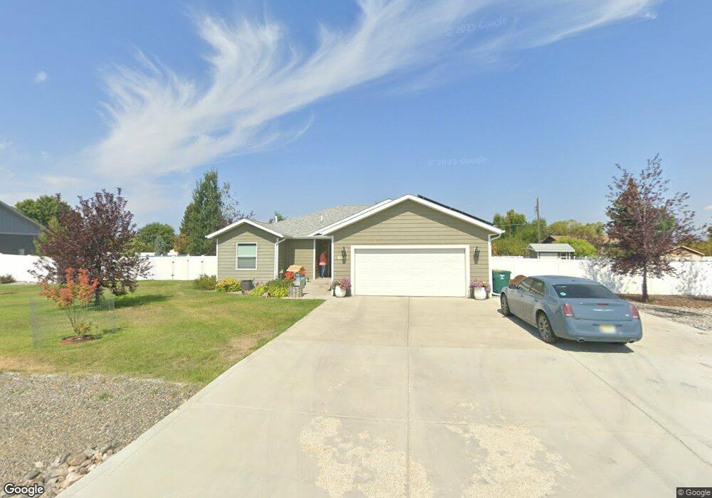
960 Cap Rd Unit Lot 11 Bryant No. 3 Helena, MT 59602
West Helena Valley NeighborhoodEstimated Value: $386,000 - $552,000
3
Beds
2
Baths
1,588
Sq Ft
$306/Sq Ft
Est. Value
About This Home
This home is located at 960 Cap Rd Unit Lot 11 Bryant No. 3, Helena, MT 59602 and is currently estimated at $485,204, approximately $305 per square foot. 960 Cap Rd Unit Lot 11 Bryant No. 3 is a home located in Lewis and Clark County with nearby schools including Four Georgians Elementary School, C.R. Anderson Middle School, and Calvary Christian School.
Ownership History
Date
Name
Owned For
Owner Type
Purchase Details
Closed on
May 7, 2012
Sold by
Jack Hamlin Inc
Bought by
Bird Bryan L
Current Estimated Value
Home Financials for this Owner
Home Financials are based on the most recent Mortgage that was taken out on this home.
Original Mortgage
$214,500
Outstanding Balance
$149,658
Interest Rate
4.05%
Mortgage Type
VA
Estimated Equity
$335,546
Create a Home Valuation Report for This Property
The Home Valuation Report is an in-depth analysis detailing your home's value as well as a comparison with similar homes in the area
Home Values in the Area
Average Home Value in this Area
Purchase History
| Date | Buyer | Sale Price | Title Company |
|---|---|---|---|
| Bird Bryan L | -- | Helena Abstract & Title Co |
Source: Public Records
Mortgage History
| Date | Status | Borrower | Loan Amount |
|---|---|---|---|
| Open | Bird Bryan L | $214,500 |
Source: Public Records
Tax History Compared to Growth
Tax History
| Year | Tax Paid | Tax Assessment Tax Assessment Total Assessment is a certain percentage of the fair market value that is determined by local assessors to be the total taxable value of land and additions on the property. | Land | Improvement |
|---|---|---|---|---|
| 2025 | $2,278 | $473,300 | $0 | $0 |
| 2024 | $3,421 | $416,500 | $0 | $0 |
| 2023 | $3,567 | $416,500 | $0 | $0 |
| 2022 | $2,970 | $291,700 | $0 | $0 |
| 2021 | $2,716 | $284,100 | $0 | $0 |
| 2020 | $2,622 | $251,200 | $0 | $0 |
| 2019 | $2,642 | $251,200 | $0 | $0 |
| 2018 | $2,403 | $224,200 | $0 | $0 |
| 2017 | $1,929 | $224,200 | $0 | $0 |
| 2016 | $1,960 | $214,200 | $0 | $0 |
| 2015 | $1,884 | $214,200 | $0 | $0 |
| 2014 | $1,804 | $112,466 | $0 | $0 |
Source: Public Records
Map
Nearby Homes
- 1030 Motsiff Rd
- 1040 Phillips Rd
- 1040 Sun Valley Rd
- 630 Stadler Rd
- 5250 N Montana Ave
- 4660 Independence Dr
- 4625 Independence Dr
- 4435 Woodchuck Dr
- 4324 N Montana Ave
- 1490 Boston Rd
- 5530 N Montana Ave
- 1412 Valley Speedway Rd
- 4155 Homestake Dr
- 5277 Glacier Point Loop
- 1344 Beaverhead Rd
- 3960 Canal Dr
- 5141 Crescent Moon Dr
- 3875 Yuhas Ave
- 835 Onyx Place
- 5489 Sahara Ct
- 960 Cap Rd
- 940 Cap Rd
- 980 Cap Rd
- 935 Motsiff Rd
- 965 Cap Rd
- 985 Cap Rd
- 985 Cap Rd Unit Lot 31 Bryant No. 3
- 945 Cap Rd
- 965 Motsiff Rd
- 885 Motsiff Rd
- 1020 Cap Rd
- 920 Cap Rd
- 1025 Cap Rd
- 1025 Cap Rd Unit Lot 32 Bryant No. 3
- 950 Isy Loop
- 1015 Motsiff Rd
- 930 Isy Loop
- 940 Motsiff Rd
- 875 Motsiff Rd
- 960 Motsiff Rd