Estimated Value: $647,000 - $685,220
4
Beds
3
Baths
1,551
Sq Ft
$427/Sq Ft
Est. Value
About This Home
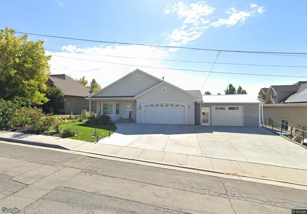
This home is located at 960 E 700 N Unit 2, Lehi, UT 84043 and is currently estimated at $662,073, approximately $426 per square foot. 960 E 700 N Unit 2 is a home located in Utah County with nearby schools including Sego Lily Elementary School, Lehi Junior High School, and Skyridge High School.
Ownership History
Date
Name
Owned For
Owner Type
Purchase Details
Closed on
May 28, 2022
Sold by
Sheri Bevard Erven
Bought by
White Noel M
Current Estimated Value
Home Financials for this Owner
Home Financials are based on the most recent Mortgage that was taken out on this home.
Original Mortgage
$647,200
Outstanding Balance
$615,813
Interest Rate
5.27%
Mortgage Type
New Conventional
Estimated Equity
$46,260
Purchase Details
Closed on
Jun 13, 2007
Sold by
Sanctuarty Design Build Llc
Bought by
Bevard Erven Sherl and Bevard Tina
Purchase Details
Closed on
Nov 17, 2005
Sold by
Johnson Ray
Bought by
Sanctuary Design Build Llc
Create a Home Valuation Report for This Property
The Home Valuation Report is an in-depth analysis detailing your home's value as well as a comparison with similar homes in the area
Home Values in the Area
Average Home Value in this Area
Purchase History
| Date | Buyer | Sale Price | Title Company |
|---|---|---|---|
| White Noel M | -- | Vanguard Title | |
| Bevard Erven Sherl | -- | Affiliated First Title Comp | |
| Sanctuary Design Build Llc | -- | Affiliated First Title Comp |
Source: Public Records
Mortgage History
| Date | Status | Borrower | Loan Amount |
|---|---|---|---|
| Open | White Noel M | $647,200 |
Source: Public Records
Tax History
| Year | Tax Paid | Tax Assessment Tax Assessment Total Assessment is a certain percentage of the fair market value that is determined by local assessors to be the total taxable value of land and additions on the property. | Land | Improvement |
|---|---|---|---|---|
| 2025 | $2,580 | $348,480 | -- | -- |
| 2024 | $2,580 | $301,895 | $0 | $0 |
| 2023 | $2,374 | $301,675 | $0 | $0 |
| 2022 | $2,604 | $320,815 | $0 | $0 |
| 2021 | $2,372 | $441,800 | $110,500 | $331,300 |
| 2020 | $2,238 | $411,900 | $102,300 | $309,600 |
| 2019 | $1,941 | $371,500 | $102,300 | $269,200 |
| 2018 | $1,940 | $351,000 | $91,700 | $259,300 |
| 2017 | $1,768 | $170,005 | $0 | $0 |
| 2016 | $1,788 | $159,555 | $0 | $0 |
| 2015 | $1,800 | $152,515 | $0 | $0 |
| 2014 | $1,770 | $149,050 | $0 | $0 |
Source: Public Records
Map
Nearby Homes
- 890 N Whipple Dr
- 832 N Somerset Aly
- 807 N Somerset Aly
- 1175 E 900 N
- 1117 N Cedar Hollow Blvd
- 414 N 1322 E
- 595 S 600 E
- 499 N 1520 E
- 428 E 500 N
- 1272 N Cedar Hollow Blvd
- 893 N 1580 E
- 1370 N Cedar Hollow Blvd
- 171 E 400 N
- 4007 W 1000 N
- 3947 W 1000 N Unit 439
- 3971 W 1000 N Unit 441
- 3959 W 1000 N
- 3995 W 1000 N
- 822 N 860 W Unit 317
- 822 W 800 St N Unit LOT319
Your Personal Tour Guide
Ask me questions while you tour the home.