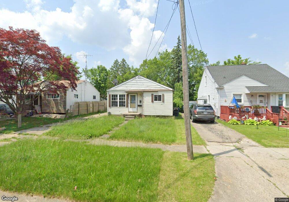
960 Hubbard Ave Flint, MI 48503
Mannhall Park NeighborhoodEstimated Value: $47,000 - $54,000
2
Beds
1
Bath
690
Sq Ft
$72/Sq Ft
Est. Value
About This Home
This home is located at 960 Hubbard Ave, Flint, MI 48503 and is currently estimated at $49,667, approximately $71 per square foot. 960 Hubbard Ave is a home located in Genesee County with nearby schools including Durant-Tuuri-Mott Elementary School, St. Paul Lutheran School, and First Flint Seventh-day Adventist Christian School.
Ownership History
Date
Name
Owned For
Owner Type
Purchase Details
Closed on
May 1, 2025
Sold by
Flint River Properties Llc and Dmz Properties Llc
Bought by
Bp Srf Flint I Llc
Current Estimated Value
Home Financials for this Owner
Home Financials are based on the most recent Mortgage that was taken out on this home.
Original Mortgage
$417,840
Outstanding Balance
$247,101
Interest Rate
6.65%
Mortgage Type
Construction
Estimated Equity
-$197,434
Purchase Details
Closed on
Jan 12, 2016
Sold by
Zerka Milad and Zerka Georgette
Bought by
Flint River Properties Llc
Purchase Details
Closed on
Dec 22, 1999
Sold by
The Chase Manhattan Bank
Bought by
Zerka Milad and Zerka Georgette
Purchase Details
Closed on
Oct 15, 1999
Sold by
Imc Mtg Company
Bought by
The Chase Manhattan Bank and Imc Home Equity Loan Trust 1997-2
Purchase Details
Closed on
Apr 21, 1999
Sold by
Natzel Natzel J and Natzel M
Bought by
Imc Mtg Company
Create a Home Valuation Report for This Property
The Home Valuation Report is an in-depth analysis detailing your home's value as well as a comparison with similar homes in the area
Home Values in the Area
Average Home Value in this Area
Purchase History
| Date | Buyer | Sale Price | Title Company |
|---|---|---|---|
| Bp Srf Flint I Llc | $522,301 | First American Title | |
| Flint River Properties Llc | -- | Attorney | |
| Zerka Milad | $28,500 | Centennial Title & Abstract | |
| The Chase Manhattan Bank | -- | -- | |
| Imc Mtg Company | $35,825 | -- |
Source: Public Records
Mortgage History
| Date | Status | Borrower | Loan Amount |
|---|---|---|---|
| Open | Bp Srf Flint I Llc | $417,840 |
Source: Public Records
Tax History Compared to Growth
Tax History
| Year | Tax Paid | Tax Assessment Tax Assessment Total Assessment is a certain percentage of the fair market value that is determined by local assessors to be the total taxable value of land and additions on the property. | Land | Improvement |
|---|---|---|---|---|
| 2025 | $757 | $18,000 | $0 | $0 |
| 2024 | $710 | $18,200 | $0 | $0 |
| 2023 | $701 | $16,000 | $0 | $0 |
| 2022 | $0 | $13,000 | $0 | $0 |
| 2021 | $706 | $11,100 | $0 | $0 |
| 2020 | $659 | $9,900 | $0 | $0 |
| 2019 | $651 | $9,000 | $0 | $0 |
| 2018 | $620 | $9,000 | $0 | $0 |
| 2017 | $607 | $0 | $0 | $0 |
| 2016 | $565 | $0 | $0 | $0 |
| 2015 | -- | $0 | $0 | $0 |
| 2014 | -- | $0 | $0 | $0 |
| 2012 | -- | $6,700 | $0 | $0 |
Source: Public Records
Map
Nearby Homes
- 976 Barney Ave
- 996 Barney Ave
- 960 Mann Ave
- 960 Salisbury Ave
- 916 Mann Ave
- 3821 W Court St
- 1017 Stocker Ave
- 3921 Joyner St
- 959 Tacken St
- 3413 Augusta St
- 3414 Van Buren Ave
- 1010 Hughes Ave
- 863 Tacken St
- 1122 Stocker Ave
- 874 Tacken St
- 870 Tacken St
- 1217 Barney Ave
- 911 Hughes Ave
- 3801 Augusta St
- 866 Tacken St
- 956 Hubbard Ave
- 964 Hubbard Ave
- 952 Hubbard Ave
- 968 Hubbard Ave
- 959 S Ballenger Hwy
- 963 S Ballenger Hwy
- 955 S Ballenger Hwy
- 967 S Ballenger Hwy
- 976 Hubbard Ave
- 971 S Ballenger Hwy
- 959 Hubbard Ave
- 963 Hubbard Ave
- 955 Hubbard Ave
- 951 Hubbard Ave
- 967 Hubbard Ave
- 975 S Ballenger Hwy
- 948 Hubbard Ave
- 944 Hubbard Ave
- 971 Hubbard Ave
- 980 Hubbard Ave