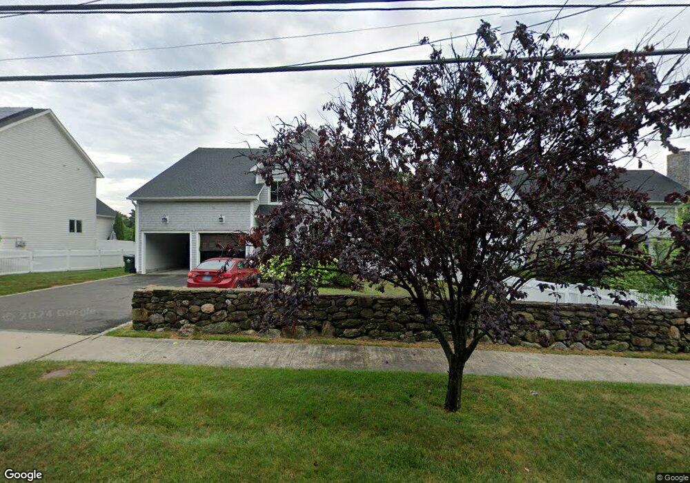
960 N Benson Rd Fairfield, CT 06824
University NeighborhoodEstimated Value: $1,586,000 - $1,943,000
5
Beds
4
Baths
3,650
Sq Ft
$478/Sq Ft
Est. Value
About This Home
This home is located at 960 N Benson Rd, Fairfield, CT 06824 and is currently estimated at $1,745,333, approximately $478 per square foot. 960 N Benson Rd is a home located in Fairfield County with nearby schools including Osborn Hill Elementary School, Fairfield Woods Middle School, and Fairfield Ludlowe High School.
Ownership History
Date
Name
Owned For
Owner Type
Purchase Details
Closed on
Dec 1, 2023
Sold by
Tycz Colleen E and Tycz Timothy
Bought by
Habib Jara and Dost Sara
Current Estimated Value
Home Financials for this Owner
Home Financials are based on the most recent Mortgage that was taken out on this home.
Original Mortgage
$1,200,000
Outstanding Balance
$1,177,038
Interest Rate
6.75%
Mortgage Type
Purchase Money Mortgage
Estimated Equity
$568,295
Purchase Details
Closed on
Jun 22, 2015
Sold by
960 North Benson Rd Ll
Bought by
Tycz Colleen and Tycz Timothy
Home Financials for this Owner
Home Financials are based on the most recent Mortgage that was taken out on this home.
Original Mortgage
$752,000
Interest Rate
3.78%
Mortgage Type
Purchase Money Mortgage
Create a Home Valuation Report for This Property
The Home Valuation Report is an in-depth analysis detailing your home's value as well as a comparison with similar homes in the area
Home Values in the Area
Average Home Value in this Area
Purchase History
| Date | Buyer | Sale Price | Title Company |
|---|---|---|---|
| Habib Jara | $1,500,000 | None Available | |
| Habib Jara | $1,500,000 | None Available | |
| Tycz Colleen | $940,000 | -- | |
| Tycz Colleen | $940,000 | -- |
Source: Public Records
Mortgage History
| Date | Status | Borrower | Loan Amount |
|---|---|---|---|
| Open | Habib Jara | $1,200,000 | |
| Closed | Habib Jara | $1,200,000 | |
| Previous Owner | Tycz Colleen | $752,000 |
Source: Public Records
Tax History Compared to Growth
Tax History
| Year | Tax Paid | Tax Assessment Tax Assessment Total Assessment is a certain percentage of the fair market value that is determined by local assessors to be the total taxable value of land and additions on the property. | Land | Improvement |
|---|---|---|---|---|
| 2025 | $17,999 | $633,990 | $277,480 | $356,510 |
| 2024 | $17,688 | $633,990 | $277,480 | $356,510 |
| 2023 | $17,441 | $633,990 | $277,480 | $356,510 |
| 2022 | $17,270 | $633,990 | $277,480 | $356,510 |
| 2021 | $17,105 | $633,990 | $277,480 | $356,510 |
| 2020 | $17,076 | $637,420 | $274,540 | $362,880 |
| 2019 | $17,076 | $637,420 | $274,540 | $362,880 |
| 2018 | $16,802 | $637,420 | $274,540 | $362,880 |
| 2017 | $16,458 | $637,420 | $274,540 | $362,880 |
| 2016 | $16,222 | $637,420 | $274,540 | $362,880 |
| 2015 | $16,475 | $664,580 | $260,120 | $404,460 |
| 2014 | $7,657 | $313,810 | $313,810 | $0 |
Source: Public Records
Map
Nearby Homes
- 168 Wormwood Rd
- 133 Green Acre Ln
- 15 Barton Rd
- 478 Crestwood Rd
- 44 Deer Run Rd
- 68 Figlar Ave
- 122 Colony St
- 38 Edge Hill Rd
- 105 Charter Oak Rd
- 20 Ermine St
- 45 Robin Cir
- 274 High St
- 42 Robin Cir
- 109 Jeniford Rd
- 83 Pell Meadow Dr
- 2180 Kings Hwy Unit 1
- 359 Reid St
- 338 Orchard Hill Ln
- 232 Pell Meadow Dr
- 1207 Stillson Rd
- 948 N Benson Rd
- 175 Dill Rd
- 932 N Benson Rd
- 147 Dill Rd
- 152 Dill Rd
- 994 N Benson Rd
- 133 Dill Rd
- 910 N Benson Rd
- 305 Wormwood Rd
- 136 Dill Rd
- 255 Wormwood Rd
- 239 Wormwood Rd
- 1014 N Benson Rd
- 888 N Benson Rd
- 271 Wormwood Rd
- 223 Wormwood Rd
- 331 Wormwood Rd
- 260 Wormwood Rd
- 1036 N Benson Rd
- 207 Wormwood Rd