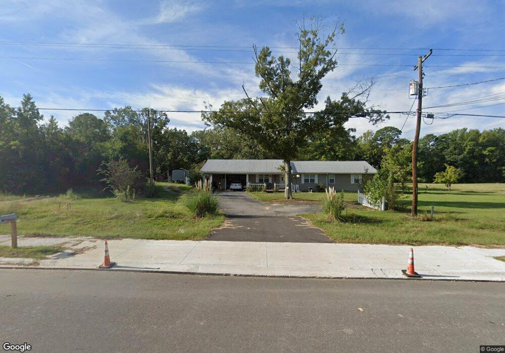
9600 Highway 270 White Hall, AR 71602
Estimated Value: $195,000 - $236,698
--
Bed
1
Bath
2,213
Sq Ft
$97/Sq Ft
Est. Value
About This Home
This home is located at 9600 Highway 270, White Hall, AR 71602 and is currently estimated at $215,675, approximately $97 per square foot. 9600 Highway 270 is a home located in Jefferson County with nearby schools including Matthews Elementary School, Robert F. Morehead Middle School, and Dollarway High School.
Ownership History
Date
Name
Owned For
Owner Type
Purchase Details
Closed on
Nov 25, 2020
Bought by
Moreno Diana
Current Estimated Value
Purchase Details
Closed on
May 26, 2005
Sold by
Herrin Herrin Stanton Teresa Jo Stanton Teresa Jo and Herrin Lackie Sandra Sue
Bought by
Leopard Joseph W and Leopard Karen
Purchase Details
Closed on
Jul 13, 1999
Bought by
Lackie Sandra Sue Herrin
Purchase Details
Closed on
Jun 15, 1992
Bought by
Herrin Lois
Purchase Details
Closed on
Jun 9, 1972
Bought by
Herrin James R and Herrin Wf
Create a Home Valuation Report for This Property
The Home Valuation Report is an in-depth analysis detailing your home's value as well as a comparison with similar homes in the area
Home Values in the Area
Average Home Value in this Area
Purchase History
| Date | Buyer | Sale Price | Title Company |
|---|---|---|---|
| Moreno Diana | $187,000 | -- | |
| Leopard Joseph W | -- | -- | |
| Lackie Sandra Sue Herrin | -- | -- | |
| Herrin Lois | -- | -- | |
| Herrin James R | -- | -- |
Source: Public Records
Tax History Compared to Growth
Tax History
| Year | Tax Paid | Tax Assessment Tax Assessment Total Assessment is a certain percentage of the fair market value that is determined by local assessors to be the total taxable value of land and additions on the property. | Land | Improvement |
|---|---|---|---|---|
| 2025 | $902 | $42,530 | $2,960 | $39,570 |
| 2024 | $902 | $42,530 | $2,960 | $39,570 |
| 2023 | $902 | $42,530 | $2,960 | $39,570 |
| 2022 | $793 | $25,950 | $1,550 | $24,400 |
| 2021 | $793 | $25,950 | $1,550 | $24,400 |
| 2020 | $418 | $25,950 | $1,550 | $24,400 |
| 2019 | $418 | $25,950 | $1,550 | $24,400 |
| 2018 | $443 | $25,950 | $1,550 | $24,400 |
| 2017 | $443 | $15,720 | $1,550 | $14,170 |
| 2016 | $443 | $15,720 | $1,550 | $14,170 |
| 2015 | $439 | $15,720 | $1,550 | $14,170 |
| 2014 | -- | $15,720 | $1,550 | $14,170 |
Source: Public Records
Map
Nearby Homes
- 9403 U S 270
- 1920 Allbritton Dr
- 410 Rolling Hills Dr
- TBD Elkins Rd
- 10115 Highway 270
- 8800 Highway 270
- 8701 Highway 270
- 1003 Camp Rd
- 412 Highway 104
- 2095 S Evans Rd
- 1005 Shephard Dr
- 199 Hardin Reed Rd
- 00 Boastwood Dr
- 1601 Rainbow Dr
- 7 Colony Cove
- 1201 Boastwood Dr
- 1018 W Holland Ave
- 617 Winchester Ave
- 0 Michael Ann Dr
- 1825 Butram Rd
- 9600 Hwy 270
- 9528 Highway 270
- 9610 Highway 270
- 9611 Highway 270
- 9529 Highway 270
- 9520 Highway 270
- 9520 Hwy 270
- 212 N Evans Rd
- 0 Cook Rd Unit 15033027
- 9510 Highway 270
- 2100 Cook Rd
- 708 S Evans Rd
- 9415 Highway 270
- 210 N Evans Rd
- 9629 Highway 270
- 2104 Cook Rd
- 203 N Evans Rd
- 713 Donna Rd
- 205 N Evans Rd
- 9411 Highway 270