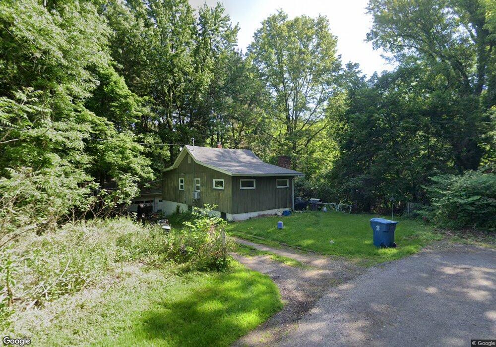
961 Farr Rd Coventry Township, OH 44319
Estimated Value: $140,000 - $293,000
2
Beds
1
Bath
1,056
Sq Ft
$203/Sq Ft
Est. Value
About This Home
This home is located at 961 Farr Rd, Coventry Township, OH 44319 and is currently estimated at $214,303, approximately $202 per square foot. 961 Farr Rd is a home located in Summit County with nearby schools including Coventry Middle School, Coventry High School, and St. Francis de Sales School.
Ownership History
Date
Name
Owned For
Owner Type
Purchase Details
Closed on
Nov 30, 2009
Sold by
Krstich Dan J and Krstich Lorena L
Bought by
Miller Jody L
Current Estimated Value
Home Financials for this Owner
Home Financials are based on the most recent Mortgage that was taken out on this home.
Original Mortgage
$53,427
Outstanding Balance
$35,027
Interest Rate
5%
Mortgage Type
Purchase Money Mortgage
Estimated Equity
$179,276
Purchase Details
Closed on
Nov 3, 2008
Sold by
Krstich Joseph W
Bought by
Krstich Dan J
Create a Home Valuation Report for This Property
The Home Valuation Report is an in-depth analysis detailing your home's value as well as a comparison with similar homes in the area
Home Values in the Area
Average Home Value in this Area
Purchase History
| Date | Buyer | Sale Price | Title Company |
|---|---|---|---|
| Miller Jody L | $52,500 | Tri County Title | |
| Krstich Dan J | $40,000 | Attorney |
Source: Public Records
Mortgage History
| Date | Status | Borrower | Loan Amount |
|---|---|---|---|
| Open | Miller Jody L | $53,427 |
Source: Public Records
Tax History Compared to Growth
Tax History
| Year | Tax Paid | Tax Assessment Tax Assessment Total Assessment is a certain percentage of the fair market value that is determined by local assessors to be the total taxable value of land and additions on the property. | Land | Improvement |
|---|---|---|---|---|
| 2025 | $3,777 | $61,674 | $24,399 | $37,275 |
| 2024 | $3,597 | $61,674 | $24,399 | $37,275 |
| 2023 | $3,777 | $61,674 | $24,399 | $37,275 |
| 2022 | $2,943 | $42,060 | $16,268 | $25,792 |
| 2021 | $2,770 | $42,060 | $16,268 | $25,792 |
| 2020 | $2,689 | $42,060 | $16,270 | $25,790 |
| 2019 | $2,200 | $31,320 | $16,270 | $15,050 |
| 2018 | $2,179 | $31,320 | $16,270 | $15,050 |
| 2017 | $2,113 | $31,320 | $16,270 | $15,050 |
| 2016 | $2,107 | $29,960 | $16,270 | $13,690 |
| 2015 | $2,113 | $29,960 | $16,270 | $13,690 |
| 2014 | $2,054 | $29,960 | $16,270 | $13,690 |
| 2013 | $2,149 | $31,760 | $16,270 | $15,490 |
Source: Public Records
Map
Nearby Homes
- 855 Fowler Ave
- 3826 Powell Ave
- 3809 Powell Ave
- 4216 State Rd
- 834 State Mill Rd
- 3719 Bower Ave
- 3803 Bay Path Dr
- 0 W Turkeyfoot Lake Rd Unit 5157637
- 552 Saunders Ave
- 796 Portage Lakes Dr
- 4698 Manchester Rd
- 441 Dorwil Dr
- 4567 Rex Lake Dr
- 584 Apple Dr
- 428 Canova Dr
- 4135 State Park Dr
- 4131 State Park Dr
- 265 E Pace Ave
- 1850 Turkeyfoot Lake Rd
- 4851 Manchester Rd