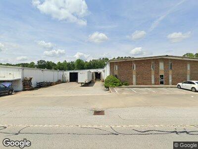
961 Highway 123 Toccoa, GA 30577
Estimated Value: $730,390
--
Bed
--
Bath
26,861
Sq Ft
$27/Sq Ft
Est. Value
About This Home
This home is located at 961 Highway 123, Toccoa, GA 30577 and is currently estimated at $730,390, approximately $27 per square foot. 961 Highway 123 is a home located in Stephens County with nearby schools including Stephens County High School.
Ownership History
Date
Name
Owned For
Owner Type
Purchase Details
Closed on
Oct 23, 2018
Sold by
Stephens County Development Authority
Bought by
Maple Ridge Homes Inc
Current Estimated Value
Home Financials for this Owner
Home Financials are based on the most recent Mortgage that was taken out on this home.
Original Mortgage
$352,750
Interest Rate
4.7%
Mortgage Type
Commercial
Purchase Details
Closed on
Mar 13, 2018
Sold by
Stephens County Georgia
Bought by
Stephens County Development Au
Create a Home Valuation Report for This Property
The Home Valuation Report is an in-depth analysis detailing your home's value as well as a comparison with similar homes in the area
Home Values in the Area
Average Home Value in this Area
Purchase History
| Date | Buyer | Sale Price | Title Company |
|---|---|---|---|
| Maple Ridge Homes Inc | $415,000 | -- | |
| Stephens County Development Au | -- | -- |
Source: Public Records
Mortgage History
| Date | Status | Borrower | Loan Amount |
|---|---|---|---|
| Open | Maple Ridge Homes Inc | $400,000 | |
| Closed | Maple Ridge Homes Inc | $352,750 |
Source: Public Records
Tax History Compared to Growth
Tax History
| Year | Tax Paid | Tax Assessment Tax Assessment Total Assessment is a certain percentage of the fair market value that is determined by local assessors to be the total taxable value of land and additions on the property. | Land | Improvement |
|---|---|---|---|---|
| 2024 | $16,401 | $460,051 | $29,478 | $430,573 |
| 2023 | $16,272 | $460,051 | $29,478 | $430,573 |
| 2022 | $13,696 | $460,051 | $29,478 | $430,573 |
| 2021 | $14,386 | $460,051 | $29,478 | $430,573 |
| 2020 | $14,555 | $460,901 | $29,478 | $431,423 |
| 2019 | $5,264 | $877,376 | $44,920 | $832,456 |
| 2018 | $0 | $877,376 | $44,920 | $832,456 |
| 2017 | $0 | $877,376 | $44,920 | $832,456 |
| 2016 | $0 | $867,712 | $44,920 | $822,792 |
| 2015 | -- | $867,712 | $44,920 | $822,792 |
| 2014 | $29,298 | $867,840 | $44,920 | $822,920 |
| 2013 | -- | $867,840 | $44,920 | $822,920 |
Source: Public Records
Map
Nearby Homes
- 308 Clearview Dr
- 327 Ayers Creek Dr
- 297 Ayers Creek Dr
- 75 Fern Valley Cir
- 55 Crabapple Ct
- 1292 Fernside Dr
- 52 Boulder Dr
- 52 Boulder Dr
- 52 Boulder Dr
- 186 Foxdale Dr
- 164 Creekview Dr
- 122 Creekview Dr
- 153 Creekview Dr
- 1037 E Doyle St
- 715 Cross Creek Dr
- 68 Hayes St
- 96 Glencrest Dr
- 261 Greer Ln
- 215 Bellvue Dr
- 118 Greer Ln
- 961 Highway 123
- 961 Highway 123
- 961 U S 123
- 47 Crest Pointe Dr
- 906 Hwy 123 - Motel
- 866 Highway 123
- 0 Malik Dr
- 0 Malik Dr Unit 3084628
- 1041 Highway 123
- 104 Fern Valley Dr
- 104 Fern Valley Dr
- 170 Crestwood Dr
- 156 Crestwood Dr
- 188 Crestwood Dr
- 131 Fern Valley Dr
- 208 Crestwood Dr
- 0 Crestwood Dr Unit 7145260
- 0 Crestwood Dr Unit 7001413
- 0 Crestwood Dr
- 84 Crestwood Dr