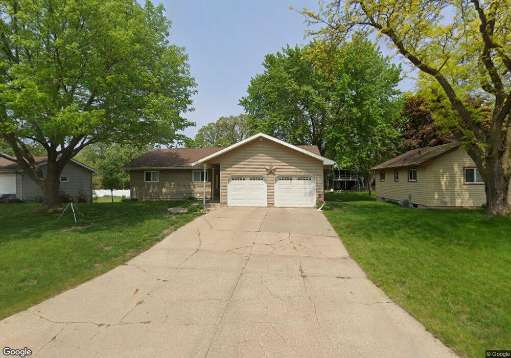
961 Liberty Ln Fairmont, MN 56031
Estimated Value: $260,507 - $362,000
4
Beds
3
Baths
2,044
Sq Ft
$151/Sq Ft
Est. Value
About This Home
This home is located at 961 Liberty Ln, Fairmont, MN 56031 and is currently estimated at $308,377, approximately $150 per square foot. 961 Liberty Ln is a home located in Martin County with nearby schools including Fairmont Elementary School, Fairmont Junior/Senior High School, and St. Paul Lutheran School.
Ownership History
Date
Name
Owned For
Owner Type
Purchase Details
Closed on
Jan 3, 2011
Sold by
Herman Heather and Herman Heather
Bought by
Hared Herman Heather and Hared Herman
Current Estimated Value
Home Financials for this Owner
Home Financials are based on the most recent Mortgage that was taken out on this home.
Original Mortgage
$174,900
Outstanding Balance
$117,286
Interest Rate
4.44%
Mortgage Type
New Conventional
Estimated Equity
$191,091
Purchase Details
Closed on
Jul 14, 2007
Sold by
Klutz Bruce A and Klutz Marilyn J
Bought by
Arends Heather and Herman Jared
Home Financials for this Owner
Home Financials are based on the most recent Mortgage that was taken out on this home.
Original Mortgage
$174,500
Interest Rate
6.54%
Mortgage Type
New Conventional
Create a Home Valuation Report for This Property
The Home Valuation Report is an in-depth analysis detailing your home's value as well as a comparison with similar homes in the area
Home Values in the Area
Average Home Value in this Area
Purchase History
| Date | Buyer | Sale Price | Title Company |
|---|---|---|---|
| Hared Herman Heather | -- | None Available | |
| Arends Heather | $174,484 | None Available |
Source: Public Records
Mortgage History
| Date | Status | Borrower | Loan Amount |
|---|---|---|---|
| Open | Hared Herman Heather | $174,900 | |
| Previous Owner | Arends Heather | $174,500 |
Source: Public Records
Tax History Compared to Growth
Tax History
| Year | Tax Paid | Tax Assessment Tax Assessment Total Assessment is a certain percentage of the fair market value that is determined by local assessors to be the total taxable value of land and additions on the property. | Land | Improvement |
|---|---|---|---|---|
| 2025 | $3,084 | $242,300 | $20,100 | $222,200 |
| 2024 | $2,706 | $245,400 | $20,100 | $225,300 |
| 2023 | $2,620 | $222,800 | $19,600 | $203,200 |
| 2022 | $2,286 | $203,400 | $20,300 | $183,100 |
| 2021 | $2,182 | $170,900 | $21,200 | $149,700 |
| 2020 | $2,120 | $170,900 | $21,200 | $149,700 |
| 2019 | $1,844 | $160,800 | $19,900 | $140,900 |
| 2018 | $2,054 | $155,700 | $19,300 | $136,400 |
| 2017 | $1,770 | $122,000 | $15,031 | $106,969 |
| 2016 | $1,670 | $119,300 | $14,705 | $104,595 |
| 2015 | $1,505 | $122,600 | $14,468 | $108,132 |
| 2013 | $1,849 | $129,300 | $14,639 | $114,661 |
Source: Public Records
Map
Nearby Homes
- 767 Shoreacres Dr
- 1700 Knollwood Dr
- 1640 Patriot Dr
- 1365 Oak Beach Dr
- 1334 Oak Beach Dr
- 1317 Beach Place
- 1910 Knollwood Dr
- 1600 S Prairie Ave
- 2413 Albion Ave
- 501 S Fairlakes Ave
- 2107 Stade Ln
- 123 Linden Ave
- 1312 S State St
- 944 S Hampton St
- 841 Redwood Dr
- 411 Albion Ave
- 1001 S Orient St
- 2224 Red Bird Ln
- 2218 Red Bird Ln
- 302 Victoria St
- 957 Liberty Ln
- 965 Liberty Ln
- 958 Shoreacres Dr
- 962 Shoreacres Dr
- 954 Shoreacres Dr
- 969 Liberty Ln
- 505 Union St
- 960 Liberty Ln
- 966 Shoreacres Dr
- 964 Liberty Ln
- 503 Union St
- 968 Liberty Ln
- 510 Independence Dr
- 500 Independence Dr
- 643 Embassy Rd
- 952 Liberty Ln
- 972 Liberty Ln
- 510 Union St
- 975 Shoreacres Dr
- 977 Shoreacres Dr