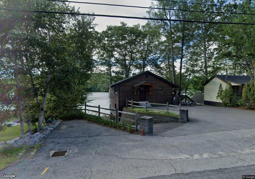
961 Us Route 3 Little Squam Holderness, NH 03245
Estimated Value: $723,000 - $1,067,428
2
Beds
3
Baths
1,898
Sq Ft
$491/Sq Ft
Est. Value
About This Home
This home is located at 961 Us Route 3 Little Squam, Holderness, NH 03245 and is currently estimated at $931,607, approximately $490 per square foot. 961 Us Route 3 Little Squam is a home located in Grafton County with nearby schools including Holderness Central School and Plymouth Regional High School.
Ownership History
Date
Name
Owned For
Owner Type
Purchase Details
Closed on
Sep 24, 2020
Sold by
Bladecki Joseph J and Bladecki Jordan J
Bought by
Bagge Jeffrey R and Bagge Lisa D
Current Estimated Value
Home Financials for this Owner
Home Financials are based on the most recent Mortgage that was taken out on this home.
Original Mortgage
$509,150
Outstanding Balance
$452,862
Interest Rate
2.9%
Mortgage Type
New Conventional
Estimated Equity
$478,745
Purchase Details
Closed on
May 6, 2019
Sold by
Wi Rt
Bought by
Bladecki Joseph J and Bladecki Jordan J
Create a Home Valuation Report for This Property
The Home Valuation Report is an in-depth analysis detailing your home's value as well as a comparison with similar homes in the area
Home Values in the Area
Average Home Value in this Area
Purchase History
| Date | Buyer | Sale Price | Title Company |
|---|---|---|---|
| Bagge Jeffrey R | $599,000 | None Available | |
| Bladecki Joseph J | $387,500 | -- |
Source: Public Records
Mortgage History
| Date | Status | Borrower | Loan Amount |
|---|---|---|---|
| Open | Bagge Jeffrey R | $509,150 |
Source: Public Records
Tax History Compared to Growth
Tax History
| Year | Tax Paid | Tax Assessment Tax Assessment Total Assessment is a certain percentage of the fair market value that is determined by local assessors to be the total taxable value of land and additions on the property. | Land | Improvement |
|---|---|---|---|---|
| 2024 | $6,978 | $806,700 | $536,600 | $270,100 |
| 2023 | $6,930 | $806,700 | $536,600 | $270,100 |
| 2022 | $6,637 | $591,500 | $380,900 | $210,600 |
| 2021 | $6,690 | $591,500 | $380,900 | $210,600 |
| 2020 | $1,835 | $451,600 | $293,800 | $157,800 |
| 2019 | $5,948 | $451,600 | $293,800 | $157,800 |
| 2018 | $2,382 | $451,600 | $293,800 | $157,800 |
| 2017 | $2,362 | $425,280 | $293,980 | $131,300 |
| 2016 | $6,030 | $425,280 | $293,980 | $131,300 |
| 2015 | $6,030 | $425,280 | $293,980 | $131,300 |
| 2014 | $6,077 | $422,580 | $293,980 | $128,600 |
| 2011 | $5,735 | $435,780 | $293,980 | $141,800 |
Source: Public Records
Map
Nearby Homes
- 73 Maple Ridge Rd
- 206 High Country Way Unit (aka Unit 100)
- 265 High Country Way
- 7 Hollows Rd
- 47 Overlook Rd
- 14 Overlook Rd
- 37 Old Ledge Rd
- 38 Range Rd
- 283 River St
- 10 Rocky Top Ln
- 12 Peaked Hill Rd
- 88 Perch Pond Rd
- 6 Buttonwood Rd
- 384 New Hampshire 113
- 00 Hicks Hill Rd
- 347 New Hampshire Route 175
- 20 Circle Dr Unit 41
- 28 Potato Island
- 202 Thompson St
- 388 Perch Pond Rd
- 961 Us Route 3
- 957 Us Route 3
- 955 Us Route 3
- 19 Maple Ridge Rd
- 974 Us Route 3
- 949 Us Route 3
- 9 Maple Ridge Rd
- 932 Us Route 3
- 24 Boulders Rd Unit 73
- 24 Boulders Rd
- 1006 U S 3 Unit 1
- 1006 U S 3 Unit 2E
- 925 Us Route 3
- 11 Ledges Rd
- 000 Maple Ridge Rd
- 71 Maple Ridge Rd
- 00 Maple Ridge Rd
- 0 Maple Ridge Rd
- 930 Us Route 3
- 186 High Country Way Unit 95