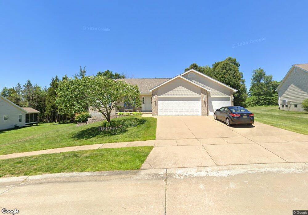
9612 Persimmon Point Dr Hillsboro, MO 63050
Estimated Value: $331,934 - $416,000
--
Bed
--
Bath
1,445
Sq Ft
$257/Sq Ft
Est. Value
About This Home
This home is located at 9612 Persimmon Point Dr, Hillsboro, MO 63050 and is currently estimated at $370,984, approximately $256 per square foot. 9612 Persimmon Point Dr is a home with nearby schools including Hillsboro Primary School, Hillsboro Elementary School, and Hillsboro Middle Elementary School.
Ownership History
Date
Name
Owned For
Owner Type
Purchase Details
Closed on
Jul 27, 2004
Sold by
Stonebrook Construction Inc
Bought by
Ploesser Wayne L and Ploesser Linda D
Current Estimated Value
Home Financials for this Owner
Home Financials are based on the most recent Mortgage that was taken out on this home.
Original Mortgage
$186,862
Outstanding Balance
$93,842
Interest Rate
6.3%
Mortgage Type
FHA
Estimated Equity
$277,142
Create a Home Valuation Report for This Property
The Home Valuation Report is an in-depth analysis detailing your home's value as well as a comparison with similar homes in the area
Home Values in the Area
Average Home Value in this Area
Purchase History
| Date | Buyer | Sale Price | Title Company |
|---|---|---|---|
| Ploesser Wayne L | -- | -- |
Source: Public Records
Mortgage History
| Date | Status | Borrower | Loan Amount |
|---|---|---|---|
| Open | Ploesser Wayne L | $186,862 |
Source: Public Records
Tax History Compared to Growth
Tax History
| Year | Tax Paid | Tax Assessment Tax Assessment Total Assessment is a certain percentage of the fair market value that is determined by local assessors to be the total taxable value of land and additions on the property. | Land | Improvement |
|---|---|---|---|---|
| 2025 | $2,999 | $51,700 | $10,700 | $41,000 |
| 2024 | $2,999 | $47,800 | $10,700 | $37,100 |
| 2023 | $2,999 | $47,800 | $10,700 | $37,100 |
| 2022 | $2,730 | $42,800 | $5,700 | $37,100 |
| 2021 | $2,794 | $41,000 | $5,700 | $35,300 |
| 2020 | $2,489 | $35,400 | $4,900 | $30,500 |
| 2019 | $2,488 | $35,400 | $4,900 | $30,500 |
| 2018 | $2,487 | $35,400 | $4,900 | $30,500 |
| 2017 | $2,364 | $35,400 | $4,900 | $30,500 |
| 2016 | $2,275 | $33,700 | $5,700 | $28,000 |
| 2015 | $2,088 | $33,700 | $5,700 | $28,000 |
| 2013 | $2,088 | $33,200 | $5,700 | $27,500 |
Source: Public Records
Map
Nearby Homes
- 9822 Woodland Rd
- 176 Pancho Villa Dr
- 1 Appomattox Ridge
- 9324 Church Dr
- 0 Hwy A 62 Acres Unit 20012897
- 4005 Twinbrook Rd
- 132 Blue Ridge Trace
- 1102 Stone Henge Ct
- 9341 Market St
- 423 Stonewater Dr
- 9904 Lockeport Point
- 405 Stonewater Dr
- 4295 Hansard Ln
- 251 Living Water Ct
- 1713 Waters Edge Way
- 2324 Garden Ln
- 2724 Niagara Falls Ct
- 10610 Stroup Rd
- 1316 Wesford Way
- 2113 Providence Park Ln
- 9616 Persimmon Point Dr
- 9608 Persimmon Point Dr
- 9617 Persimmon Point Dr
- 9620 Persimmon Point Dr
- 9607 Persimmon Point Dr
- 9604 Persimmon Point Dr
- 9624 Persimmon Point Dr
- 9625 Persimmon Point Dr
- 9603 Persimmon Point Dr
- 9600 Persimmon Point Dr
- 3470 Jarvis Rd
- 3470 Jarvis Rd
- 9628 Persimmon Point Dr
- 3505 Cedar Glade Ct
- 9631 Persimmon Point Dr
- 9632 Persimmon Point Dr
- 3521 Cedar Glade Ct
- 2533 Cedar Glade Ct
- 3525 Cedar Glade Ct
- 9635 Persimmon Point Dr