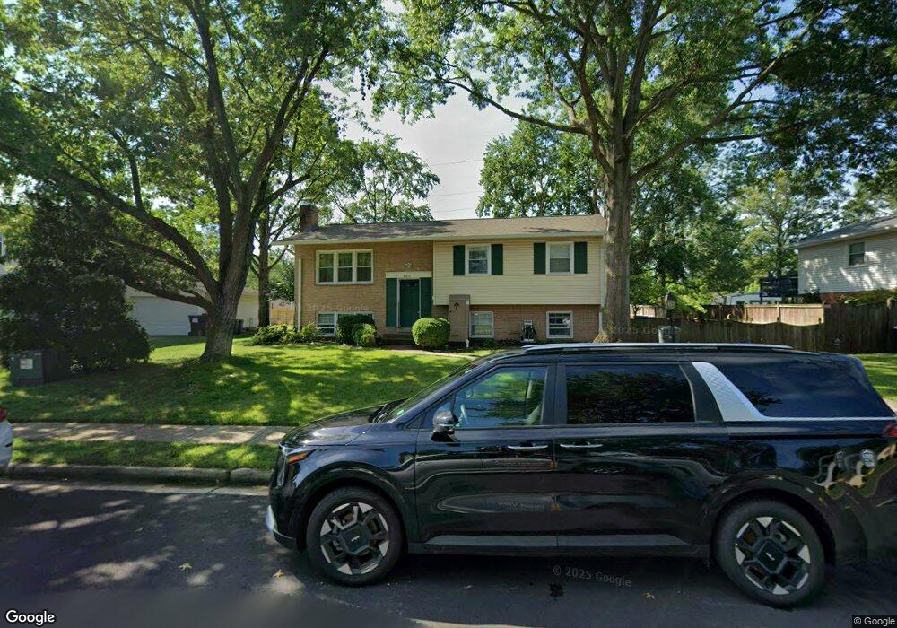
9613 Bonair Dr Manassas, VA 20109
Estimated Value: $502,415 - $574,000
3
Beds
3
Baths
1,205
Sq Ft
$444/Sq Ft
Est. Value
About This Home
This home is located at 9613 Bonair Dr, Manassas, VA 20109 and is currently estimated at $535,604, approximately $444 per square foot. 9613 Bonair Dr is a home located in Prince William County with nearby schools including Sudley Elementary School, Unity Braxton Middle School, and Unity Reed High School.
Ownership History
Date
Name
Owned For
Owner Type
Purchase Details
Closed on
Apr 30, 2025
Sold by
Simmons David M and Simmons Margaret M
Bought by
Simmons Family Trust and Simmons
Current Estimated Value
Purchase Details
Closed on
Aug 31, 1998
Sold by
Hill+ John P
Bought by
Simmons David M and Simmons Margaret M
Home Financials for this Owner
Home Financials are based on the most recent Mortgage that was taken out on this home.
Original Mortgage
$105,000
Interest Rate
6.9%
Mortgage Type
New Conventional
Create a Home Valuation Report for This Property
The Home Valuation Report is an in-depth analysis detailing your home's value as well as a comparison with similar homes in the area
Home Values in the Area
Average Home Value in this Area
Purchase History
| Date | Buyer | Sale Price | Title Company |
|---|---|---|---|
| Simmons Family Trust | -- | None Listed On Document | |
| Simmons David M | $153,900 | -- |
Source: Public Records
Mortgage History
| Date | Status | Borrower | Loan Amount |
|---|---|---|---|
| Previous Owner | Simmons David M | $105,000 |
Source: Public Records
Tax History Compared to Growth
Tax History
| Year | Tax Paid | Tax Assessment Tax Assessment Total Assessment is a certain percentage of the fair market value that is determined by local assessors to be the total taxable value of land and additions on the property. | Land | Improvement |
|---|---|---|---|---|
| 2025 | $4,451 | $470,200 | $140,700 | $329,500 |
| 2024 | $4,451 | $447,600 | $129,800 | $317,800 |
| 2023 | $4,462 | $428,800 | $125,000 | $303,800 |
| 2022 | $4,649 | $419,800 | $125,000 | $294,800 |
| 2021 | $4,716 | $384,700 | $113,700 | $271,000 |
| 2020 | $5,551 | $358,100 | $113,700 | $244,400 |
| 2019 | $5,247 | $338,500 | $113,700 | $224,800 |
| 2018 | $3,961 | $328,000 | $113,700 | $214,300 |
| 2017 | $3,901 | $314,200 | $113,700 | $200,500 |
| 2016 | $3,668 | $297,800 | $100,300 | $197,500 |
| 2015 | $3,265 | $290,000 | $96,800 | $193,200 |
| 2014 | $3,265 | $258,500 | $85,500 | $173,000 |
Source: Public Records
Map
Nearby Homes
- 9613 King George Dr
- 9732 Copeland Dr
- 9724 Copeland Dr
- 7812 Amherst Dr
- 9699 Copeland Dr
- 7726 Amherst Dr
- 7703 Amherst Dr
- 7723 Appomattox Ave
- 7608 Bland Dr
- 118 Mace St
- 9405 Blackstone Rd
- 7530 Campbell Ct
- 7823 Brookview Ct
- 7832 Brookview Ct
- 8333 Gaither St
- 8310 Rolling Rd
- 7518 Quail Run Ln
- 7506 Todd Place
- 7699 Callan Dr
- 186 Lambert Dr
- 9615 Bonair Dr
- 9611 Bonair Dr
- 9614 King George Dr
- 9616 King George Dr
- 9609 Bonair Dr
- 9617 Bonair Dr
- 9612 King George Dr
- 9608 Bonair Dr
- 9618 King George Dr
- 9610 King George Dr
- 9620 King George Dr
- 9607 Bonair Dr
- 9619 Bonair Dr
- 9612 Bonair Dr
- 7657 Wesley Rd
- 7656 Wesley Rd
- 9608 King George Dr
- 9622 King George Dr
- 9614 Bonair Dr
- 9605 Bonair Dr