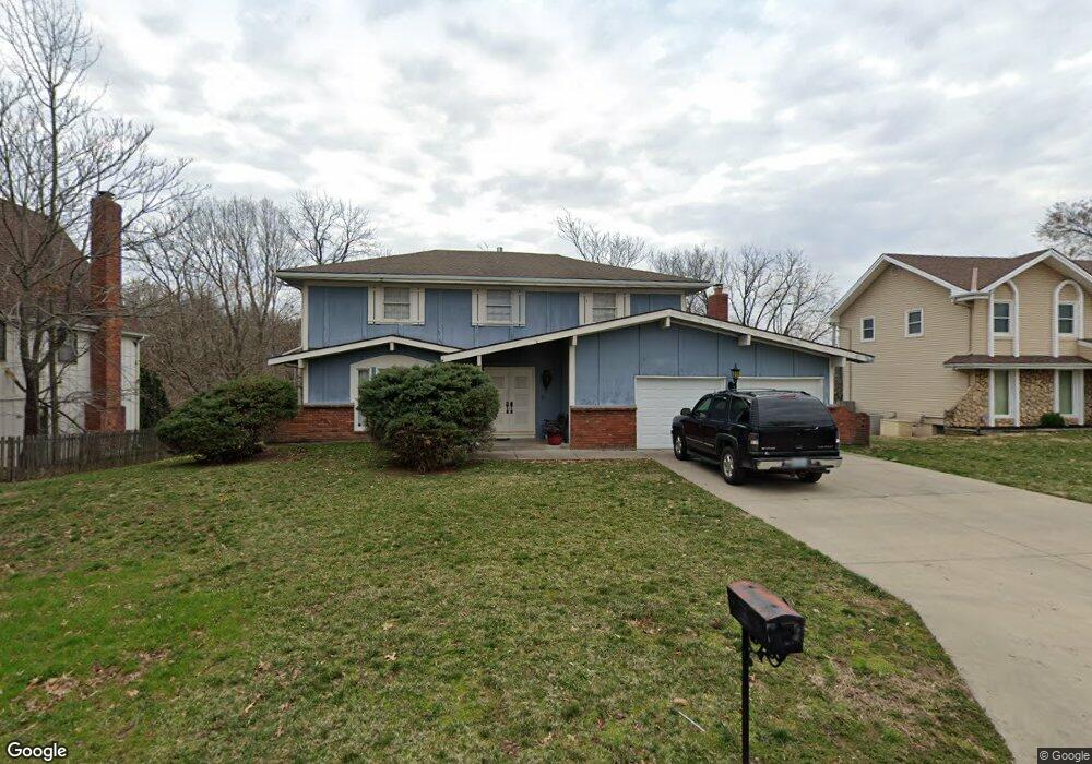
9615 Olmstead Rd Kansas City, MO 64134
Highview Estates NeighborhoodEstimated Value: $316,062 - $357,000
3
Beds
2
Baths
2,230
Sq Ft
$151/Sq Ft
Est. Value
About This Home
This home is located at 9615 Olmstead Rd, Kansas City, MO 64134 and is currently estimated at $337,016, approximately $151 per square foot. 9615 Olmstead Rd is a home located in Jackson County with nearby schools including Truman Elementary School, St Regis School, and Islamic School of Greater Kansas City.
Ownership History
Date
Name
Owned For
Owner Type
Purchase Details
Closed on
Nov 7, 2005
Sold by
Kammerdiener Thomas S
Bought by
Dunn Aretha
Current Estimated Value
Home Financials for this Owner
Home Financials are based on the most recent Mortgage that was taken out on this home.
Original Mortgage
$124,400
Outstanding Balance
$71,248
Interest Rate
6.79%
Mortgage Type
Fannie Mae Freddie Mac
Estimated Equity
$265,768
Purchase Details
Closed on
May 10, 2005
Sold by
Bosler Margie G
Bought by
Kammerdiener Thomas S
Home Financials for this Owner
Home Financials are based on the most recent Mortgage that was taken out on this home.
Original Mortgage
$111,718
Interest Rate
6.03%
Mortgage Type
Credit Line Revolving
Create a Home Valuation Report for This Property
The Home Valuation Report is an in-depth analysis detailing your home's value as well as a comparison with similar homes in the area
Home Values in the Area
Average Home Value in this Area
Purchase History
| Date | Buyer | Sale Price | Title Company |
|---|---|---|---|
| Dunn Aretha | -- | Covenant Title & Escrow Llc | |
| Kammerdiener Thomas S | -- | Cbkc Title & Escrow Llc |
Source: Public Records
Mortgage History
| Date | Status | Borrower | Loan Amount |
|---|---|---|---|
| Open | Dunn Aretha | $124,400 | |
| Previous Owner | Kammerdiener Thomas S | $111,718 |
Source: Public Records
Tax History Compared to Growth
Tax History
| Year | Tax Paid | Tax Assessment Tax Assessment Total Assessment is a certain percentage of the fair market value that is determined by local assessors to be the total taxable value of land and additions on the property. | Land | Improvement |
|---|---|---|---|---|
| 2025 | $4,131 | $46,987 | $6,779 | $40,208 |
| 2024 | $4,057 | $47,724 | $5,331 | $42,393 |
| 2023 | $4,057 | $47,724 | $7,773 | $39,951 |
| 2022 | $3,518 | $35,530 | $7,135 | $28,395 |
| 2021 | $3,035 | $35,530 | $7,135 | $28,395 |
| 2020 | $2,921 | $32,329 | $7,135 | $25,194 |
| 2019 | $2,763 | $32,329 | $7,135 | $25,194 |
| 2018 | $2,225 | $24,309 | $3,297 | $21,012 |
| 2017 | $2,071 | $24,309 | $3,297 | $21,012 |
| 2016 | $2,071 | $21,977 | $4,658 | $17,319 |
| 2014 | $2,008 | $21,546 | $4,566 | $16,980 |
Source: Public Records
Map
Nearby Homes
- 10500 E Bannister Rd
- 9420 Ralston Ave
- 9721 Elm Ave
- 9525 Manning Ave
- 9425 E 90th Terrace
- 10111 Lane Ave
- 10401 View High Dr
- 0 View High Dr Unit HMS2548973
- 9319 E 105th St
- 9109 E 89th St
- 1031 NW Cedar Creek Ln
- 9006 Tennessee Ave
- 8617 Evanston Ave
- 12200 E 89 Terrace
- 928 NW Cedar Creek Ln
- 9414 Lewis Ave
- 8641 E 97th Terrace
- 9616 E 86th Terrace
- 8700 E Bannister Terrace
- 8512 Maywood Ave
- 9621 Olmstead Rd
- 9609 Olmstead Rd
- 10220 E 96th Terrace
- 9608 Olmstead Rd
- 10217 E 96th Terrace
- 10214 E 96th Terrace
- 10315 E 96th St
- 10301 E 96th St
- 10209 E 96th Terrace
- 10210 E 96th Terrace
- 10209 E 96th Terrace
- 10215 E 96th St
- 9543 Olmstead Rd
- 10316 E 96th St
- 10200 E 96th Terrace
- 10201 E 96th Terrace
- 10308 E 96th St
- 10300 E 96th St
- 10216 E 96th St
- 9618 Maywood Ave