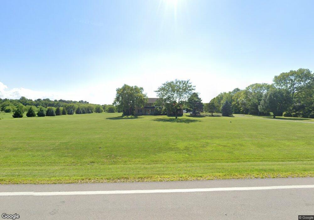
9615 State Route 99 N Monroeville, OH 44847
Estimated Value: $304,000 - $527,000
4
Beds
3
Baths
2,694
Sq Ft
$162/Sq Ft
Est. Value
About This Home
This home is located at 9615 State Route 99 N, Monroeville, OH 44847 and is currently estimated at $436,834, approximately $162 per square foot. 9615 State Route 99 N is a home located in Erie County with nearby schools including Furry Elementary School, Meadowlawn Elementary School, and Briar Middle School.
Ownership History
Date
Name
Owned For
Owner Type
Purchase Details
Closed on
Nov 1, 2023
Sold by
Puchalski Melissa
Bought by
Reiter Neil F and Reiter Cynthia A
Current Estimated Value
Purchase Details
Closed on
Oct 20, 2023
Sold by
Reiter Neil F and Reiter Cynthia A
Bought by
Roemmele Michael P
Purchase Details
Closed on
Jan 1, 1987
Bought by
Reiter Neil F and Reiter Cynthia A
Create a Home Valuation Report for This Property
The Home Valuation Report is an in-depth analysis detailing your home's value as well as a comparison with similar homes in the area
Home Values in the Area
Average Home Value in this Area
Purchase History
| Date | Buyer | Sale Price | Title Company |
|---|---|---|---|
| Reiter Neil F | $132,000 | Hartung Title | |
| Roemmele Michael P | $75,000 | Hartung Title | |
| Reiter Neil F | -- | -- |
Source: Public Records
Tax History Compared to Growth
Tax History
| Year | Tax Paid | Tax Assessment Tax Assessment Total Assessment is a certain percentage of the fair market value that is determined by local assessors to be the total taxable value of land and additions on the property. | Land | Improvement |
|---|---|---|---|---|
| 2024 | $4,817 | $127,396 | $29,067 | $98,329 |
| 2023 | $4,588 | $93,537 | $20,125 | $73,412 |
| 2022 | $4,071 | $93,537 | $20,125 | $73,412 |
| 2021 | $4,072 | $93,540 | $20,130 | $73,410 |
| 2020 | $3,812 | $81,460 | $20,130 | $61,330 |
| 2019 | $3,939 | $81,460 | $20,130 | $61,330 |
| 2018 | $3,939 | $81,460 | $20,130 | $61,330 |
| 2017 | $3,768 | $76,510 | $15,060 | $61,450 |
| 2016 | $3,200 | $76,510 | $15,060 | $61,450 |
| 2015 | $3,130 | $76,510 | $15,060 | $61,450 |
| 2014 | $3,457 | $82,650 | $15,060 | $67,590 |
| 2013 | $3,402 | $82,650 | $15,060 | $67,590 |
Source: Public Records
Map
Nearby Homes
- 13303 Patten Tract Rd
- 5109 Delematre Rd
- 6208 Skadden Rd
- 8802 Mason Rd
- 10701 Strecker Rd
- 7114 Hayes Ave
- 9611 Mason Rd
- 6606 Ridgewood Dr
- 6609 Ridgewood Dr
- 5512 Billings Rd
- 0 Susan Dr
- 3050 E Main St
- 6704 Parker Rd
- 7316 Parker Rd
- VL Cold Creek Ct
- 196 Ridge St N
- 4117 Maple Ave
- 124 Sunset Dr
- 817 E Main St
- 808 Castalia St
- 9609 State Route 99 N
- 9713 State Route 99 N
- 9519 State Route 99 N
- 9519 Ohio 99
- 9610 State Route 99 N
- 9518 State Route 99 N
- 9614 State Route 99 N
- 9714 State Route 99 N
- 9512 State Route 99 N
- 9505 State Route 99 N
- 9720 State Route 99 N
- 9813 State Route 99 N
- 9806 State Route 99 N
- 9806 Ohio 99
- 9502 Bemis Rd
- 9413 State Route 99 N
- 9819 State Route 99 N
- 9706 Bemis Rd
- 9404 Bemis Rd
- 9610 Bemis Rd