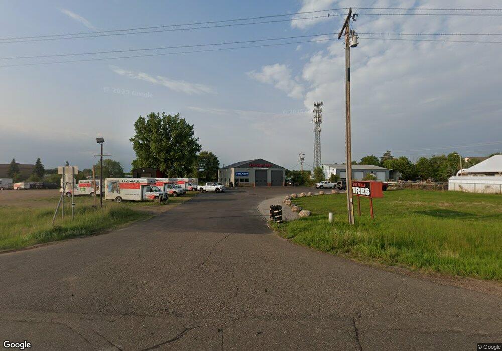
9617 Highway 10 NW Ramsey, MN 55303
Estimated Value: $559,085
--
Bed
--
Bath
3,000
Sq Ft
$186/Sq Ft
Est. Value
About This Home
This home is located at 9617 Highway 10 NW, Ramsey, MN 55303 and is currently estimated at $559,085, approximately $186 per square foot. 9617 Highway 10 NW is a home located in Anoka County with nearby schools including Twin Lakes Elementary School, Salk Middle School, and Elk River Senior High School.
Ownership History
Date
Name
Owned For
Owner Type
Purchase Details
Closed on
Oct 1, 2022
Sold by
Kurth Holdings Llc
Bought by
Mico Holdings Llc
Current Estimated Value
Purchase Details
Closed on
Apr 25, 2014
Sold by
Wuorio Judith A
Bought by
Nelson Jeffrey J and Nelson Linda C
Purchase Details
Closed on
Jan 13, 2014
Sold by
Nelson Jeffrey J and Nelson Linda C
Bought by
Kurth Holdings Llc
Home Financials for this Owner
Home Financials are based on the most recent Mortgage that was taken out on this home.
Original Mortgage
$170,000
Interest Rate
4.31%
Mortgage Type
Future Advance Clause Open End Mortgage
Create a Home Valuation Report for This Property
The Home Valuation Report is an in-depth analysis detailing your home's value as well as a comparison with similar homes in the area
Home Values in the Area
Average Home Value in this Area
Purchase History
| Date | Buyer | Sale Price | Title Company |
|---|---|---|---|
| Mico Holdings Llc | $550,000 | -- | |
| Nelson Jeffrey J | -- | None Available | |
| Kurth Holdings Llc | $270,000 | Sherburne County Abstract & | |
| Nelson Jeffrey J | $200,000 | Sherburne County Abstract & |
Source: Public Records
Mortgage History
| Date | Status | Borrower | Loan Amount |
|---|---|---|---|
| Previous Owner | Kurth Holdings Llc | $170,000 |
Source: Public Records
Tax History Compared to Growth
Tax History
| Year | Tax Paid | Tax Assessment Tax Assessment Total Assessment is a certain percentage of the fair market value that is determined by local assessors to be the total taxable value of land and additions on the property. | Land | Improvement |
|---|---|---|---|---|
| 2025 | $12,933 | $531,900 | $209,100 | $322,800 |
| 2024 | $12,933 | $469,900 | $209,100 | $260,800 |
| 2023 | $9,118 | $409,400 | $173,900 | $235,500 |
| 2022 | $8,192 | $350,700 | $165,500 | $185,200 |
| 2021 | $7,921 | $294,900 | $165,500 | $129,400 |
| 2020 | $8,191 | $280,900 | $165,500 | $115,400 |
| 2019 | $7,473 | $280,700 | $165,500 | $115,200 |
| 2018 | $7,471 | $264,200 | $0 | $0 |
| 2017 | $8,339 | $257,300 | $0 | $0 |
| 2016 | $8,151 | $244,000 | $0 | $0 |
| 2015 | $8,336 | $244,000 | $157,600 | $86,400 |
| 2014 | -- | $236,700 | $157,600 | $79,100 |
Source: Public Records
Map
Nearby Homes
- 20475 County St Unit 30
- 15250 Tiger St NW
- 5998 Rathbun Ave NE
- 9160 164th Ln NW
- 15005 Tiger St NW
- Lewis Plan at River Pointe - The Meadows of River Pointe
- Clearwater Plan at River Pointe - The Meadows of River Pointe
- Sinclair Plan at River Pointe - The Meadows of River Pointe
- Vanderbilt Plan at River Pointe - The Meadows of River Pointe
- Springfield Plan at River Pointe - The Meadows of River Pointe
- Bristol Plan at River Pointe - The Meadows of River Pointe
- 15211 Nutria NW
- 15183 Nutria St NW
- 17552 57th St NE
- 8524 151st Ln NW
- 8642 149th Ct NW
- 17760 54th St NE
- 5945 Ranger Ave NE
- Sinclair Plan at Northfork Meadows
- McKinley Plan at Northfork Meadows
- 9617 U S 10
- 9535 U S 10
- xxx Adams St
- 0 Xxx Adams St Unit 6307246
- 9500 156th St NW
- 9500 156th Ave NW
- 9411 Alpine Dr NW
- 000 156th Ave NW
- OOO 156th Ave NW
- xxx 156th Ave NW
- 9744 Highway 10
- 9744 U S 10
- 9784 Highway 10
- 9349 Highway 10 NW
- 9745 Highway 10
- 9333 Alpine Dr NW
- 9333 Alpine Dr NW
- 9333 Alpine Dr NW
- 9333 Alpine Dr NW
- 9333 Alpine Dr NW
