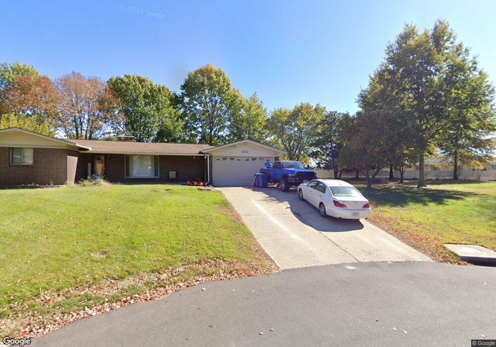
963 Southwood Dr Arnold, MO 63010
Estimated Value: $247,000 - $324,000
--
Bed
1
Bath
1,548
Sq Ft
$183/Sq Ft
Est. Value
About This Home
This home is located at 963 Southwood Dr, Arnold, MO 63010 and is currently estimated at $282,878, approximately $182 per square foot. 963 Southwood Dr is a home located in Jefferson County with nearby schools including Rockport Heights Elementary School, Fox Middle School, and Fox Senior High School.
Ownership History
Date
Name
Owned For
Owner Type
Purchase Details
Closed on
Apr 9, 2020
Sold by
Mueller Gregory A and Mueller Timothy J
Bought by
Prusinowski Richard and Prusinowski Jeanette
Current Estimated Value
Home Financials for this Owner
Home Financials are based on the most recent Mortgage that was taken out on this home.
Original Mortgage
$161,500
Outstanding Balance
$143,069
Interest Rate
3.4%
Mortgage Type
New Conventional
Estimated Equity
$139,809
Purchase Details
Closed on
Feb 1, 2013
Sold by
Citimortgage Inc
Bought by
Secretary Of Hud
Create a Home Valuation Report for This Property
The Home Valuation Report is an in-depth analysis detailing your home's value as well as a comparison with similar homes in the area
Home Values in the Area
Average Home Value in this Area
Purchase History
| Date | Buyer | Sale Price | Title Company |
|---|---|---|---|
| Prusinowski Richard | -- | Title Partners Agency Llc | |
| Secretary Of Hud | -- | None Available |
Source: Public Records
Mortgage History
| Date | Status | Borrower | Loan Amount |
|---|---|---|---|
| Open | Prusinowski Richard | $161,500 |
Source: Public Records
Tax History Compared to Growth
Tax History
| Year | Tax Paid | Tax Assessment Tax Assessment Total Assessment is a certain percentage of the fair market value that is determined by local assessors to be the total taxable value of land and additions on the property. | Land | Improvement |
|---|---|---|---|---|
| 2025 | $1,700 | $26,200 | $2,900 | $23,300 |
| 2024 | $1,700 | $24,300 | $2,900 | $21,400 |
| 2023 | $1,700 | $24,300 | $2,900 | $21,400 |
| 2022 | $1,733 | $24,300 | $2,900 | $21,400 |
| 2021 | $1,733 | $24,300 | $2,900 | $21,400 |
| 2020 | $1,661 | $22,100 | $2,500 | $19,600 |
| 2019 | $1,666 | $22,100 | $2,500 | $19,600 |
| 2018 | $1,656 | $22,100 | $2,500 | $19,600 |
| 2017 | $1,681 | $22,100 | $2,500 | $19,600 |
| 2016 | $1,454 | $20,500 | $2,900 | $17,600 |
| 2015 | $1,458 | $20,500 | $2,900 | $17,600 |
| 2013 | -- | $20,000 | $2,900 | $17,100 |
Source: Public Records
Map
Nearby Homes
- 0 Unknown Unit 22001740
- 0 Unknown Unit 22001753
- 0 Unknown Unit 22071117
- 0 Unknown Unit 22001730
- 0 Unknown Unit 22071145
- 0 Unknown Unit 21017758
- 1125 Foxwood Estates Dr
- 1347 Libra Dr
- 1319 Tony Dr
- 672 Berrywine Ln
- 2825 Sherry Dr
- 1419 Fox Ridge Ct
- 1385 Fox Ridge Ct
- 1013 Loretta Dr
- 2284 Sunnyridge Dr
- 630 Idaho Dr
- 2348 Roland Dr
- 3270 Bayvue Blvd
- 18 Pleasant Valley Terrace
- 344 Bramtonn Place
- 968 Southcrest Dr
- 2920 Southwood Dr
- 1000 Southcrest Dr
- 2900 Southwood
- 969 Southcrest Dr
- 2930 Southwood Dr
- 967 Southgate Dr
- 975 Southcrest Dr
- 1008 Southcrest Dr
- 1000 Southgate Dr
- 2940 Southwood Dr
- 1007 Southcrest Dr
- 1009 Southgate Dr
- 1016 Southcrest Dr
- 2930 Schneider Dr
- 970 Southgate Dr
- 2924 Schneider Dr
- 1015 Southcrest Dr
- 1882 Southwood
- 1002 Southgate Dr