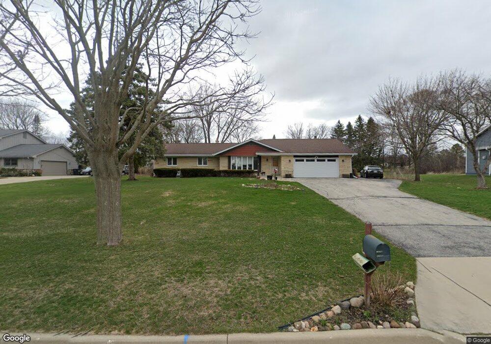
9640 W Barnard Ave Milwaukee, WI 53228
Estimated Value: $311,320 - $446,000
3
Beds
2
Baths
1,826
Sq Ft
$207/Sq Ft
Est. Value
About This Home
This home is located at 9640 W Barnard Ave, Milwaukee, WI 53228 and is currently estimated at $377,080, approximately $206 per square foot. 9640 W Barnard Ave is a home located in Milwaukee County with nearby schools including Hales Corners Elementary School, Whitnall Middle School, and Whitnall High School.
Ownership History
Date
Name
Owned For
Owner Type
Purchase Details
Closed on
Jul 29, 2025
Sold by
Zweck Katherine M
Bought by
Kjell Rentals Llc
Current Estimated Value
Purchase Details
Closed on
May 25, 2021
Sold by
Zweck Katherine M
Bought by
Zweck Katherine M and Stefan Laura
Purchase Details
Closed on
Jan 17, 2017
Sold by
Stefan Robert J
Bought by
Zweck Katherine M
Create a Home Valuation Report for This Property
The Home Valuation Report is an in-depth analysis detailing your home's value as well as a comparison with similar homes in the area
Home Values in the Area
Average Home Value in this Area
Purchase History
| Date | Buyer | Sale Price | Title Company |
|---|---|---|---|
| Kjell Rentals Llc | $344,000 | None Listed On Document | |
| Zweck Katherine M | -- | None Listed On Document | |
| Zweck Katherine M | -- | None Available |
Source: Public Records
Tax History Compared to Growth
Tax History
| Year | Tax Paid | Tax Assessment Tax Assessment Total Assessment is a certain percentage of the fair market value that is determined by local assessors to be the total taxable value of land and additions on the property. | Land | Improvement |
|---|---|---|---|---|
| 2024 | $5,981 | $344,000 | $117,300 | $226,700 |
| 2023 | $5,981 | $344,000 | $117,300 | $226,700 |
| 2022 | $5,843 | $219,500 | $90,200 | $129,300 |
| 2021 | $6,282 | $219,500 | $90,200 | $129,300 |
| 2020 | $6,100 | $219,500 | $90,200 | $129,300 |
| 2019 | $5,890 | $219,500 | $90,200 | $129,300 |
| 2018 | $6,149 | $219,500 | $90,200 | $129,300 |
| 2017 | $5,299 | $210,900 | $90,200 | $120,700 |
| 2016 | $5,303 | $210,900 | $90,200 | $120,700 |
| 2015 | $5,236 | $210,900 | $90,200 | $120,700 |
| 2014 | $5,347 | $210,900 | $90,200 | $120,700 |
| 2013 | $5,374 | $210,900 | $90,200 | $120,700 |
Source: Public Records
Map
Nearby Homes
- 5175 S Root River Pkwy Unit 6
- 4256 S 96th St
- 9839 Brookside Dr
- 9000 W Cold Spring Rd
- 5210 S Froemming Dr
- 10201 Brookside Dr
- 4475 S 108th St
- 4050 S Shady Lane Ct
- 4962 S 82nd St
- 5121 S 111th St
- 9015 W Grange Ave
- 4013 S 106th St
- 11111 W Edgerton Ave
- 5305 S 110th St
- 5445 Wild Cherry Cir
- 4657 S 114th St
- 4540 S 116th St
- 7911 W Cold Spring Rd
- 7701 W Barnard Ave
- 3762 S 94th St
- 9620 W Barnard Ave
- 9710 W Barnard Ave
- 9724 W Barnard Ave
- 9600 W Barnard Ave
- 9625 W Barnard Ave
- 9701 W Barnard Ave
- 4807 S 96th St
- 9738 W Barnard Ave
- 4824 S Brookdale Dr
- 9633 W Layton Ave
- 9621 W Layton Ave
- 9711 W Layton Ave
- 4814 S Brookdale Dr
- 4823 S 96th St
- 9524 W Barnard Ave
- 4838 S Brookdale Dr
- 9725 W Layton Ave
- 9601 W Layton Ave
- 9700 W Layton Ave
- 9600 W Layton Ave