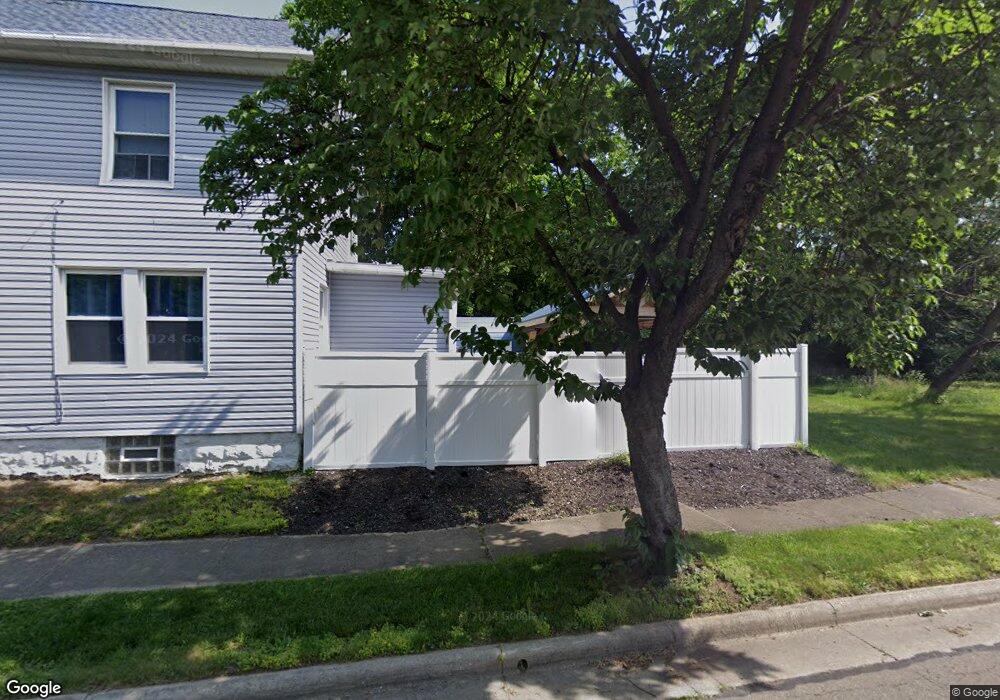
965 Bloomfield Ave Akron, OH 44302
Highland Square NeighborhoodEstimated Value: $82,122
4
Beds
1
Bath
1,373
Sq Ft
$60/Sq Ft
Est. Value
About This Home
This home is located at 965 Bloomfield Ave, Akron, OH 44302 and is currently estimated at $82,122, approximately $59 per square foot. 965 Bloomfield Ave is a home located in Summit County with nearby schools including Summit Academy School, Our Lady Of The Elms Elementary School, and Julie Billiart School Akron.
Ownership History
Date
Name
Owned For
Owner Type
Purchase Details
Closed on
May 13, 2015
Sold by
Oswald Kurt and Scalise Kristen M
Bought by
The City Of Akron
Current Estimated Value
Purchase Details
Closed on
Apr 21, 2015
Sold by
Oswald Kurt and Scalise Kristen M
Bought by
The City Of Akron
Purchase Details
Closed on
Apr 18, 2007
Sold by
Lewis Thomas A and Lewis Catina
Bought by
Oswald Kurt
Purchase Details
Closed on
Mar 29, 2006
Sold by
Houglan Patricia A
Bought by
Lewis Thomas A
Create a Home Valuation Report for This Property
The Home Valuation Report is an in-depth analysis detailing your home's value as well as a comparison with similar homes in the area
Home Values in the Area
Average Home Value in this Area
Purchase History
| Date | Buyer | Sale Price | Title Company |
|---|---|---|---|
| The City Of Akron | -- | None Available | |
| The City Of Akron | -- | None Available | |
| Oswald Kurt | $47,000 | Guardian Title | |
| Lewis Thomas A | $10,000 | Clear Title Solutions |
Source: Public Records
Tax History Compared to Growth
Tax History
| Year | Tax Paid | Tax Assessment Tax Assessment Total Assessment is a certain percentage of the fair market value that is determined by local assessors to be the total taxable value of land and additions on the property. | Land | Improvement |
|---|---|---|---|---|
| 2025 | -- | $3,805 | $3,805 | -- |
| 2024 | -- | $3,805 | $3,805 | -- |
| 2023 | -- | $3,805 | $3,805 | -- |
| 2022 | -- | $2,237 | $2,237 | $0 |
| 2021 | $153 | $2,237 | $2,237 | $0 |
| 2020 | $0 | $2,240 | $2,240 | $0 |
| 2019 | $153 | $3,340 | $3,340 | $0 |
| 2018 | $0 | $3,340 | $3,340 | $0 |
| 2017 | $307 | $3,340 | $3,340 | $0 |
| 2016 | $307 | $3,340 | $3,340 | $0 |
| 2015 | $307 | $3,340 | $3,340 | $0 |
| 2014 | $2,004 | $3,340 | $3,340 | $0 |
| 2013 | -- | $3,340 | $3,340 | $0 |
Source: Public Records
Map
Nearby Homes
- 316 Grand Ave
- 928 Bloomfield Ave
- 920 Bloomfield Ave
- 1021 Delia Ave
- 1066 Emma Ave
- 166 Marvin Ave
- 1071 Delia Ave
- 893 Delia Ave
- 939 W Exchange St
- 892 Delia Ave
- 1017 Stadelman Ave
- 962 Stadelman Ave
- 908 Stadelman Ave
- 141 Grand Ave
- S/L 12 W Sunrise View Dr
- 295 Noble Ave
- 900 Work Dr
- 890 Work Dr
- 127 Hollinger Ave
- 885 Bye St Unit 887
- 961 Bloomfield Ave
- 292 Gordon Dr
- 157 Burton Ave
- 161 Burton Ave
- 288 Gordon Dr
- 955 Bloomfield Ave
- 153 Burton Ave
- 284 Gordon Dr
- 165 Burton Ave
- 951 Bloomfield Ave
- 960 Bloomfield Ave
- 280 Gordon Dr
- 956 Bloomfield Ave
- 143 Burton Ave
- 947 Bloomfield Ave
- 173 Burton Ave
- 952 Bloomfield Ave
- 287 Gordon Dr
- 276 Gordon Dr
- 984 Bloomfield Ave