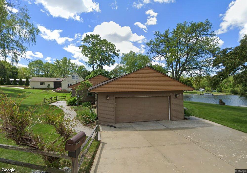
9667 Susin Ln Clarkston, MI 48348
Estimated Value: $390,389 - $504,000
3
Beds
2
Baths
1,585
Sq Ft
$277/Sq Ft
Est. Value
About This Home
This home is located at 9667 Susin Ln, Clarkston, MI 48348 and is currently estimated at $439,097, approximately $277 per square foot. 9667 Susin Ln is a home located in Oakland County with nearby schools including Springfield Christian Academy.
Ownership History
Date
Name
Owned For
Owner Type
Purchase Details
Closed on
Dec 18, 2018
Sold by
Paszek Kathleen E and Yeloushan Kathleen E
Bought by
Yeloushan Kathleen E
Current Estimated Value
Purchase Details
Closed on
Jun 12, 2009
Sold by
Martin Diane M and Boucard Denise C
Bought by
Paszek Kathleen E
Home Financials for this Owner
Home Financials are based on the most recent Mortgage that was taken out on this home.
Original Mortgage
$142,208
Interest Rate
4.25%
Mortgage Type
FHA
Purchase Details
Closed on
May 18, 2007
Sold by
Moller John J and Moller Mary
Bought by
Moller Mary J and Martin Diane M
Create a Home Valuation Report for This Property
The Home Valuation Report is an in-depth analysis detailing your home's value as well as a comparison with similar homes in the area
Home Values in the Area
Average Home Value in this Area
Purchase History
| Date | Buyer | Sale Price | Title Company |
|---|---|---|---|
| Yeloushan Kathleen E | -- | None Available | |
| Paszek Kathleen E | $150,000 | Philip R Seaver Title Co Inc | |
| Paszek Kathleen E | -- | Philip R Seaver Title Co Inc | |
| Moller Mary J | -- | None Available |
Source: Public Records
Mortgage History
| Date | Status | Borrower | Loan Amount |
|---|---|---|---|
| Previous Owner | Paszek Kathleen E | $142,208 |
Source: Public Records
Tax History Compared to Growth
Tax History
| Year | Tax Paid | Tax Assessment Tax Assessment Total Assessment is a certain percentage of the fair market value that is determined by local assessors to be the total taxable value of land and additions on the property. | Land | Improvement |
|---|---|---|---|---|
| 2024 | $2,427 | $184,060 | $0 | $0 |
| 2023 | $2,315 | $167,450 | $0 | $0 |
| 2022 | $3,212 | $155,830 | $0 | $0 |
| 2021 | $2,913 | $145,550 | $0 | $0 |
| 2020 | $2,090 | $137,100 | $0 | $0 |
| 2018 | $2,818 | $123,300 | $48,100 | $75,200 |
| 2015 | -- | $101,800 | $0 | $0 |
| 2014 | -- | $87,900 | $0 | $0 |
| 2011 | -- | $86,700 | $0 | $0 |
Source: Public Records
Map
Nearby Homes
- 0 Dixie Hwy Unit 20251027429
- 9866 Dixie Hwy
- 9876 Dixie Hwy
- 9635 Norman Rd
- 9765 Dixie Hwy
- 8453 Harbortowne Dr
- 8911 Tartan Dr
- 9877 Dixie Hwy
- 9580 Dixie Hwy
- 10086 King Rd
- 8700 Clarridge Rd
- 10145 Creekwood Trail
- 10418 King Rd
- 10438 King Rd
- 9909 Kingston Ridge Unit 44
- 9933 Kingston Ridge Unit 43
- 9266 Hillcrest
- 8410 S Shore Dr Unit 29
- 9128 Kelly Lake Dr
- 7565 Old Pond Dr