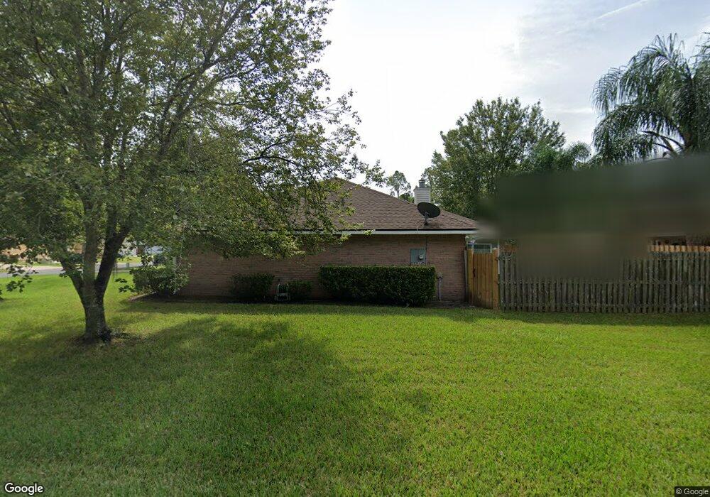
9668 Cedar Ridge Dr E Jacksonville, FL 32221
Crystal Springs/Jacksonville Farms NeighborhoodEstimated Value: $349,651 - $369,000
3
Beds
2
Baths
2,250
Sq Ft
$160/Sq Ft
Est. Value
About This Home
This home is located at 9668 Cedar Ridge Dr E, Jacksonville, FL 32221 and is currently estimated at $360,163, approximately $160 per square foot. 9668 Cedar Ridge Dr E is a home located in Duval County with nearby schools including Crystal Springs Elementary School, Edward H. White High School, and Trinity Church Academy.
Ownership History
Date
Name
Owned For
Owner Type
Purchase Details
Closed on
Dec 13, 2002
Sold by
Adams Homes Of Northwest Florida Inc
Bought by
West Ronnie L and West Gwendolyn
Current Estimated Value
Home Financials for this Owner
Home Financials are based on the most recent Mortgage that was taken out on this home.
Original Mortgage
$134,995
Outstanding Balance
$55,073
Interest Rate
5.92%
Mortgage Type
FHA
Estimated Equity
$305,090
Create a Home Valuation Report for This Property
The Home Valuation Report is an in-depth analysis detailing your home's value as well as a comparison with similar homes in the area
Home Values in the Area
Average Home Value in this Area
Purchase History
| Date | Buyer | Sale Price | Title Company |
|---|---|---|---|
| West Ronnie L | $149,900 | -- |
Source: Public Records
Mortgage History
| Date | Status | Borrower | Loan Amount |
|---|---|---|---|
| Open | West Ronnie L | $134,995 |
Source: Public Records
Tax History
| Year | Tax Paid | Tax Assessment Tax Assessment Total Assessment is a certain percentage of the fair market value that is determined by local assessors to be the total taxable value of land and additions on the property. | Land | Improvement |
|---|---|---|---|---|
| 2026 | $2,510 | $167,396 | -- | -- |
| 2025 | $2,276 | $167,396 | -- | -- |
| 2024 | $2,203 | $162,679 | -- | -- |
| 2023 | $2,203 | $157,941 | $0 | $0 |
| 2022 | $2,006 | $153,341 | $0 | $0 |
| 2021 | $1,881 | $143,109 | $0 | $0 |
| 2020 | $1,858 | $141,134 | $0 | $0 |
| 2019 | $1,830 | $137,961 | $0 | $0 |
| 2018 | $1,800 | $135,389 | $0 | $0 |
| 2017 | $1,771 | $132,605 | $0 | $0 |
| 2016 | $1,754 | $129,878 | $0 | $0 |
| 2015 | $1,769 | $128,976 | $0 | $0 |
| 2014 | $1,770 | $127,953 | $0 | $0 |
Source: Public Records
Map
Nearby Homes
- 9736 Cedar Ridge Dr W
- 1530 Summit Oaks Dr E
- 998 Fox Chapel Ln
- 1497 Tomcat Dr
- 1244 Peabody Dr E
- 1442 Seawolf Trail N
- 10173 Rising Mist Ln
- 9733 Peabody Dr N
- 9286 Thunderbolt Ct
- 9366 Thunderbolt Dr
- 1680 Carter Landing Blvd
- 0 Crystal Springs Rd
- 9658 Freefall Rd
- 8985 Normandy Blvd Unit 39
- 8985 Normandy Blvd Unit 29
- 8985 Normandy Blvd Unit 216
- 8985 Normandy Blvd Unit 229
- 8985 Normandy Blvd Unit 250
- 8985 Normandy Blvd Unit 278
- 8985 Normandy Blvd Unit 202
- 9642 Cedar Ridge Dr E
- 1531 Leeworth Ln Unit 2
- 1537 Leeworth Ln Unit 2
- 9636 Cedar Ridge Dr E
- 1545 Leeworth Ln Unit 2
- 9661 Cedar Ridge Dr E
- 9655 Cedar Ridge Dr E
- 9667 Cedar Ridge Dr E Unit 2
- 9643 Cedar Ridge Dr E Unit 2
- 9649 Cedar Ridge Dr E Unit 2
- 9637 Cedar Ridge Dr E
- 9628 Cedar Ridge Dr W
- 9628 Cedar Ridge Dr E
- 9679 Cedar Ridge Dr E
- 9631 Cedar Ridge Dr E
- 9685 Cedar Ridge Dr E
- 1553 Leeworth Ln
- 1538 Leeworth Ln Unit 1
- 9620 Cedar Ridge Dr E
- 9625 Cedar Ridge Dr E
Your Personal Tour Guide
Ask me questions while you tour the home.