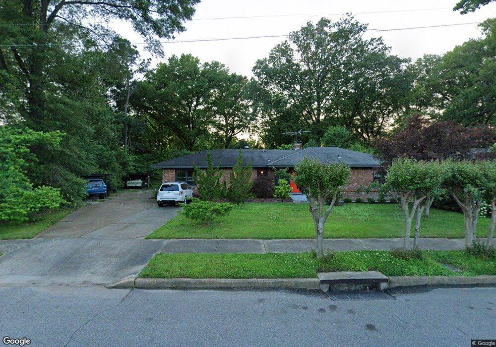
967 Colonial Rd Memphis, TN 38117
Colonial Acres NeighborhoodEstimated Value: $276,000 - $327,000
4
Beds
2
Baths
2,065
Sq Ft
$143/Sq Ft
Est. Value
About This Home
This home is located at 967 Colonial Rd, Memphis, TN 38117 and is currently estimated at $295,637, approximately $143 per square foot. 967 Colonial Rd is a home located in Shelby County with nearby schools including Sea Isle Elementary School, Colonial Middle, and Overton High.
Ownership History
Date
Name
Owned For
Owner Type
Purchase Details
Closed on
Apr 21, 2016
Sold by
Wallace Louise R
Bought by
Anderson Kyrstan Overstreet and Anderson Jerry
Current Estimated Value
Home Financials for this Owner
Home Financials are based on the most recent Mortgage that was taken out on this home.
Original Mortgage
$129,200
Outstanding Balance
$102,810
Interest Rate
3.73%
Mortgage Type
New Conventional
Estimated Equity
$192,827
Purchase Details
Closed on
Nov 21, 2008
Sold by
Wallace Harold W and Wallace Louise R
Bought by
Wallace Louise R
Create a Home Valuation Report for This Property
The Home Valuation Report is an in-depth analysis detailing your home's value as well as a comparison with similar homes in the area
Home Values in the Area
Average Home Value in this Area
Purchase History
| Date | Buyer | Sale Price | Title Company |
|---|---|---|---|
| Anderson Kyrstan Overstreet | $136,000 | None Available | |
| Wallace Louise R | -- | None Available |
Source: Public Records
Mortgage History
| Date | Status | Borrower | Loan Amount |
|---|---|---|---|
| Open | Anderson Kyrstan Overstreet | $129,200 |
Source: Public Records
Tax History Compared to Growth
Tax History
| Year | Tax Paid | Tax Assessment Tax Assessment Total Assessment is a certain percentage of the fair market value that is determined by local assessors to be the total taxable value of land and additions on the property. | Land | Improvement |
|---|---|---|---|---|
| 2025 | $2,174 | $64,750 | $10,125 | $54,625 |
| 2024 | $2,174 | $64,125 | $12,325 | $51,800 |
| 2023 | $3,906 | $64,125 | $12,325 | $51,800 |
| 2022 | $3,906 | $64,125 | $12,325 | $51,800 |
| 2021 | $3,952 | $64,125 | $12,325 | $51,800 |
| 2020 | $2,605 | $35,950 | $12,325 | $23,625 |
| 2019 | $2,605 | $35,950 | $12,325 | $23,625 |
| 2018 | $2,531 | $34,925 | $12,325 | $22,600 |
| 2017 | $1,435 | $34,925 | $12,325 | $22,600 |
| 2016 | $1,297 | $29,675 | $0 | $0 |
| 2014 | $1,297 | $29,675 | $0 | $0 |
Source: Public Records
Map
Nearby Homes
- 4844 Welchshire Ave
- 4680 Crossover Ln
- 830 Colonial Rd
- 1063 Woodview Dr
- 820 Creekside Dr Unit 1
- 814 Thistledown Dr Unit 1206
- 812 Creekside Dr Unit 2
- 1014 S Perkins Rd
- 4764 Eagle Crest Dr Unit 4002
- 4921 Alrose Ave
- 1089 Ivy Rd
- 4936 Kaye Rd
- 4771 Audubon View Cir Unit 3005
- 4614 Perkins Cove
- 4777 Audubon View Cir Unit 3004
- 809 Merrywood Dr Unit 4
- 4776 Audubon View Cir Unit 1
- 881 S Perkins Rd
- 4841 Dee Rd
- 4784 Marlin Ave
- 959 Colonial Rd
- 979 Colonial Rd
- 951 Colonial Rd
- 987 Colonial Rd
- 4746 Kaye Rd
- 945 Colonial Rd
- 964 Rustling Oaks Cir
- 4780 Rustling Oaks Dr
- 962 Rustling Oaks Cir
- 4782 Rustling Oaks Dr
- 960 Rustling Oaks Cir
- 955 Rustling Oaks Cir
- 4736 Kaye Rd
- 4784 Rustling Oaks Dr
- 958 Rustling Oaks Cir
- 953 Rustling Oaks Cir
- 951 Rustling Oaks Cir
- 4774 Kaye Rd
- 4786 Rustling Oaks Dr
- 949 Rustling Oaks Cir