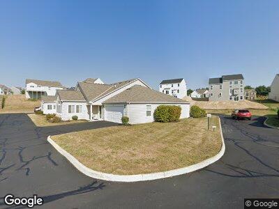
967 Governors Cir Unit OVC6B Lancaster, OH 43130
Estimated Value: $247,966 - $320,000
2
Beds
2
Baths
1,274
Sq Ft
$231/Sq Ft
Est. Value
About This Home
This home is located at 967 Governors Cir Unit OVC6B, Lancaster, OH 43130 and is currently estimated at $294,242, approximately $230 per square foot. 967 Governors Cir Unit OVC6B is a home located in Fairfield County with nearby schools including General Sherman Junior High School, Lancaster High School, and St Mary Elementary School.
Ownership History
Date
Name
Owned For
Owner Type
Purchase Details
Closed on
Aug 19, 2019
Sold by
Scott Kenneth W and Scott Martha S
Bought by
Jacobs Carolyn S
Current Estimated Value
Home Financials for this Owner
Home Financials are based on the most recent Mortgage that was taken out on this home.
Original Mortgage
$153,675
Outstanding Balance
$136,864
Interest Rate
3.8%
Mortgage Type
New Conventional
Estimated Equity
$167,738
Purchase Details
Closed on
Sep 18, 2014
Sold by
Westover Communities Llc
Bought by
Scott Kenneth W and Scott Martha S
Create a Home Valuation Report for This Property
The Home Valuation Report is an in-depth analysis detailing your home's value as well as a comparison with similar homes in the area
Home Values in the Area
Average Home Value in this Area
Purchase History
| Date | Buyer | Sale Price | Title Company |
|---|---|---|---|
| Jacobs Carolyn S | $204,900 | Northwest Advantage Ttl Agcy | |
| Scott Kenneth W | $154,900 | Title First Agency Inc |
Source: Public Records
Mortgage History
| Date | Status | Borrower | Loan Amount |
|---|---|---|---|
| Open | Jacobs Carolyn S | $105,000 | |
| Open | Jacobs Carolyn S | $153,675 | |
| Previous Owner | Scott Kenneth W | $100,000 |
Source: Public Records
Tax History Compared to Growth
Tax History
| Year | Tax Paid | Tax Assessment Tax Assessment Total Assessment is a certain percentage of the fair market value that is determined by local assessors to be the total taxable value of land and additions on the property. | Land | Improvement |
|---|---|---|---|---|
| 2024 | $5,726 | $63,690 | $8,750 | $54,940 |
| 2023 | $2,316 | $63,690 | $8,750 | $54,940 |
| 2022 | $2,326 | $63,690 | $8,750 | $54,940 |
| 2021 | $2,125 | $54,530 | $8,750 | $45,780 |
| 2020 | $2,037 | $54,530 | $8,750 | $45,780 |
| 2019 | $1,936 | $54,530 | $8,750 | $45,780 |
| 2018 | $1,725 | $46,150 | $8,750 | $37,400 |
| 2017 | $1,726 | $46,150 | $8,750 | $37,400 |
| 2016 | $1,681 | $46,150 | $8,750 | $37,400 |
| 2015 | $1,669 | $44,480 | $8,750 | $35,730 |
| 2014 | $1,635 | $44,480 | $8,750 | $35,730 |
| 2013 | $1,635 | $44,240 | $8,750 | $35,490 |
Source: Public Records
Map
Nearby Homes
- 2357 Pine Crest Dr
- 185 9th St
- 255 9th St
- 282 14th St
- 3 1st St
- 126 7th St
- 288 14th St
- 71 3rd St
- 0 W Fair Ave Unit 225007509
- 0 W Fair Ave
- 420 Twentyfirst St
- 795 Lambton Cir W
- 1845 Shasta Dr
- 1721 Union St
- 1904 Cedar Hill Rd
- 1636 W Mulberry St
- 2451 Oakview Ln
- 0 Jefferson Ave Unit 225017117
- 2445 Columbus Lancaster Rd NW Unit 147
- 2445 Columbus Lancaster Rd NW Unit Lot 343
- 967 Governors Cir Unit OVC6B
- 967 Governor's Cir
- 963 Governor's Cir
- 969 Governor's Cir
- 969 Governors Cir
- 965 Governor's Cir
- 965 Governors Cir Unit OVC6D
- 971 Governors Cir Unit 5971
- 975 Governors Cir Unit 5975
- 957 Governor's Cir
- 951 Governor's Cir
- 973 Governors Cir Unit 5973
- 953 Governor's Cir
- 977 Governors Cir Unit 5977
- 966 Thornhill Place
- 956 Governor's Cir
- 958 Governor's Cir
- 958 Thorn Hill Place
- 974 Thorn Hill Place
- 939 Governor's Cir
